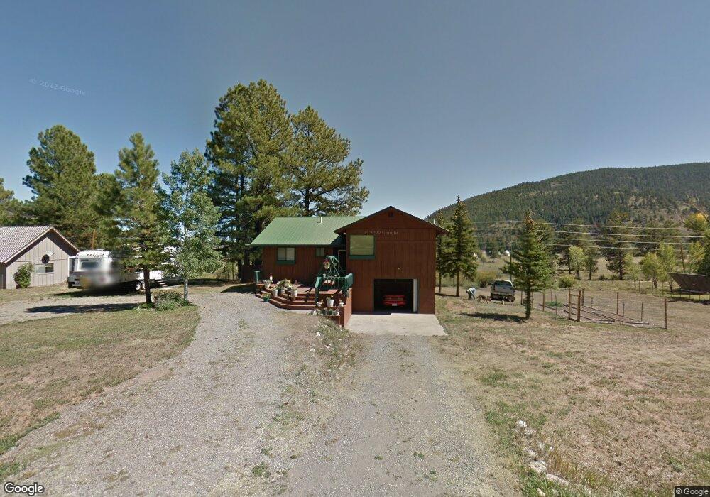
510 Conifer Dr South Fork, CO 81154
Estimated Value: $404,000 - $456,000
3
Beds
2
Baths
1,417
Sq Ft
$302/Sq Ft
Est. Value
About This Home
This home is located at 510 Conifer Dr, South Fork, CO 81154 and is currently estimated at $428,398, approximately $302 per square foot. 510 Conifer Dr is a home located in Rio Grande County with nearby schools including Del Norte K-8 School and Del Norte High School.
Ownership History
Date
Name
Owned For
Owner Type
Purchase Details
Closed on
Nov 11, 2021
Sold by
Shepherd Steven Edward and Shepherd Steve
Bought by
Shepherd Steven Edward
Current Estimated Value
Home Financials for this Owner
Home Financials are based on the most recent Mortgage that was taken out on this home.
Original Mortgage
$229,500
Interest Rate
3.05%
Mortgage Type
New Conventional
Purchase Details
Closed on
Jul 17, 2019
Sold by
Rockett Debbie
Bought by
Shepherd Steve
Home Financials for this Owner
Home Financials are based on the most recent Mortgage that was taken out on this home.
Original Mortgage
$232,750
Interest Rate
3.82%
Mortgage Type
New Conventional
Purchase Details
Closed on
Apr 14, 2015
Sold by
Timmons Tim M and Timmons Terri J
Bought by
Rockett Debbie
Home Financials for this Owner
Home Financials are based on the most recent Mortgage that was taken out on this home.
Original Mortgage
$129,560
Interest Rate
3.82%
Mortgage Type
Purchase Money Mortgage
Purchase Details
Closed on
Jun 20, 2005
Sold by
Hampton Dan E and Hampton Nancy A
Bought by
Timmons Tim M and Timmons Terri J
Create a Home Valuation Report for This Property
The Home Valuation Report is an in-depth analysis detailing your home's value as well as a comparison with similar homes in the area
Purchase History
| Date | Buyer | Sale Price | Title Company |
|---|---|---|---|
| Shepherd Steven Edward | $500 | None Listed On Document | |
| Shepherd Steve | $245,000 | Allpine Title Inc | |
| Rockett Debbie | $172,000 | None Available | |
| Timmons Tim M | $165,000 | -- |
Source: Public Records
Mortgage History
| Date | Status | Borrower | Loan Amount |
|---|---|---|---|
| Previous Owner | Shepherd Steven Edward | $229,500 | |
| Previous Owner | Shepherd Steve | $232,750 | |
| Previous Owner | Rockett Debbie | $129,560 |
Source: Public Records
Tax History Compared to Growth
Tax History
| Year | Tax Paid | Tax Assessment Tax Assessment Total Assessment is a certain percentage of the fair market value that is determined by local assessors to be the total taxable value of land and additions on the property. | Land | Improvement |
|---|---|---|---|---|
| 2024 | $1,317 | $20,301 | $3,828 | $16,473 |
| 2023 | $1,317 | $20,301 | $3,828 | $16,473 |
| 2022 | $1,042 | $16,013 | $4,383 | $11,630 |
| 2021 | $1,054 | $16,473 | $4,509 | $11,964 |
| 2020 | $895 | $13,930 | $4,509 | $9,421 |
| 2019 | $897 | $13,930 | $4,509 | $9,421 |
| 2018 | $890 | $13,754 | $0 | $0 |
| 2017 | $897 | $13,754 | $0 | $0 |
| 2016 | $718 | $14,206 | $0 | $0 |
| 2015 | $780 | $14,206 | $0 | $0 |
| 2014 | $780 | $15,396 | $0 | $0 |
| 2013 | $686 | $15,396 | $0 | $0 |
Source: Public Records
Map
Nearby Homes
- 484 Conifer Dr
- 484 Conifer Dr
- 0544 Conifer Dr
- 0 Conifer Dr Unit 623904
- 0 Conifer Dr Unit 642298
- 0 Conifer Dr Unit 644905
- 0 Conifer Dr Unit 661235
- 0 Conifer Dr Unit 670126
- 0 Conifer Dr Unit 669102
- 0 Conifer Dr Unit 670444
- 0 Conifer Dr Unit 669669
- 0 Conifer Dr Unit 670441
- 0 Conifer Dr Unit 671629
- 0 Conifer Dr Unit 680952
- 0 Conifer Dr Unit 682554
- 0 Conifer Dr Unit 605132
- 0 Conifer Dr Unit 694106
- 0 Conifer Dr Unit 697061
- 0 Conifer Dr Unit 702548
- 0 Conifer Dr Unit 706499
