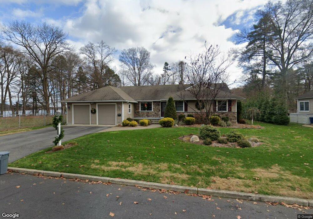
510 Demarest Ave Oradell, NJ 07649
Estimated Value: $1,073,470 - $1,184,000
--
Bed
--
Bath
2,490
Sq Ft
$452/Sq Ft
Est. Value
About This Home
This home is located at 510 Demarest Ave, Oradell, NJ 07649 and is currently estimated at $1,126,368, approximately $452 per square foot. 510 Demarest Ave is a home located in Bergen County with nearby schools including Oradell Elementary School, River Dell Middle School, and River Dell Regional High School.
Ownership History
Date
Name
Owned For
Owner Type
Purchase Details
Closed on
Sep 30, 1997
Sold by
Mcgovern Neil P and Mcgovern Neil P
Bought by
Mcgovern Kenneth M and Mcgovern Maureen B
Current Estimated Value
Home Financials for this Owner
Home Financials are based on the most recent Mortgage that was taken out on this home.
Original Mortgage
$130,000
Interest Rate
7.46%
Create a Home Valuation Report for This Property
The Home Valuation Report is an in-depth analysis detailing your home's value as well as a comparison with similar homes in the area
Home Values in the Area
Average Home Value in this Area
Purchase History
| Date | Buyer | Sale Price | Title Company |
|---|---|---|---|
| Mcgovern Kenneth M | $270,000 | -- |
Source: Public Records
Mortgage History
| Date | Status | Borrower | Loan Amount |
|---|---|---|---|
| Closed | Mcgovern Kenneth M | $130,000 |
Source: Public Records
Tax History Compared to Growth
Tax History
| Year | Tax Paid | Tax Assessment Tax Assessment Total Assessment is a certain percentage of the fair market value that is determined by local assessors to be the total taxable value of land and additions on the property. | Land | Improvement |
|---|---|---|---|---|
| 2025 | $19,092 | $865,400 | $414,000 | $451,400 |
| 2024 | $18,633 | $701,400 | $300,400 | $401,000 |
| 2023 | $17,860 | $698,400 | $299,400 | $399,000 |
| 2022 | $17,860 | $667,900 | $289,400 | $378,500 |
| 2021 | $17,780 | $635,900 | $273,400 | $362,500 |
| 2020 | $17,465 | $632,100 | $271,900 | $360,200 |
| 2019 | $17,323 | $621,800 | $268,400 | $353,400 |
| 2018 | $16,901 | $615,700 | $266,900 | $348,800 |
| 2017 | $16,358 | $605,400 | $263,400 | $342,000 |
| 2016 | $15,190 | $510,400 | $242,400 | $268,000 |
| 2015 | $14,858 | $508,800 | $242,400 | $266,400 |
| 2014 | $14,165 | $508,800 | $242,400 | $266,400 |
Source: Public Records
Map
Nearby Homes
- 680 Soldier Hill Rd
- 590 Center St Unit 1
- 171 Harrison St
- 109 Center St
- 133 Center St Unit E5
- 69 River Rd
- 784 Austin Ave
- 147 Pine Ave
- 171 Cleveland St
- 812 Golf Place
- 243 Main St
- 890 Oradell Ave
- 812 Ridgewood Ave
- 87 Palisade Ave
- 492 Oaktree Rd
- 58 Kinderkamack Rd Unit 23
- 14 Congress Rd
- 256 Stevens Ct
- 552 Burlington St
- 59 Colonial Rd
- 500 Demarest Ave
- 494 Demarest Ave
- 511 Demarest Ave
- 505 Demarest Ave
- 497 Demarest Ave
- 516 Lakeview Dr
- 484 Demarest Ave
- 485 Lakeview Dr
- 485 Demarest Ave
- 480 Demarest Ave
- 479 Lakeview Dr
- 477 Demarest Ave
- 474 Demarest Ave
- 486 Grove St
- 473 Lakeview Dr
- 482 Grove St
- 471 Demarest Ave
- 468 Demarest Ave
- 478 Grove St
- 467 Lakeview Dr