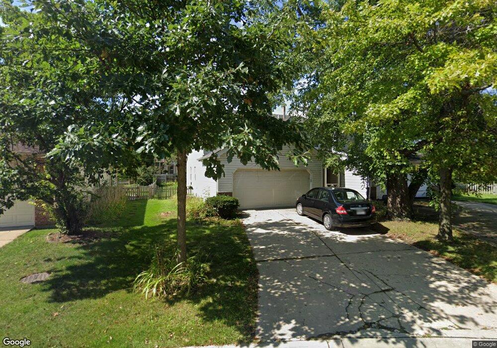
510 Dunsten Cir Northbrook, IL 60062
Estimated Value: $507,370 - $592,000
3
Beds
3
Baths
1,820
Sq Ft
$297/Sq Ft
Est. Value
About This Home
This home is located at 510 Dunsten Cir, Northbrook, IL 60062 and is currently estimated at $541,343, approximately $297 per square foot. 510 Dunsten Cir is a home located in Cook County with nearby schools including Westmoor Elementary School, Northbrook Junior High School, and Glenbrook North High School.
Ownership History
Date
Name
Owned For
Owner Type
Purchase Details
Closed on
Oct 20, 2004
Sold by
Englander Alan and Englander Ellen
Bought by
Mahay Gopal and Mahay Amarjit
Current Estimated Value
Home Financials for this Owner
Home Financials are based on the most recent Mortgage that was taken out on this home.
Original Mortgage
$205,000
Outstanding Balance
$97,077
Interest Rate
5.12%
Mortgage Type
Unknown
Estimated Equity
$444,266
Purchase Details
Closed on
May 5, 1998
Sold by
Englander Alan and Englander Ellen B
Bought by
Englander Alan and Englander Ellen B
Purchase Details
Closed on
Jun 29, 1994
Sold by
Pascal John and Pascal Penni
Bought by
Englander Alan and Gold Ellen
Home Financials for this Owner
Home Financials are based on the most recent Mortgage that was taken out on this home.
Original Mortgage
$180,000
Interest Rate
7.87%
Create a Home Valuation Report for This Property
The Home Valuation Report is an in-depth analysis detailing your home's value as well as a comparison with similar homes in the area
Home Values in the Area
Average Home Value in this Area
Purchase History
| Date | Buyer | Sale Price | Title Company |
|---|---|---|---|
| Mahay Gopal | $345,000 | Chicago Title Insurance Comp | |
| Englander Alan | -- | -- | |
| Englander Alan | $225,000 | Republic Title Company |
Source: Public Records
Mortgage History
| Date | Status | Borrower | Loan Amount |
|---|---|---|---|
| Open | Mahay Gopal | $205,000 | |
| Previous Owner | Englander Alan | $180,000 |
Source: Public Records
Tax History Compared to Growth
Tax History
| Year | Tax Paid | Tax Assessment Tax Assessment Total Assessment is a certain percentage of the fair market value that is determined by local assessors to be the total taxable value of land and additions on the property. | Land | Improvement |
|---|---|---|---|---|
| 2024 | $8,381 | $39,638 | $7,002 | $32,636 |
| 2023 | $8,106 | $40,000 | $7,000 | $33,000 |
| 2022 | $8,106 | $40,000 | $7,000 | $33,000 |
| 2021 | $6,874 | $30,847 | $4,146 | $26,701 |
| 2020 | $6,792 | $30,847 | $4,146 | $26,701 |
| 2019 | $6,591 | $33,898 | $4,146 | $29,752 |
| 2018 | $6,538 | $31,356 | $3,601 | $27,755 |
| 2017 | $6,383 | $31,356 | $3,601 | $27,755 |
| 2016 | $6,976 | $35,010 | $3,601 | $31,409 |
| 2015 | $5,859 | $27,352 | $3,055 | $24,297 |
| 2014 | $5,609 | $27,352 | $3,055 | $24,297 |
| 2013 | $5,422 | $27,352 | $3,055 | $24,297 |
Source: Public Records
Map
Nearby Homes
- 628 Greenwood Rd
- 2874 Maria Ave
- 519 Anthony Trail
- 771 Greenwood Rd
- 783 Greenwood Rd
- 795 Greenwood Rd
- 3030 Pheasant Creek Dr Unit 207
- 3030 Pheasant Creek Dr Unit 102
- 2814 Crimson Ct
- 3050 Pheasant Creek Dr Unit 301
- 3070 Pheasant Creek Dr Unit 201
- 821 Woodbine Ln
- 1012 Sussex Dr Unit 1012
- 945 Hawthorne Ln
- 1039 Sussex Dr Unit 1039
- 3110 Pheasant Creek Dr Unit 101
- 3110 Pheasant Creek Dr Unit 206
- 3110 Pheasant Creek Dr Unit A
- 19 Burning Tree Ln
- 3549 Bayberry Dr
- 508 Dunsten Cir
- 512 Dunsten Cir
- 506 Dunsten Cir
- 514 Dunsten Cir
- 504 Dunsten Cir
- 515 Dunsten Cir
- 516 Dunsten Cir
- 517 Dunsten Cir
- 518 Dunsten Cir
- 502 Dunsten Cir
- 507 Dunsten Cir
- 520 Dunsten Cir
- 521 Dunsten Cir
- 505 Dunsten Cir
- 522 Dunsten Cir
- 2788 Spenser Ct
- 544 Pfingsten Rd
- 2780 Spenser Ct
- 560 Pfingsten Rd
- 530 Pfingsten Rd