Estimated Value: $316,000 - $331,396
2
Beds
2
Baths
1,082
Sq Ft
$298/Sq Ft
Est. Value
About This Home
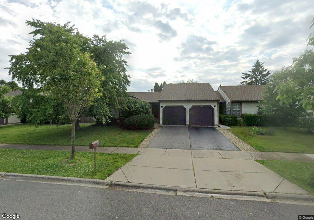
This home is located at 510 Lyon Dr, Buffalo Grove, IL 60089 and is currently estimated at $322,599, approximately $298 per square foot. 510 Lyon Dr is a home located in Lake County with nearby schools including Prairie Elementary School, Twin Groves Middle School, and Adlai E Stevenson High School.
Ownership History
Date
Name
Owned For
Owner Type
Purchase Details
Closed on
Oct 16, 2024
Sold by
Barbara Cohn 1999 Dynastic Trust and Lawrence Cohn 2000 Family Endowment Trus
Bought by
Shen Jie
Current Estimated Value
Home Financials for this Owner
Home Financials are based on the most recent Mortgage that was taken out on this home.
Original Mortgage
$225,000
Outstanding Balance
$216,449
Interest Rate
6.25%
Mortgage Type
New Conventional
Estimated Equity
$106,150
Purchase Details
Closed on
Mar 22, 2005
Sold by
Tattleman Steven A
Bought by
Lawrence Cohn 2000 Family Trust and Barbara Cohn Dynastic Trust
Create a Home Valuation Report for This Property
The Home Valuation Report is an in-depth analysis detailing your home's value as well as a comparison with similar homes in the area
Home Values in the Area
Average Home Value in this Area
Purchase History
| Date | Buyer | Sale Price | Title Company |
|---|---|---|---|
| Shen Jie | $300,000 | Chicago Title | |
| Lawrence Cohn 2000 Family Trust | $237,000 | First American Title |
Source: Public Records
Mortgage History
| Date | Status | Borrower | Loan Amount |
|---|---|---|---|
| Open | Shen Jie | $225,000 |
Source: Public Records
Tax History Compared to Growth
Tax History
| Year | Tax Paid | Tax Assessment Tax Assessment Total Assessment is a certain percentage of the fair market value that is determined by local assessors to be the total taxable value of land and additions on the property. | Land | Improvement |
|---|---|---|---|---|
| 2024 | $8,260 | $85,337 | $26,540 | $58,797 |
| 2023 | $7,965 | $80,521 | $25,042 | $55,479 |
| 2022 | $7,965 | $76,388 | $23,757 | $52,631 |
| 2021 | $7,667 | $75,565 | $23,501 | $52,064 |
| 2020 | $7,486 | $75,823 | $23,581 | $52,242 |
| 2019 | $7,379 | $75,543 | $23,494 | $52,049 |
| 2018 | $6,176 | $63,989 | $25,542 | $38,447 |
| 2017 | $5,953 | $62,496 | $24,946 | $37,550 |
| 2016 | $5,811 | $59,845 | $23,888 | $35,957 |
| 2015 | $5,677 | $55,967 | $22,340 | $33,627 |
| 2014 | $5,989 | $58,197 | $23,994 | $34,203 |
| 2012 | $5,896 | $58,314 | $24,042 | $34,272 |
Source: Public Records
Map
Nearby Homes
- 538 Lasalle Ct
- 327 Lasalle Ln
- 1118 Larraway Dr
- 1901 Brandywyn Ln
- 1903 Sheridan Rd
- 268 Hoffmann Dr
- 1265 Devonshire Rd
- 15 Thompson Ct
- 361 Hoffmann Dr
- 1113 Lockwood Dr
- 890 Knollwood Dr
- 333 Didier Ct
- 896 Chaucer Way Unit 2
- 22118 N Prairie Rd
- 1141 Devonshire Rd
- 938 Hidden Lake Dr
- 2033 Olive Hill Dr
- 486 Satinwood Terrace Unit 11
- 1998 Sheridan Ct
- 1012 Hobson Dr