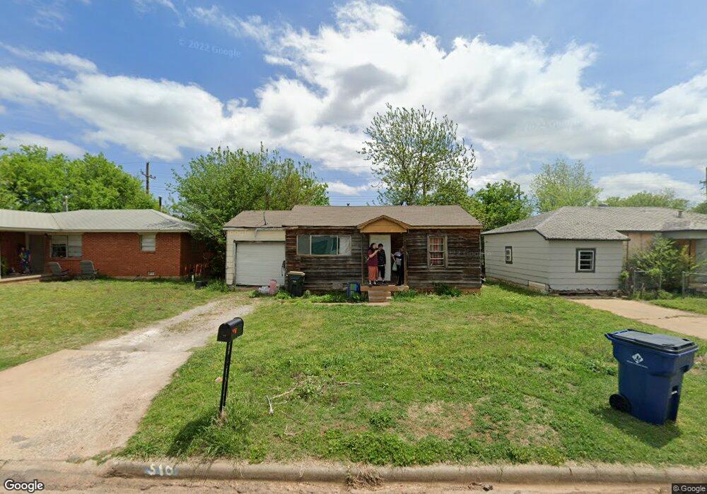
510 N K St Duncan, OK 73533
Estimated Value: $37,000 - $45,000
3
Beds
1
Bath
672
Sq Ft
$60/Sq Ft
Est. Value
About This Home
This home is located at 510 N K St, Duncan, OK 73533 and is currently estimated at $40,183, approximately $59 per square foot. 510 N K St is a home located in Stephens County with nearby schools including Woodrow Wilson Elementary School, Duncan Middle School, and Duncan High School.
Ownership History
Date
Name
Owned For
Owner Type
Purchase Details
Closed on
Mar 27, 2024
Sold by
Mcdaniel Enterprises/Duncan Lp
Bought by
R/E Solutions/Duncan Inc
Current Estimated Value
Purchase Details
Closed on
Jan 10, 2008
Sold by
Mrc Investments Llc
Bought by
Bm Enterprises Of Duncan Lp
Purchase Details
Closed on
Nov 19, 2004
Sold by
Rich Jon and Rich Paula
Purchase Details
Closed on
May 18, 2004
Sold by
Bancfirst
Purchase Details
Closed on
Mar 31, 2004
Sold by
Thompson Nancy S Etal
Purchase Details
Closed on
Dec 22, 1999
Sold by
Tipton C Frank
Purchase Details
Closed on
Oct 4, 1995
Sold by
Tipton Thelma J
Create a Home Valuation Report for This Property
The Home Valuation Report is an in-depth analysis detailing your home's value as well as a comparison with similar homes in the area
Home Values in the Area
Average Home Value in this Area
Purchase History
| Date | Buyer | Sale Price | Title Company |
|---|---|---|---|
| R/E Solutions/Duncan Inc | -- | None Listed On Document | |
| Bm Enterprises Of Duncan Lp | $8,000 | None Available | |
| -- | -- | -- | |
| -- | $5,000 | -- | |
| -- | -- | -- | |
| -- | -- | -- | |
| -- | -- | -- |
Source: Public Records
Tax History Compared to Growth
Tax History
| Year | Tax Paid | Tax Assessment Tax Assessment Total Assessment is a certain percentage of the fair market value that is determined by local assessors to be the total taxable value of land and additions on the property. | Land | Improvement |
|---|---|---|---|---|
| 2025 | $315 | $3,736 | $284 | $3,452 |
| 2024 | $134 | $1,575 | $284 | $1,291 |
| 2023 | $134 | $1,575 | $284 | $1,291 |
| 2022 | $121 | $1,428 | $284 | $1,144 |
| 2021 | $123 | $1,447 | $284 | $1,163 |
| 2020 | $113 | $1,312 | $284 | $1,028 |
| 2019 | $108 | $1,250 | $284 | $966 |
| 2018 | $111 | $1,250 | $284 | $966 |
| 2017 | $128 | $1,495 | $284 | $1,211 |
| 2016 | $130 | $1,535 | $284 | $1,251 |
| 2015 | $116 | $1,466 | $284 | $1,182 |
| 2014 | $116 | $1,396 | $284 | $1,112 |
Source: Public Records
Map
Nearby Homes