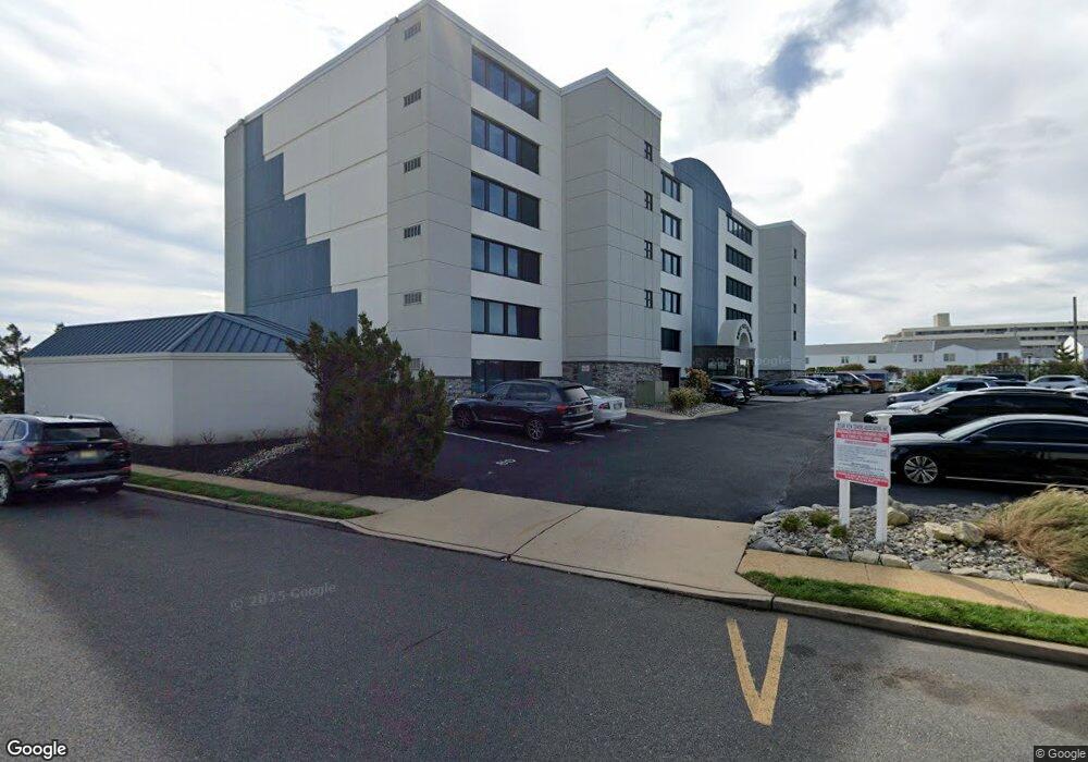
510 Ocean Ave N Unit 6 Long Branch, NJ 07740
Estimated Value: $645,026 - $1,019,000
1
Bed
2
Baths
1,128
Sq Ft
$716/Sq Ft
Est. Value
About This Home
This home is located at 510 Ocean Ave N Unit 6, Long Branch, NJ 07740 and is currently estimated at $807,257, approximately $715 per square foot. 510 Ocean Ave N Unit 6 is a home located in Monmouth County with nearby schools including Long Branch High School, Holy Trinity School, and Bet Yaakov of the Jersey Shore.
Ownership History
Date
Name
Owned For
Owner Type
Purchase Details
Closed on
Sep 19, 2005
Sold by
Robinson Patricia
Bought by
Robinson Patricia and Robinson James
Current Estimated Value
Home Financials for this Owner
Home Financials are based on the most recent Mortgage that was taken out on this home.
Original Mortgage
$45,350
Interest Rate
5.41%
Mortgage Type
Stand Alone Second
Purchase Details
Closed on
Sep 6, 2005
Sold by
Corpina Joseph B
Bought by
Robinson Patricia
Home Financials for this Owner
Home Financials are based on the most recent Mortgage that was taken out on this home.
Original Mortgage
$45,350
Interest Rate
5.41%
Mortgage Type
Stand Alone Second
Purchase Details
Closed on
Jun 16, 2000
Sold by
St Clare Regina
Bought by
Corpina Joseph and Corpina Nancy
Home Financials for this Owner
Home Financials are based on the most recent Mortgage that was taken out on this home.
Original Mortgage
$100,000
Interest Rate
8.48%
Create a Home Valuation Report for This Property
The Home Valuation Report is an in-depth analysis detailing your home's value as well as a comparison with similar homes in the area
Home Values in the Area
Average Home Value in this Area
Purchase History
| Date | Buyer | Sale Price | Title Company |
|---|---|---|---|
| Robinson Patricia | -- | -- | |
| Robinson Patricia | $450,000 | -- | |
| Corpina Joseph | $125,000 | -- |
Source: Public Records
Mortgage History
| Date | Status | Borrower | Loan Amount |
|---|---|---|---|
| Previous Owner | Robinson Patricia | $45,350 | |
| Previous Owner | Robinson Patricia | $359,650 | |
| Previous Owner | Corpina Joseph | $100,000 |
Source: Public Records
Tax History Compared to Growth
Tax History
| Year | Tax Paid | Tax Assessment Tax Assessment Total Assessment is a certain percentage of the fair market value that is determined by local assessors to be the total taxable value of land and additions on the property. | Land | Improvement |
|---|---|---|---|---|
| 2025 | $9,111 | $614,300 | $465,000 | $149,300 |
| 2024 | $8,872 | $592,800 | $450,000 | $142,800 |
| 2023 | $8,872 | $571,300 | $435,000 | $136,300 |
| 2022 | $9,811 | $503,100 | $383,000 | $120,100 |
| 2021 | $9,811 | $490,300 | $378,000 | $112,300 |
| 2020 | $10,170 | $486,600 | $375,000 | $111,600 |
| 2019 | $8,000 | $380,600 | $275,000 | $105,600 |
| 2018 | $7,963 | $376,700 | $275,000 | $101,700 |
| 2017 | $7,725 | $374,800 | $275,000 | $99,800 |
| 2016 | $7,522 | $372,200 | $275,000 | $97,200 |
| 2015 | $9,402 | $422,200 | $325,000 | $97,200 |
| 2014 | $8,359 | $395,600 | $137,700 | $257,900 |
Source: Public Records
Map
Nearby Homes
- 510 Ocean Ave N Unit 10
- 480 Ocean Ave Unit 2K
- 464 2nd Ave
- 14 Tower Rd
- 119 Avery Ave Unit H21
- 17 Tower Rd Unit D2
- 107 W End Ave
- 392 Ocean Ave Unit 1305
- 392 Ocean Ave Unit 1203
- 392 Ocean Ave Unit 1412
- 392 Ocean Ave Unit 1502
- 392 Ocean Ave Unit 1505
- 392 Ocean Ave Unit 1705
- 392 Ocean Ave Unit 1804
- 392 Ocean Ave Unit 1603
- 392 Ocean Ave Unit 1509
- 392 Ocean Ave Unit 1803
- 392 Ocean Ave Unit 1201
- 392 Ocean Ave Unit 1410
- 392 Ocean Ave Unit 1207
- 510 Ocean Ave N Unit 21
- 510 Ocean Ave N Unit 7
- 510 Ocean Ave Unit 28
- 510 Ocean Ave Unit 5
- 510 Ocean Ave Unit 1
- 510 Ocean Ave Unit 14
- 510 Ocean Ave Unit 24
- 510 Ocean Ave Unit 19
- 510 Ocean Ave Unit 32
- 510 Ocean Ave Unit 6
- 510 Ocean Ave Unit 29
- 510 Ocean Ave Unit 15
- 510 Ocean Ave Unit 27
- 510 Ocean Ave Unit 30
- 510 Ocean Ave Unit 18
- 510 Ocean Ave Unit 10
- 510 Ocean Ave Unit 31
- 510 Ocean Ave Unit 7
- 510 Ocean Ave Unit 16
- 510 Ocean Ave Unit 25