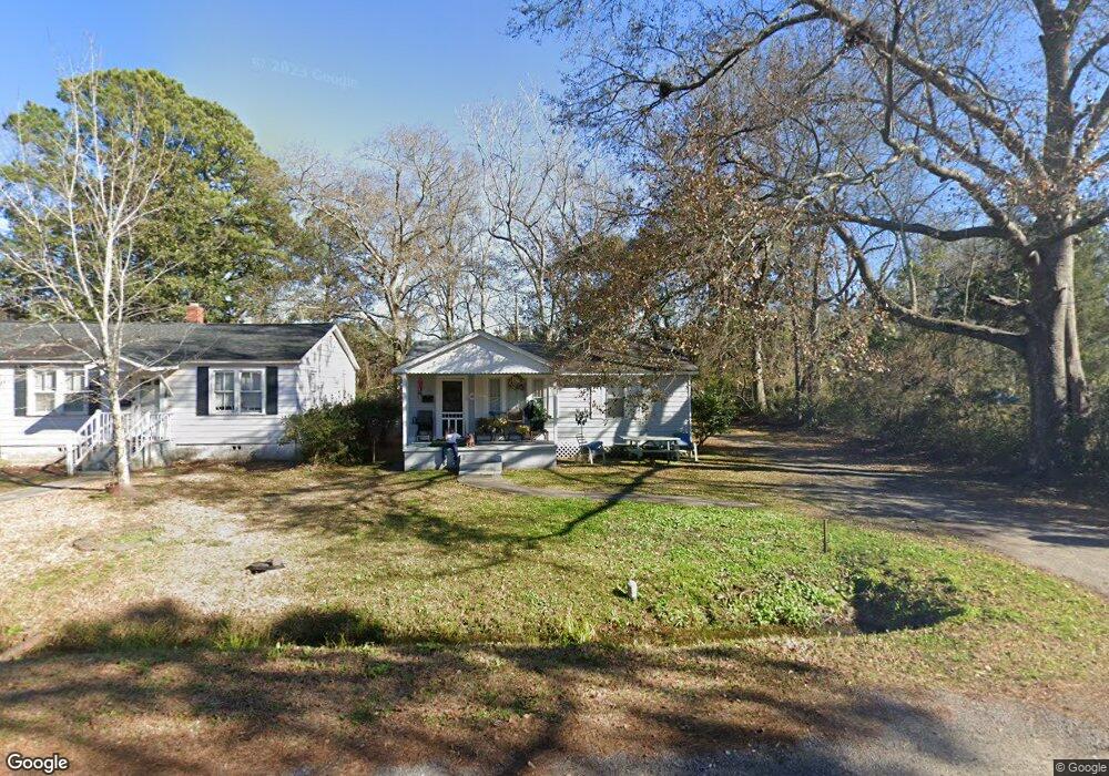
510 Palm St Georgetown, SC 29440
Estimated Value: $72,000 - $107,000
3
Beds
1
Bath
640
Sq Ft
$145/Sq Ft
Est. Value
About This Home
This home is located at 510 Palm St, Georgetown, SC 29440 and is currently estimated at $93,024, approximately $145 per square foot. 510 Palm St is a home located in Georgetown County with nearby schools including Kensington Elementary School, Georgetown Middle School, and Georgetown High School.
Ownership History
Date
Name
Owned For
Owner Type
Purchase Details
Closed on
Nov 30, 2006
Sold by
Marroc Properties Inc
Bought by
Vanderhorst Perry
Current Estimated Value
Purchase Details
Closed on
Feb 14, 2005
Sold by
Russ Carrol C
Bought by
Marroc Properties Inc
Home Financials for this Owner
Home Financials are based on the most recent Mortgage that was taken out on this home.
Original Mortgage
$35,000
Interest Rate
5.68%
Mortgage Type
Future Advance Clause Open End Mortgage
Create a Home Valuation Report for This Property
The Home Valuation Report is an in-depth analysis detailing your home's value as well as a comparison with similar homes in the area
Home Values in the Area
Average Home Value in this Area
Purchase History
| Date | Buyer | Sale Price | Title Company |
|---|---|---|---|
| Vanderhorst Perry | $47,000 | None Available | |
| Marroc Properties Inc | $35,000 | -- |
Source: Public Records
Mortgage History
| Date | Status | Borrower | Loan Amount |
|---|---|---|---|
| Previous Owner | Marroc Properties Inc | $35,000 |
Source: Public Records
Tax History Compared to Growth
Tax History
| Year | Tax Paid | Tax Assessment Tax Assessment Total Assessment is a certain percentage of the fair market value that is determined by local assessors to be the total taxable value of land and additions on the property. | Land | Improvement |
|---|---|---|---|---|
| 2024 | $994 | $2,610 | $650 | $1,960 |
| 2023 | $994 | $2,610 | $650 | $1,960 |
| 2022 | $895 | $2,610 | $650 | $1,960 |
| 2021 | $867 | $0 | $0 | $0 |
| 2020 | $866 | $0 | $0 | $0 |
| 2019 | $874 | $0 | $0 | $0 |
| 2018 | $880 | $0 | $0 | $0 |
| 2017 | $785 | $0 | $0 | $0 |
| 2016 | $777 | $2,676 | $0 | $0 |
| 2015 | $757 | $0 | $0 | $0 |
| 2014 | $757 | $43,300 | $10,800 | $32,500 |
| 2012 | -- | $43,300 | $10,800 | $32,500 |
Source: Public Records
Map
Nearby Homes
- 1508 Duke St
- 1306 Richmond Dr
- 2405 & 2407 Highmarket St
- 902 Palm St
- 2478 N Fraser St Unit 12+ acres
- 1510 Front St
- 125 N Fraser St
- 105 S Merriman Rd
- 105 S Merriman Rd Unit 1
- 910 Willowbank Rd
- 1137 Palmetto St
- 1209 Prince St
- 1121 Grimes St
- 0 Rainey Dr
- 133 Wood St
- 1010 Highmarket St
- 1019 Prince St
- 932 Duke St Unit Historic District of
- 1502 Pennsylvania Ave
- 811 Prince St Unit Historic District
- 512 Palm St
- 511 N Congdon St
- 509 N Congdon St
- 515 N Congdon St
- 1715 Hampton St
- 516 Palm St
- 507 Palm St
- 507 N Congdon St
- 509 Palm St
- 1714 Church St
- 517 N Congdon St
- 513 Palm St
- 1710 Church St
- 505 Palm St
- TBD N Congdon St
- 0 N Congdon St Unit 2309479
- 0 N Congdon St Unit 2126462
- 0 N Congdon St
- TBA--0 N Congdon St
- 505 N Congdon St