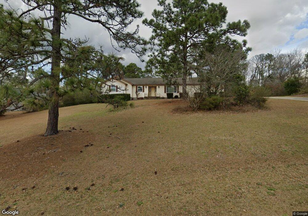
510 Pheasant Ridge Dr Warner Robins, GA 31088
Estimated Value: $249,773 - $271,000
3
Beds
2
Baths
1,890
Sq Ft
$139/Sq Ft
Est. Value
About This Home
This home is located at 510 Pheasant Ridge Dr, Warner Robins, GA 31088 and is currently estimated at $262,943, approximately $139 per square foot. 510 Pheasant Ridge Dr is a home located in Houston County with nearby schools including Quail Run Elementary School, Thomson Middle School, and Northside High School.
Ownership History
Date
Name
Owned For
Owner Type
Purchase Details
Closed on
Jun 1, 2011
Sold by
Waltermeyer Paul Estate
Bought by
Waltermeyer Margaret
Current Estimated Value
Purchase Details
Closed on
Sep 25, 2006
Sold by
Kolvick Ruth Arlene and Kolvick Robert John
Bought by
Waltermeyer Paul and Waltermeyer Margaret
Purchase Details
Closed on
Jun 5, 1981
Sold by
Mcneal-Watson Inc
Bought by
Kolvick Robert J
Create a Home Valuation Report for This Property
The Home Valuation Report is an in-depth analysis detailing your home's value as well as a comparison with similar homes in the area
Home Values in the Area
Average Home Value in this Area
Purchase History
| Date | Buyer | Sale Price | Title Company |
|---|---|---|---|
| Waltermeyer Margaret | -- | -- | |
| Waltermeyer Paul | $153,500 | None Available | |
| Kolvick Robert J | -- | -- |
Source: Public Records
Tax History Compared to Growth
Tax History
| Year | Tax Paid | Tax Assessment Tax Assessment Total Assessment is a certain percentage of the fair market value that is determined by local assessors to be the total taxable value of land and additions on the property. | Land | Improvement |
|---|---|---|---|---|
| 2024 | $1,819 | $85,160 | $12,000 | $73,160 |
| 2023 | $1,447 | $68,960 | $12,000 | $56,960 |
| 2022 | $1,217 | $59,440 | $11,200 | $48,240 |
| 2021 | $1,119 | $55,160 | $11,200 | $43,960 |
| 2020 | $936 | $47,440 | $11,200 | $36,240 |
| 2019 | $936 | $47,440 | $11,200 | $36,240 |
| 2018 | $936 | $47,440 | $11,200 | $36,240 |
| 2017 | $937 | $47,440 | $11,200 | $36,240 |
| 2016 | $938 | $47,440 | $11,200 | $36,240 |
| 2015 | $941 | $47,440 | $11,200 | $36,240 |
| 2014 | -- | $47,440 | $11,200 | $36,240 |
| 2013 | -- | $47,440 | $11,200 | $36,240 |
Source: Public Records
Map
Nearby Homes
- 322 Pheasant Ridge Dr
- 108 Covey Run Dr
- 307 Pheasant Ridge Dr
- 205 Bowen Dr
- 314 Briarmoor Dr
- Maple Plan at
- Belmont Plan at
- Oakwood Plan at
- Cannaberra Plan at
- Jackson Plan at
- Hawthorn Plan at
- Camden Plan at
- Delilah Plan at
- Aspen Plan at
- Dogwood Plan at
- Cypress Plan at
- Harrison Plan at
- 208 Antler Trail
- 203 Morning Dove Ln
- 713 Pheasant Ridge Dr
- 508 Pheasant Ridge Dr
- 512 Pheasant Ridge Dr
- 509 Pheasant Ridge Dr
- 507 Pheasant Ridge Dr
- 139 Partridge Trail
- 137 Partridge Trail
- 141 Partridge Trail
- 505 Pheasant Ridge Dr
- 511 Pheasant Ridge Dr
- 506 Pheasant Ridge Dr
- 135 Partridge Trail
- 133 Partridge Trail
- 515 Pheasant Ridge Dr
- 138 Partridge Trail
- 116 Covey Run Dr
- 140 Partridge Trail
- 131 Partridge Trail
- 503 Pheasant Ridge Dr
- 320 Pheasant Ridge Dr
- 132 Partridge Trail