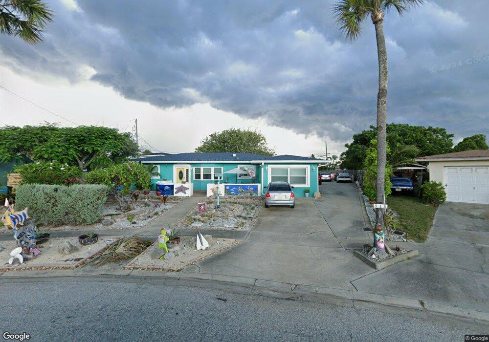
510 Royal Palm Blvd Satellite Beach, FL 32937
Estimated Value: $543,000 - $578,367
3
Beds
2
Baths
1,751
Sq Ft
$320/Sq Ft
Est. Value
About This Home
This home is located at 510 Royal Palm Blvd, Satellite Beach, FL 32937 and is currently estimated at $559,592, approximately $319 per square foot. 510 Royal Palm Blvd is a home located in Brevard County with nearby schools including Surfside Elementary School, Satellite Senior High School, and DeLaura Middle School.
Ownership History
Date
Name
Owned For
Owner Type
Purchase Details
Closed on
Nov 7, 2019
Sold by
Foley Susan Santore and Santore Cynthia Ann
Bought by
Foley Susan Santore and Santore Cynthia Ann
Current Estimated Value
Purchase Details
Closed on
Jun 18, 2018
Sold by
Foley Susan Santore and Estate Of Theresa Ann Santore
Bought by
Foley Susan Santore and Santore Cynthia Ann
Purchase Details
Closed on
May 23, 1995
Sold by
Ginish Linda R
Bought by
Santore Theresa
Home Financials for this Owner
Home Financials are based on the most recent Mortgage that was taken out on this home.
Original Mortgage
$88,500
Interest Rate
8.35%
Create a Home Valuation Report for This Property
The Home Valuation Report is an in-depth analysis detailing your home's value as well as a comparison with similar homes in the area
Home Values in the Area
Average Home Value in this Area
Purchase History
| Date | Buyer | Sale Price | Title Company |
|---|---|---|---|
| Foley Susan Santore | -- | None Available | |
| Foley Susan Santore | -- | Attorney | |
| Santore Theresa | $118,000 | -- |
Source: Public Records
Mortgage History
| Date | Status | Borrower | Loan Amount |
|---|---|---|---|
| Previous Owner | Santore Theresa | $88,500 |
Source: Public Records
Tax History Compared to Growth
Tax History
| Year | Tax Paid | Tax Assessment Tax Assessment Total Assessment is a certain percentage of the fair market value that is determined by local assessors to be the total taxable value of land and additions on the property. | Land | Improvement |
|---|---|---|---|---|
| 2025 | $4,700 | $293,060 | -- | -- |
| 2024 | $4,637 | $284,810 | -- | -- |
| 2023 | $4,637 | $276,520 | $0 | $0 |
| 2022 | $4,360 | $268,470 | $0 | $0 |
| 2021 | $4,515 | $260,660 | $0 | $0 |
| 2020 | $4,506 | $257,070 | $125,000 | $132,070 |
| 2019 | $4,597 | $256,830 | $125,000 | $131,830 |
| 2018 | $2,180 | $135,550 | $0 | $0 |
| 2017 | $2,022 | $132,770 | $0 | $0 |
| 2016 | $2,024 | $130,040 | $85,000 | $45,040 |
| 2015 | $2,070 | $129,140 | $75,000 | $54,140 |
| 2014 | $2,071 | $128,120 | $70,000 | $58,120 |
Source: Public Records
Map
Nearby Homes
- 199 Skyline Ct
- 155 Elm Ave
- 1455 Highway A1a Unit 507
- 484 Greenway Ave
- 204 Queens Ct
- 210 Queens Ct
- 189 Kings Way
- 105 Carissa Dr
- 110 Desoto Pkwy Unit 5
- 589 Coconut St
- 1369 Highway A1a Unit 8
- 1369 Highway A1a Unit 7
- 170 Norwood Ave
- 0 Cassia Blvd
- 380 Cherry Ct
- 295 Cinnamon Dr
- 1326 Highway A1a
- 375 Cherry Dr
- 230 Harwood Ave
- 235 S Marco Way
- 508 Royal Palm Blvd
- 120 Maple Dr
- 520 Royal Palm Blvd
- 110 Maple Dr
- 121 Skyline Cir
- 119 Skyline Cir
- 123 Skyline Cir
- 506 Royal Palm Blvd
- 515 Royal Palm Blvd
- 125 Skyline Cir
- 530 Royal Palm Blvd
- 130 Maple Dr
- 108 Maple Dr
- 118 Skyline Cir
- 535 Royal Palm Blvd
- 116 Skyline Cir
- 504 Royal Palm Blvd
- 127 Skyline Cir
- 540 Royal Palm Blvd
- 510 Coconut St