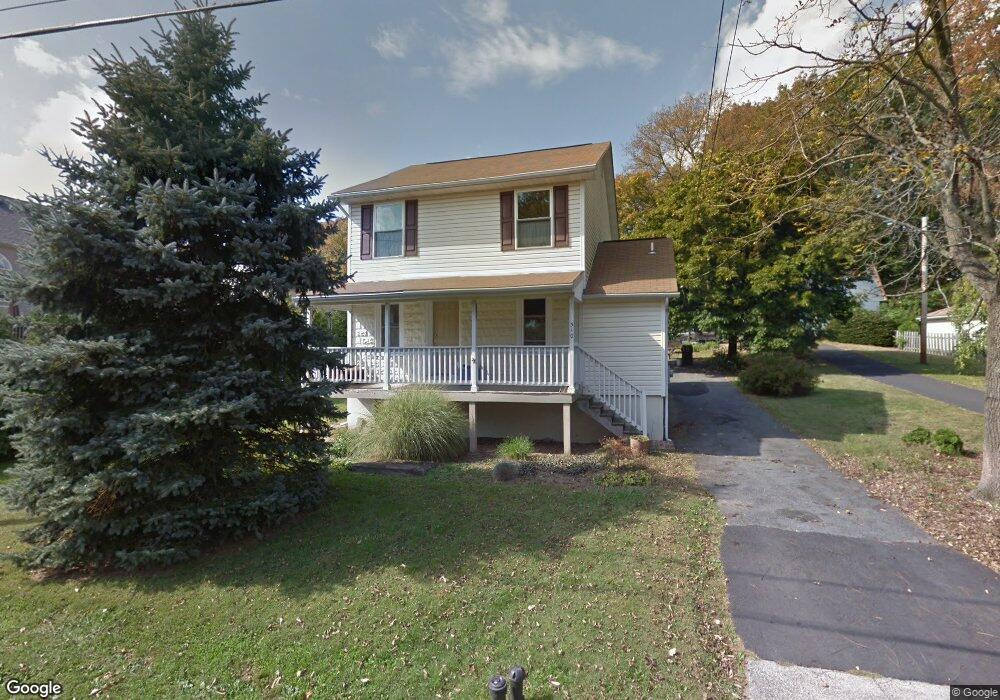
510 S 12th St Perkasie, PA 18944
East Rockhill NeighborhoodEstimated Value: $367,000 - $372,000
2
Beds
2
Baths
1,452
Sq Ft
$254/Sq Ft
Est. Value
About This Home
This home is located at 510 S 12th St, Perkasie, PA 18944 and is currently estimated at $368,899, approximately $254 per square foot. 510 S 12th St is a home located in Bucks County with nearby schools including Pennridge High School, Upper Bucks Christian School, and Community Service Foundation.
Ownership History
Date
Name
Owned For
Owner Type
Purchase Details
Closed on
Jan 18, 1994
Sold by
Wismer Brian S and Wismer Kimberly A
Bought by
Wismer Brian S and Wismer Kimberly A
Current Estimated Value
Home Financials for this Owner
Home Financials are based on the most recent Mortgage that was taken out on this home.
Original Mortgage
$76,500
Interest Rate
7.11%
Purchase Details
Closed on
Nov 28, 1989
Bought by
Wismer Brian S
Create a Home Valuation Report for This Property
The Home Valuation Report is an in-depth analysis detailing your home's value as well as a comparison with similar homes in the area
Home Values in the Area
Average Home Value in this Area
Purchase History
| Date | Buyer | Sale Price | Title Company |
|---|---|---|---|
| Wismer Brian S | -- | -- | |
| Wismer Brian S | $82,000 | -- |
Source: Public Records
Mortgage History
| Date | Status | Borrower | Loan Amount |
|---|---|---|---|
| Closed | Wismer Brian S | $76,500 |
Source: Public Records
Tax History Compared to Growth
Tax History
| Year | Tax Paid | Tax Assessment Tax Assessment Total Assessment is a certain percentage of the fair market value that is determined by local assessors to be the total taxable value of land and additions on the property. | Land | Improvement |
|---|---|---|---|---|
| 2025 | $3,178 | $18,480 | $1,840 | $16,640 |
| 2024 | $3,178 | $18,480 | $1,840 | $16,640 |
| 2023 | $3,141 | $18,480 | $1,840 | $16,640 |
| 2022 | $3,141 | $18,480 | $1,840 | $16,640 |
| 2021 | $3,085 | $18,480 | $1,840 | $16,640 |
| 2020 | $3,085 | $18,480 | $1,840 | $16,640 |
| 2019 | $3,067 | $18,480 | $1,840 | $16,640 |
| 2018 | $3,067 | $18,480 | $1,840 | $16,640 |
| 2017 | $3,044 | $18,480 | $1,840 | $16,640 |
| 2016 | $3,044 | $18,480 | $1,840 | $16,640 |
| 2015 | -- | $18,480 | $1,840 | $16,640 |
| 2014 | -- | $18,480 | $1,840 | $16,640 |
Source: Public Records
Map
Nearby Homes
- 225 S Ridge Rd
- Newhaven Grand Plan at Green Ridge Estates West
- Sutton Plan at Green Ridge Estates West
- Worthington Plan at Green Ridge Estates West
- Newhaven Plan at Green Ridge Estates West
- Barclay Plan at Green Ridge Estates West
- 414 S Ridge Rd
- 202 Parkridge Dr
- 1212 Jordan Ln
- 1200 Jordan Ln
- 1205 Jordan Ln
- 510 S 5th St
- 618 W Walnut St
- 42 S 8th St Unit HOMESITE 21
- 205 S 7th St
- 604 W Walnut St
- 504 S 4th St
- 616 W Walnut St
- 333 S 4th St
- 40 N 8th St Unit HOMESITE B20
- LOT 10 S 12th St
- 601 12th St
- 508 S 12th St
- 504 S 12th St
- 510 Jefferson Dr
- 506 Jefferson Dr
- 600 12th St
- 502 S 12th St
- 616 S 12th St
- 620 S 12th St
- 600 Jefferson Dr
- 500 Jefferson Dr
- 250 Parkridge Dr
- 248 Parkridge Dr
- 603 12th St
- 603 S 12th St
- 512 Concord Place
- 246 Parkridge Dr
- 252 Parkridge Dr
- 604 Jefferson Dr