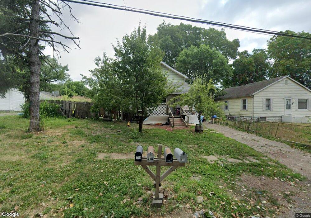
510 S Wesley St Unit 1 Springfield, IL 62703
Estimated Value: $42,000 - $60,892
--
Bed
--
Bath
--
Sq Ft
4,356
Sq Ft Lot
About This Home
This home is located at 510 S Wesley St Unit 1, Springfield, IL 62703 and is currently estimated at $51,297. 510 S Wesley St Unit 1 is a home located in Sangamon County with nearby schools including Matheny-Withrow Elementary School, Washington Middle School, and Lanphier High School.
Ownership History
Date
Name
Owned For
Owner Type
Purchase Details
Closed on
Nov 20, 2024
Sold by
Mcgrown Dion
Bought by
New View Land Llc
Current Estimated Value
Purchase Details
Closed on
Aug 22, 2024
Sold by
Eac Properties Llc Series 1
Bought by
Mcgrown Dion
Purchase Details
Closed on
Aug 19, 2024
Sold by
Sangamon County
Bought by
Eac Properties Llc
Purchase Details
Closed on
Jun 28, 2013
Purchase Details
Closed on
Dec 2, 1997
Create a Home Valuation Report for This Property
The Home Valuation Report is an in-depth analysis detailing your home's value as well as a comparison with similar homes in the area
Home Values in the Area
Average Home Value in this Area
Purchase History
| Date | Buyer | Sale Price | Title Company |
|---|---|---|---|
| New View Land Llc | $1,000 | None Listed On Document | |
| New View Land Llc | $1,000 | None Listed On Document | |
| Mcgrown Dion | $10,000 | None Listed On Document | |
| Eac Properties Llc | -- | None Listed On Document | |
| -- | -- | -- | |
| -- | -- | -- |
Source: Public Records
Tax History Compared to Growth
Tax History
| Year | Tax Paid | Tax Assessment Tax Assessment Total Assessment is a certain percentage of the fair market value that is determined by local assessors to be the total taxable value of land and additions on the property. | Land | Improvement |
|---|---|---|---|---|
| 2024 | $804 | $15,581 | $2,817 | $12,764 |
| 2023 | $722 | $14,116 | $2,552 | $11,564 |
| 2022 | $670 | $13,437 | $2,429 | $11,008 |
| 2021 | $575 | $12,321 | $2,227 | $10,094 |
| 2020 | $554 | $12,250 | $2,214 | $10,036 |
| 2019 | $539 | $12,204 | $2,206 | $9,998 |
| 2018 | $542 | $12,435 | $2,248 | $10,187 |
| 2017 | $647 | $12,057 | $2,180 | $9,877 |
| 2016 | $952 | $11,381 | $2,058 | $9,323 |
| 2015 | $949 | $11,329 | $2,049 | $9,280 |
| 2014 | $968 | $11,696 | $2,115 | $9,581 |
| 2013 | $991 | $12,353 | $2,234 | $10,119 |
Source: Public Records
Map
Nearby Homes
- 530 S Livingston St Unit 1
- 2991 Niccolls Rd
- 3011 Niccolls Rd
- 143 S Wesley St Unit 1
- 1105 Knoll Pointe Place
- 2128 E Capitol Ave
- 2152 E Adams St
- 160 Forrest Ave Unit FP-35
- 2132 E Adams St
- 2310 E Kansas St
- 404 N Daniels Ave
- 2331 South Grand Ave E
- 300 Forrest Ave Unit 120
- 300 Forrest Ave Unit 62
- 300 Forrest Ave Unit 103
- 300 Forrest Ave Unit 59
- 300 Forrest Ave Unit 107
- 300 Forrest Ave Unit 41
- 300 Forrest Ave Unit 109
- 2009 E Kansas St
- 512 S Wesley St
- 506 S Wesley St
- 602 S Wesley St
- 504 S Wesley St
- 601 S Wesley St Unit 1
- 604 S Wesley St
- 509 S Wesley St
- 511 S Wesley St
- 2704 E Jackson St Unit 1
- 507 S Wesley St
- 502 S Wesley St Unit 1
- 606 S Wesley St
- 605 S Wesley St
- 505 S Wesley St
- 2710 E Jackson St
- 500 S Wesley St Unit 1
- 503 S Wesley St
- 608 S Wesley St
- 2720 E Jackson St Unit 1
- 612 S Wesley St Unit 1