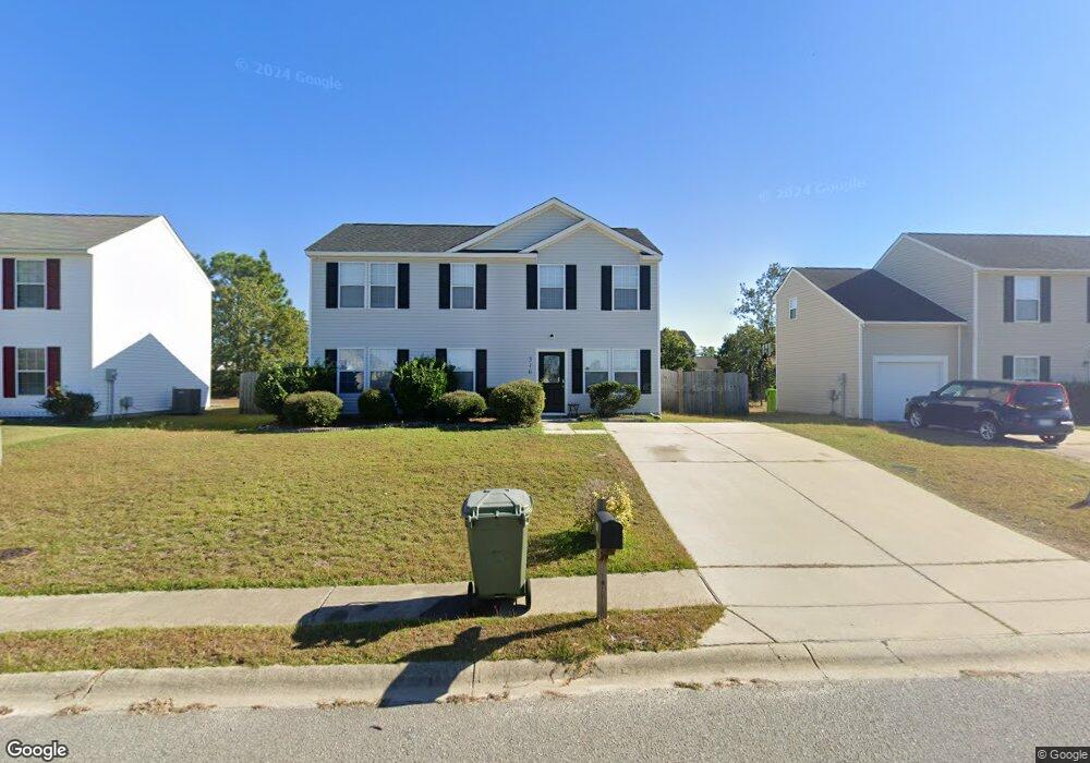
510 Sandpine Rd Columbia, SC 29229
Northeast Columbia NeighborhoodEstimated Value: $205,000 - $239,000
4
Beds
1
Bath
1,824
Sq Ft
$124/Sq Ft
Est. Value
About This Home
This home is located at 510 Sandpine Rd, Columbia, SC 29229 and is currently estimated at $225,722, approximately $123 per square foot. 510 Sandpine Rd is a home located in Richland County with nearby schools including Kelly Mill Middle School and Ridge View High School.
Ownership History
Date
Name
Owned For
Owner Type
Purchase Details
Closed on
Oct 23, 2024
Sold by
Tah Ms-2 Borrower Llc
Bought by
Tricon Sfr 2024-4 Borrower Llc
Current Estimated Value
Purchase Details
Closed on
Nov 21, 2019
Sold by
Tah Holding Lp
Bought by
Tah Ms 2 Borrower Llc
Purchase Details
Closed on
Dec 19, 2017
Sold by
Dibo Properties Llc
Bought by
Tah Holding Lp
Purchase Details
Closed on
Oct 30, 2017
Sold by
Bank Of America N A
Bought by
Dibo Properties Llc
Purchase Details
Closed on
Apr 26, 2002
Sold by
Firstar Homes Inc
Bought by
Gause Yvonne M
Home Financials for this Owner
Home Financials are based on the most recent Mortgage that was taken out on this home.
Original Mortgage
$98,900
Interest Rate
7.07%
Mortgage Type
Purchase Money Mortgage
Create a Home Valuation Report for This Property
The Home Valuation Report is an in-depth analysis detailing your home's value as well as a comparison with similar homes in the area
Home Values in the Area
Average Home Value in this Area
Purchase History
| Date | Buyer | Sale Price | Title Company |
|---|---|---|---|
| Tricon Sfr 2024-4 Borrower Llc | -- | Os National | |
| Tricon Sfr 2024-4 Borrower Llc | -- | Os National | |
| Tah Ms 2 Borrower Llc | -- | Os National Llc | |
| Tah Holding Lp | $100,000 | None Available | |
| Dibo Properties Llc | $70,000 | None Available | |
| Gause Yvonne M | $98,900 | -- | |
| Firstar Homes Inc | -- | -- |
Source: Public Records
Mortgage History
| Date | Status | Borrower | Loan Amount |
|---|---|---|---|
| Previous Owner | Gause Yvonne M | $98,900 |
Source: Public Records
Tax History Compared to Growth
Tax History
| Year | Tax Paid | Tax Assessment Tax Assessment Total Assessment is a certain percentage of the fair market value that is determined by local assessors to be the total taxable value of land and additions on the property. | Land | Improvement |
|---|---|---|---|---|
| 2024 | $4,619 | $131,100 | $0 | $0 |
| 2023 | $4,502 | $4,560 | $0 | $0 |
| 2022 | $4,119 | $114,000 | $20,300 | $93,700 |
| 2021 | $4,114 | $6,840 | $0 | $0 |
| 2020 | $4,132 | $6,840 | $0 | $0 |
| 2019 | $4,110 | $6,840 | $0 | $0 |
| 2018 | $3,641 | $6,000 | $0 | $0 |
| 2017 | $3,160 | $5,290 | $0 | $0 |
| 2016 | $3,144 | $5,290 | $0 | $0 |
| 2015 | $1,012 | $3,520 | $0 | $0 |
| 2014 | $1,011 | $88,100 | $0 | $0 |
| 2013 | -- | $3,520 | $0 | $0 |
Source: Public Records
Map
Nearby Homes
- 449 Legend Oaks Dr
- 201 Denby Cir
- 387 Legend Oaks Dr
- 1909 Lake Carolina Dr
- 1971 Lake Carolina Dr
- 253 Fox Grove Cir
- 1981 Lake Carolina Dr
- 233 Fox Grove Cir
- 478 Fox Trot Dr
- 461 Edenhall Dr
- 261 Bassett Loop
- 229 Bassett Loop
- 349 Gracemount Ln
- 246 Whitton Ln
- 113 Chapelwood Dr
- 405 Spring Oak Ln
- 1509 Legion Dr
- 311 Harbor Dr
- 442 Denman Loop
- 0 Topknoll Ct
- 600 Sandpine Rd
- 508 Sandpine Rd
- 410 Bombing Range Rd
- 408 Bombing Range Rd
- 506 Sandpine Rd
- 406 Bombing Range Rd
- 412 Bombing Range Rd
- 601 Sandpine Rd
- 332 Denby Cir
- 602 Sandpine Rd
- 414 Bombing Range Rd
- 504 Sandpine Rd
- 604 Sandpine Rd
- 404 Bombing Range Rd
- 313 Denby Cir
- 328 Denby Cir
- 416 Bombing Range Rd
- 1 Candon Ct
- 606 Sandpine Rd
- 100 Denby Cir