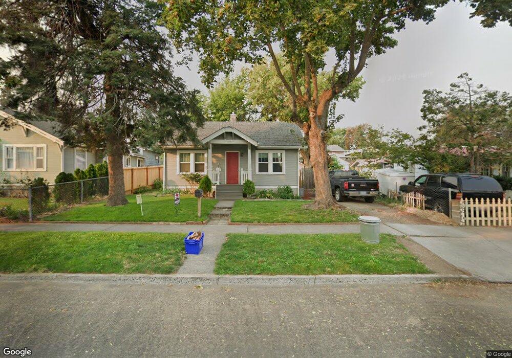
510 W 11th St the Dalles, OR 97058
Estimated Value: $291,598 - $328,000
2
Beds
1
Bath
1,542
Sq Ft
$201/Sq Ft
Est. Value
About This Home
This home is located at 510 W 11th St, the Dalles, OR 97058 and is currently estimated at $309,799, approximately $200 per square foot. 510 W 11th St is a home located in Wasco County with nearby schools including Colonel Wright Elementary School, The Dalles Middle School, and The Dalles High School.
Ownership History
Date
Name
Owned For
Owner Type
Purchase Details
Closed on
Jul 15, 2011
Sold by
Denton David S and Denton Christina E
Bought by
Homesales Inc
Current Estimated Value
Purchase Details
Closed on
Sep 11, 2008
Sold by
Pyle Nate N and Pyle Debbie
Bought by
Denton David S and Denton Christina E
Home Financials for this Owner
Home Financials are based on the most recent Mortgage that was taken out on this home.
Original Mortgage
$152,898
Interest Rate
6.5%
Mortgage Type
Future Advance Clause Open End Mortgage
Create a Home Valuation Report for This Property
The Home Valuation Report is an in-depth analysis detailing your home's value as well as a comparison with similar homes in the area
Home Values in the Area
Average Home Value in this Area
Purchase History
| Date | Buyer | Sale Price | Title Company |
|---|---|---|---|
| Homesales Inc | -- | -- | |
| Denton David S | $145,000 | -- |
Source: Public Records
Mortgage History
| Date | Status | Borrower | Loan Amount |
|---|---|---|---|
| Previous Owner | Denton David S | $152,898 |
Source: Public Records
Tax History Compared to Growth
Tax History
| Year | Tax Paid | Tax Assessment Tax Assessment Total Assessment is a certain percentage of the fair market value that is determined by local assessors to be the total taxable value of land and additions on the property. | Land | Improvement |
|---|---|---|---|---|
| 2024 | $1,835 | $101,944 | -- | -- |
| 2023 | $1,781 | $98,975 | $0 | $0 |
| 2022 | $1,742 | $167,389 | $0 | $0 |
| 2021 | $1,689 | $162,514 | $0 | $0 |
| 2020 | $1,647 | $157,781 | $0 | $0 |
| 2019 | $1,739 | $153,185 | $0 | $0 |
| 2018 | $1,691 | $85,377 | $0 | $0 |
| 2017 | $1,637 | $82,890 | $0 | $0 |
| 2016 | $1,602 | $80,476 | $0 | $0 |
Source: Public Records
Map
Nearby Homes
- 719 W 11th St
- 1314 Mount Hood St
- 811 W 9th St
- 608 W 6th St
- 309 W 7th St
- 529 W 3rd Place
- 0 W 16th St
- 209 1/2 W 5th Place
- 990 W 8th Place
- 1832 Cherry Heights Rd
- 115 W Scenic Dr
- 216 E 5th St
- 319 E 7th St
- 417 Park Place
- 2405 Wright St
- 531 E 8th St
- 1105 Blakely Way
- 809 E 7th St
- 0 Sandstone Way
- 2437 Wright Dr