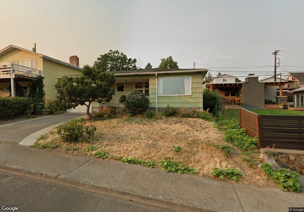
510 W 13th St the Dalles, OR 97058
Estimated Value: $255,230 - $263,000
2
Beds
1
Bath
1,109
Sq Ft
$234/Sq Ft
Est. Value
About This Home
This home is located at 510 W 13th St, the Dalles, OR 97058 and is currently estimated at $259,115, approximately $233 per square foot. 510 W 13th St is a home located in Wasco County with nearby schools including Colonel Wright Elementary School, The Dalles Middle School, and The Dalles High School.
Ownership History
Date
Name
Owned For
Owner Type
Purchase Details
Closed on
Oct 28, 2024
Sold by
Watts Mary Louise
Bought by
Watts John P and Burt Donna
Current Estimated Value
Create a Home Valuation Report for This Property
The Home Valuation Report is an in-depth analysis detailing your home's value as well as a comparison with similar homes in the area
Home Values in the Area
Average Home Value in this Area
Purchase History
| Date | Buyer | Sale Price | Title Company |
|---|---|---|---|
| Watts John P | -- | None Listed On Document | |
| Watts John P | -- | None Listed On Document |
Source: Public Records
Tax History Compared to Growth
Tax History
| Year | Tax Paid | Tax Assessment Tax Assessment Total Assessment is a certain percentage of the fair market value that is determined by local assessors to be the total taxable value of land and additions on the property. | Land | Improvement |
|---|---|---|---|---|
| 2024 | $2,045 | $113,640 | -- | -- |
| 2023 | $1,986 | $110,331 | $0 | $0 |
| 2022 | $1,942 | $136,102 | $0 | $0 |
| 2021 | $1,882 | $132,138 | $0 | $0 |
| 2020 | $1,836 | $128,289 | $0 | $0 |
| 2019 | $1,938 | $124,552 | $0 | $0 |
| 2018 | $1,885 | $95,172 | $0 | $0 |
| 2017 | $1,825 | $92,400 | $0 | $0 |
| 2016 | $1,786 | $89,709 | $0 | $0 |
Source: Public Records
Map
Nearby Homes
- 602 W 13th St
- 719 W 11th St
- 0 W 16th St
- 906 Garrison St
- 811 W 9th St
- 115 W Scenic Dr
- 309 W 7th St
- 608 W 6th St
- 529 W 3rd Place
- 522 W 22nd St
- 990 W 8th Place
- 209 1/2 W 5th Place
- 417 Park Place
- 1832 Cherry Heights Rd
- 216 E 5th St
- 319 E 7th St
- 1014 Laughlin St
- 0 Sandstone Way
- 531 E 8th St
- 2601 Ericksen Way