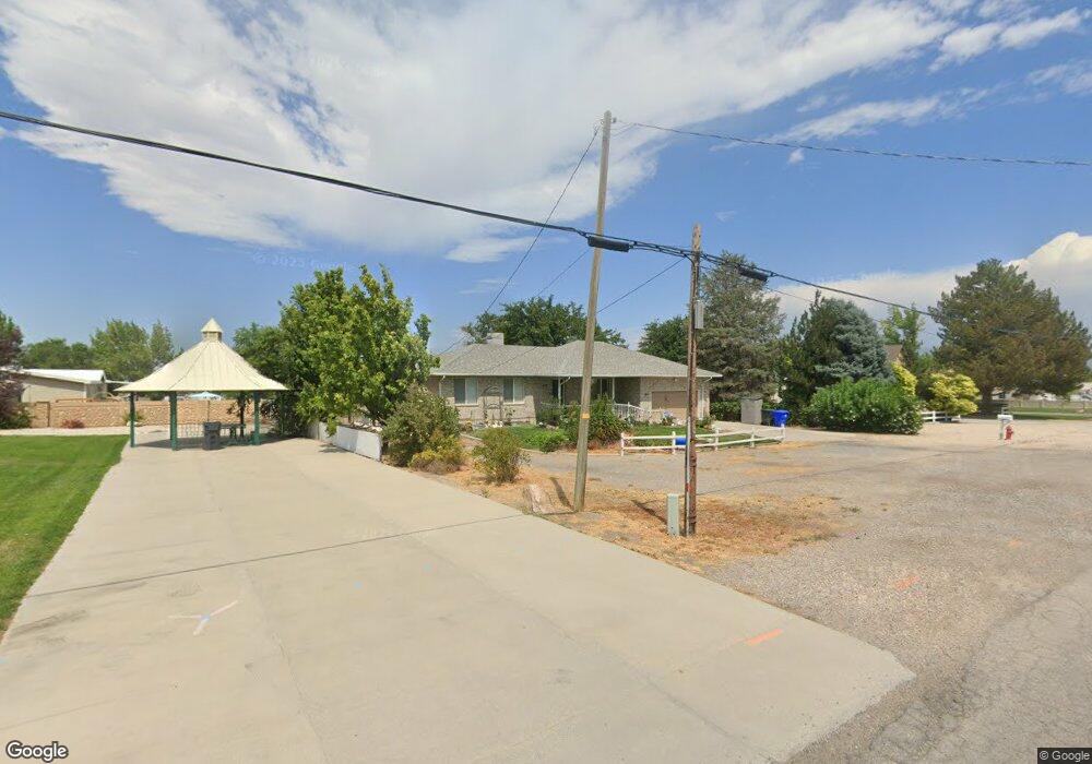
510 W Clark St Grantsville, UT 84029
Estimated Value: $520,000 - $567,686
3
Beds
2
Baths
2,734
Sq Ft
$198/Sq Ft
Est. Value
About This Home
This home is located at 510 W Clark St, Grantsville, UT 84029 and is currently estimated at $540,172, approximately $197 per square foot. 510 W Clark St is a home located in Tooele County with nearby schools including Grantsville Elementary School, Grantsville Junior High School, and Grantsville High School.
Ownership History
Date
Name
Owned For
Owner Type
Purchase Details
Closed on
May 14, 2025
Sold by
Wiss Leilani K
Bought by
Leilani K Wiss Living Trust and Wiss
Current Estimated Value
Purchase Details
Closed on
Jun 17, 2007
Sold by
Harris Robert M
Bought by
Wiss Leilani K
Home Financials for this Owner
Home Financials are based on the most recent Mortgage that was taken out on this home.
Original Mortgage
$90,000
Interest Rate
6.16%
Mortgage Type
New Conventional
Purchase Details
Closed on
Jan 11, 2007
Sold by
Harris Nancy A
Bought by
Harris Robert M
Create a Home Valuation Report for This Property
The Home Valuation Report is an in-depth analysis detailing your home's value as well as a comparison with similar homes in the area
Home Values in the Area
Average Home Value in this Area
Purchase History
| Date | Buyer | Sale Price | Title Company |
|---|---|---|---|
| Leilani K Wiss Living Trust | -- | Meridian Title | |
| Wiss Leilani K | -- | None Available | |
| Harris Robert M | -- | None Available |
Source: Public Records
Mortgage History
| Date | Status | Borrower | Loan Amount |
|---|---|---|---|
| Previous Owner | Wiss Leilani K | $90,000 |
Source: Public Records
Tax History Compared to Growth
Tax History
| Year | Tax Paid | Tax Assessment Tax Assessment Total Assessment is a certain percentage of the fair market value that is determined by local assessors to be the total taxable value of land and additions on the property. | Land | Improvement |
|---|---|---|---|---|
| 2025 | $3,698 | $330,630 | $113,300 | $217,330 |
| 2024 | $3,698 | $301,959 | $113,300 | $188,659 |
| 2023 | $3,698 | $271,890 | $77,550 | $194,340 |
| 2022 | $3,076 | $283,044 | $89,375 | $193,669 |
| 2021 | $2,504 | $187,932 | $55,000 | $132,932 |
| 2020 | $2,478 | $321,121 | $97,750 | $223,371 |
| 2019 | $2,626 | $329,310 | $69,000 | $260,310 |
| 2018 | $2,599 | $306,358 | $69,000 | $237,358 |
| 2017 | $2,155 | $268,104 | $69,000 | $199,104 |
| 2016 | $2,074 | $143,219 | $39,750 | $103,469 |
| 2015 | $2,074 | $143,219 | $0 | $0 |
| 2014 | -- | $98,487 | $0 | $0 |
Source: Public Records
Map
Nearby Homes
- 500 W Clark St
- 49 Tiebreaker Cir
- 407 W Richard St
- 26 N Wayne Way
- 39 N Wayne Way
- 37 N Wayne Way
- 600 W Clark St
- 643 W Banner Dr
- 653 W Banner Dr
- 655 W Banner Dr Unit 1042
- 690 W Sagewood Cir
- 28 Meadowlark Cir
- Logan Plan at Springfield Estates
- Lily Plan at Springfield Estates
- Asher Plan at Springfield Estates
- Jordan Plan at Springfield Estates
- Kingston Craftsman Plan at Springfield Estates
- Brooklyn Plan at Springfield Estates
- McCade Modern Plan at Springfield Estates
- Sawyer Craftsman Plan at Springfield Estates
- 484 W Clark St
- 481 W Clark St
- 94 Tiebreaker Cir
- 475 W Clark St
- 469 W Clark St
- 133 N Paige Ln Unit 1
- 133 N Paige Ln
- 86 Tiebreaker Cir
- 65 N Blaine Ave
- 460 W Clark St
- 71 N Blaine Ave
- 95 N Blaine Ave
- 85 Tiebreaker Cir
- 96 Tiebreaker Dr
- 78 Tiebreaker Cir
- 61 N Blaine Ave
- 81 N Blaine Ave
- 88 Tiebreaker Dr
- 77 Tiebreaker Cir
- 431 W Clark St