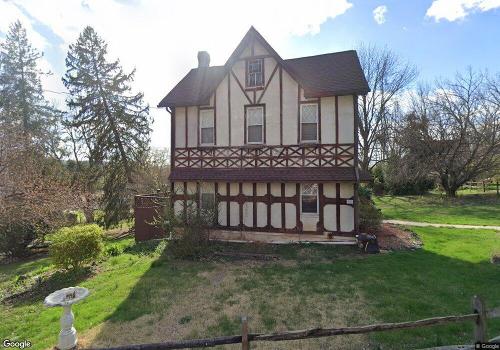
510 W Neversink Rd Reading, PA 19606
Estimated Value: $248,285 - $337,000
3
Beds
2
Baths
1,764
Sq Ft
$167/Sq Ft
Est. Value
About This Home
This home is located at 510 W Neversink Rd, Reading, PA 19606 and is currently estimated at $294,571, approximately $166 per square foot. 510 W Neversink Rd is a home located in Berks County with nearby schools including Jacksonwald Elementary School, Exeter Township Junior High School, and Exeter Township Senior High School.
Ownership History
Date
Name
Owned For
Owner Type
Purchase Details
Closed on
May 31, 2006
Sold by
The Estate Of Winifred E Stanley
Bought by
Stanley Andrew P
Current Estimated Value
Home Financials for this Owner
Home Financials are based on the most recent Mortgage that was taken out on this home.
Original Mortgage
$106,000
Interest Rate
6.37%
Mortgage Type
Adjustable Rate Mortgage/ARM
Create a Home Valuation Report for This Property
The Home Valuation Report is an in-depth analysis detailing your home's value as well as a comparison with similar homes in the area
Home Values in the Area
Average Home Value in this Area
Purchase History
| Date | Buyer | Sale Price | Title Company |
|---|---|---|---|
| Stanley Andrew P | $160,000 | Stewart Title Guaranty Co |
Source: Public Records
Mortgage History
| Date | Status | Borrower | Loan Amount |
|---|---|---|---|
| Closed | Stanley Andrew P | $106,000 |
Source: Public Records
Tax History Compared to Growth
Tax History
| Year | Tax Paid | Tax Assessment Tax Assessment Total Assessment is a certain percentage of the fair market value that is determined by local assessors to be the total taxable value of land and additions on the property. | Land | Improvement |
|---|---|---|---|---|
| 2025 | $1,195 | $76,700 | $33,200 | $43,500 |
| 2024 | $3,642 | $76,700 | $33,200 | $43,500 |
| 2023 | $3,523 | $76,700 | $33,200 | $43,500 |
| 2022 | $3,484 | $76,700 | $33,200 | $43,500 |
| 2021 | $3,431 | $76,700 | $33,200 | $43,500 |
| 2020 | $3,393 | $76,700 | $33,200 | $43,500 |
| 2019 | $3,356 | $76,700 | $33,200 | $43,500 |
| 2018 | $3,346 | $76,700 | $33,200 | $43,500 |
| 2017 | $3,297 | $76,700 | $33,200 | $43,500 |
| 2016 | $798 | $76,700 | $33,200 | $43,500 |
| 2015 | $798 | $76,700 | $33,200 | $43,500 |
| 2014 | $770 | $76,700 | $33,200 | $43,500 |
Source: Public Records
Map
Nearby Homes
- 10 Klapperthal Rd
- 56 Hearthstone Dr
- 601 W 37th St
- 6-4 Willow Way
- 16 Ironstone Dr
- 5 Craig Dr
- 31 1 Wister
- 55 1 Holly Dr
- 202 W 39th St
- 3505 Circle Ave
- 111 W 33rd St
- 60-6 Mint Tier Unit 6
- 4482 Heron Dr
- 0 Perkiomen Ave Unit PABK2061892
- 3406 Perkiomen Ave
- 101 Killian Dr
- 3609 Grant St
- 4536 Del Mar Dr
- 2460 Grandview Ave
- 0 Highland Ave
- 11 Dewald Rd
- 520 W Neversink Rd
- 21 Dewald Rd
- 521 W Neversink Rd
- 31 Dewald Rd
- 511 W Neversink Rd
- 530 W Neversink Rd
- 480 W Neversink Rd
- 481 W Neversink Rd
- 41 Dewald Rd
- 513 W Neversink Rd
- 540 W Neversink Rd
- 470 W Neversink Rd
- 51 Dewald Rd
- 550 W Neversink Rd
- 541 W Neversink Rd
- 461 W Neversink Rd
- 560 W Neversink Rd
- 460 W Neversink Rd
- 0 Dewald Rd