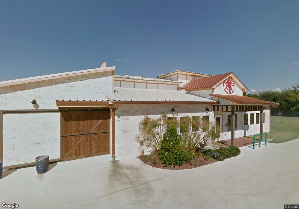
5101 E University Dr Unit WEST Aubrey, TX 76227
North Denton NeighborhoodEstimated Value: $1,813,000
Studio
--
Bath
24,960
Sq Ft
$73/Sq Ft
Est. Value
About This Home
This home is located at 5101 E University Dr Unit WEST, Aubrey, TX 76227 and is currently estimated at $1,813,000, approximately $72 per square foot. 5101 E University Dr Unit WEST is a home located in Denton County with nearby schools including Hodge Elementary School, Strickland Middle School, and Billy Ryan High School.
Ownership History
Date
Name
Owned For
Owner Type
Purchase Details
Closed on
Jul 29, 2021
Sold by
Stock Robert and Stock Viveca
Bought by
Buffalo Property Holdings Llc
Current Estimated Value
Home Financials for this Owner
Home Financials are based on the most recent Mortgage that was taken out on this home.
Original Mortgage
$3,800,000
Outstanding Balance
$2,381,237
Interest Rate
2.93%
Mortgage Type
Seller Take Back
Estimated Equity
-$568,237
Create a Home Valuation Report for This Property
The Home Valuation Report is an in-depth analysis detailing your home's value as well as a comparison with similar homes in the area
Home Values in the Area
Average Home Value in this Area
Purchase History
| Date | Buyer | Sale Price | Title Company |
|---|---|---|---|
| Buffalo Property Holdings Llc | -- | None Available |
Source: Public Records
Mortgage History
| Date | Status | Borrower | Loan Amount |
|---|---|---|---|
| Open | Buffalo Property Holdings Llc | $3,800,000 |
Source: Public Records
Tax History
| Year | Tax Paid | Tax Assessment Tax Assessment Total Assessment is a certain percentage of the fair market value that is determined by local assessors to be the total taxable value of land and additions on the property. | Land | Improvement |
|---|---|---|---|---|
| 2025 | $32,235 | $2,095,000 | $1,363,254 | $731,746 |
| 2024 | $15,387 | $797,188 | $242,975 | $554,213 |
| 2023 | $30,690 | $1,917,646 | $908,836 | $1,008,810 |
| 2022 | $20,621 | $1,598,850 | $721,624 | $877,226 |
| 2021 | $11,242 | $1,457,205 | $166,686 | $1,290,519 |
| 2020 | $11,223 | $1,457,205 | $166,686 | $1,290,519 |
| 2019 | $11,293 | $1,457,205 | $166,686 | $1,290,519 |
| 2018 | $12,848 | $1,392,216 | $166,686 | $1,225,530 |
| 2017 | $10,647 | $1,300,000 | $166,687 | $1,133,313 |
| 2016 | $9,411 | $1,150,000 | $166,687 | $983,313 |
| 2015 | -- | $955,050 | $166,687 | $788,363 |
Source: Public Records
Map
Nearby Homes
- 1809 N Trinity Rd
- 2000 N Trinity Rd
- 70.79AC Collins-Mingo Rd
- 11.71 AC Mingo & Collins Rd
- 1500 Lakeview Blvd
- 2701-2757 Greenleaf Cir
- 2518 Laney Rd
- 7701 Oak Creek Ln
- 17.63AC Collins Rd
- 41.45AC Collins Rd
- 307 S Trinity Rd
- 313 S Trinity Rd
- 8517 Stallion St
- 6565 Rockridge Trail
- 1450 Woodland Dr
- 3407 Cooper Creek Rd
- 5167 Rockhill Rd
- 1810 Woodland Dr
- 651 S Trinity Rd
- 6757 Rockridge Trail
- 5101 E University Dr Unit East
- 5101 E University Dr
- 5101 E University Dr Unit 601
- 5118 E University Dr Unit A
- 5118 E University Dr Unit 1
- 5118 E University Dr
- 3016 N Trinity Rd
- 5100 E University A Dr
- 5100 E University Dr
- 5100 E University Dr Unit 1
- 1850 Riverside Dr
- 106 N Trinity Rd
- 2699 Browntrail Ct
- 3030 N Trinity Rd
- 1899 Riverside Dr
- 0 Riverside Dr
- 5024 E University Dr
- 5120 E University Dr
- 3025 N Trinity Rd
- 3036 N Trinity Rd
Your Personal Tour Guide
Ask me questions while you tour the home.