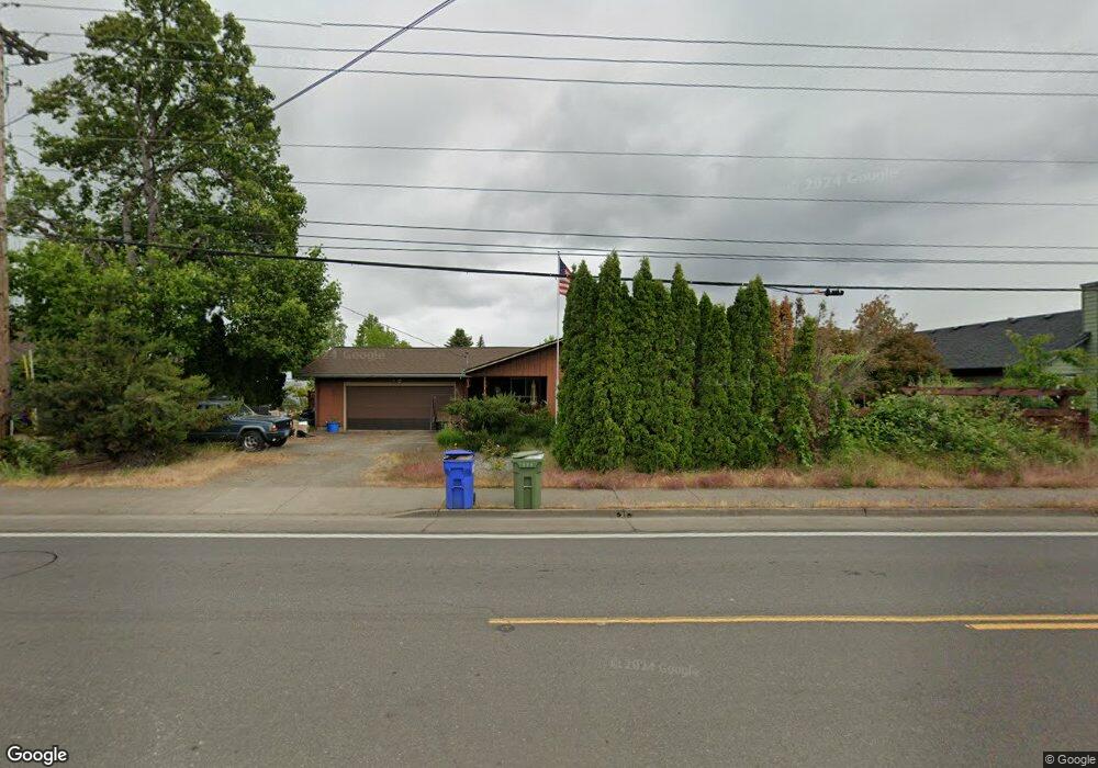
5101 Royal Ave Eugene, OR 97402
Bethel NeighborhoodEstimated Value: $295,945 - $433,000
3
Beds
2
Baths
1,592
Sq Ft
$234/Sq Ft
Est. Value
About This Home
This home is located at 5101 Royal Ave, Eugene, OR 97402 and is currently estimated at $372,486, approximately $233 per square foot. 5101 Royal Ave is a home located in Lane County with nearby schools including Prairie Mountain School and Willamette High School.
Ownership History
Date
Name
Owned For
Owner Type
Purchase Details
Closed on
Dec 2, 2025
Sold by
Norton Kelly G
Bought by
Norton Brandon
Current Estimated Value
Home Financials for this Owner
Home Financials are based on the most recent Mortgage that was taken out on this home.
Original Mortgage
$240,000
Outstanding Balance
$227,801
Interest Rate
6.19%
Mortgage Type
Seller Take Back
Estimated Equity
$144,685
Purchase Details
Closed on
Aug 26, 2015
Sold by
Haines Kathleen G
Bought by
Norton Kelly G
Home Financials for this Owner
Home Financials are based on the most recent Mortgage that was taken out on this home.
Original Mortgage
$182,000
Interest Rate
4.05%
Mortgage Type
VA
Purchase Details
Closed on
Jun 6, 2011
Sold by
Haines Kathleen G
Bought by
Haines Kathleen G and Haines Survivors Trust
Create a Home Valuation Report for This Property
The Home Valuation Report is an in-depth analysis detailing your home's value as well as a comparison with similar homes in the area
Home Values in the Area
Average Home Value in this Area
Purchase History
| Date | Buyer | Sale Price | Title Company |
|---|---|---|---|
| Norton Brandon | $240,000 | Fidelity National Title | |
| Norton Kelly G | $182,000 | Western Title & Escrow Co | |
| Haines Kathleen G | -- | None Available | |
| Haines Kathleen G | -- | None Available |
Source: Public Records
Mortgage History
| Date | Status | Borrower | Loan Amount |
|---|---|---|---|
| Open | Norton Brandon | $240,000 | |
| Previous Owner | Norton Kelly G | $182,000 |
Source: Public Records
Tax History
| Year | Tax Paid | Tax Assessment Tax Assessment Total Assessment is a certain percentage of the fair market value that is determined by local assessors to be the total taxable value of land and additions on the property. | Land | Improvement |
|---|---|---|---|---|
| 2025 | $3,070 | $208,032 | -- | -- |
| 2024 | $2,992 | $201,973 | -- | -- |
| 2023 | $2,992 | $196,091 | $0 | $0 |
| 2022 | $2,785 | $190,380 | $0 | $0 |
| 2021 | $2,727 | $184,835 | $0 | $0 |
| 2020 | $2,647 | $179,452 | $0 | $0 |
| 2019 | $2,517 | $174,226 | $0 | $0 |
| 2018 | $2,447 | $164,225 | $0 | $0 |
| 2017 | $2,756 | $164,225 | $0 | $0 |
| 2016 | $2,686 | $159,442 | $0 | $0 |
| 2015 | $2,633 | $154,798 | $0 | $0 |
| 2014 | $2,593 | $150,289 | $0 | $0 |
Source: Public Records
Map
Nearby Homes
- 749 St Charles St
- 735 St Charles St
- 5260 Forest Ln
- 723 St Charles St
- 715 St Charles St
- 716 St Charles St
- 5254 Forest Ln
- 5275 Forest Ln
- 683 Saint Charles St
- 671 Saint Charles St
- 5320 Royal Ave
- 648 Oakwood Dr
- 670 Saint Charles St
- 664 Saint Charles St
- 647 Oakwood Dr
- 639 Oakwood Dr
- 658 Saint Charles St
- 4900 Royal Ave Unit 105
- 4900 Royal Ave Unit SP13
- 1199 N Terry St
- 5097 Royal Ave
- 5111 Royal Ave
- 5093 Royal Ave
- 5102 Royal Ave
- 5081 Royal Ave
- 5085 Royal Ave
- 5120 Royal Ave
- 786 Driftwood Dr
- 5075 Royal Ave
- 787 N Terry St
- 797 Driftwood Dr
- 774 Driftwood Dr
- 5165 Royal Ave
- 5130 Royal Ave
- 5071 Royal Ave
- 785 Driftwood Dr
- 5067 Royal Ave
- 787 Woodland Acres Ln
- 771 Woodland Acres Ln
- 762 Driftwood Dr
Your Personal Tour Guide
Ask me questions while you tour the home.