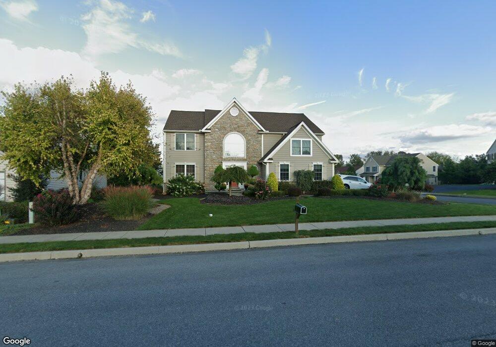
5103 Stoudts Ferry Bridge Rd Reading, PA 19605
Outer Muhlenberg Township NeighborhoodEstimated Value: $472,547 - $531,000
4
Beds
4
Baths
3,054
Sq Ft
$164/Sq Ft
Est. Value
About This Home
This home is located at 5103 Stoudts Ferry Bridge Rd, Reading, PA 19605 and is currently estimated at $499,637, approximately $163 per square foot. 5103 Stoudts Ferry Bridge Rd is a home located in Berks County with nearby schools including C E Cole Intermediate School, Muhlenberg Elementary Center, and Muhlenberg Junior High School.
Ownership History
Date
Name
Owned For
Owner Type
Purchase Details
Closed on
Nov 29, 2011
Sold by
Harter Samuel K and Perella Courtney B
Bought by
Harter Samuel K and Harter Courtney B
Current Estimated Value
Home Financials for this Owner
Home Financials are based on the most recent Mortgage that was taken out on this home.
Original Mortgage
$28,000
Outstanding Balance
$19,154
Interest Rate
4.01%
Mortgage Type
Credit Line Revolving
Estimated Equity
$480,483
Create a Home Valuation Report for This Property
The Home Valuation Report is an in-depth analysis detailing your home's value as well as a comparison with similar homes in the area
Home Values in the Area
Average Home Value in this Area
Purchase History
| Date | Buyer | Sale Price | Title Company |
|---|---|---|---|
| Harter Samuel K | -- | None Available |
Source: Public Records
Mortgage History
| Date | Status | Borrower | Loan Amount |
|---|---|---|---|
| Open | Harter Samuel K | $28,000 | |
| Open | Harter Samuel K | $224,000 |
Source: Public Records
Tax History Compared to Growth
Tax History
| Year | Tax Paid | Tax Assessment Tax Assessment Total Assessment is a certain percentage of the fair market value that is determined by local assessors to be the total taxable value of land and additions on the property. | Land | Improvement |
|---|---|---|---|---|
| 2025 | $2,916 | $194,200 | $49,600 | $144,600 |
| 2024 | $9,350 | $194,200 | $49,600 | $144,600 |
| 2023 | $8,775 | $194,200 | $49,600 | $144,600 |
| 2022 | $8,630 | $194,200 | $49,600 | $144,600 |
| 2021 | $8,426 | $194,200 | $49,600 | $144,600 |
| 2020 | $8,426 | $194,200 | $49,600 | $144,600 |
| 2019 | $8,247 | $194,200 | $49,600 | $144,600 |
| 2018 | $8,101 | $194,200 | $49,600 | $144,600 |
| 2017 | $7,949 | $194,200 | $49,600 | $144,600 |
| 2016 | $2,355 | $194,200 | $49,600 | $144,600 |
| 2015 | $2,355 | $194,200 | $49,600 | $144,600 |
| 2014 | $2,355 | $194,200 | $49,600 | $144,600 |
Source: Public Records
Map
Nearby Homes
- 1025 River Crest Dr
- 5213 Stoudts Ferry Bridge Rd
- 1041 River Crest Dr
- 1282 Fredrick Blvd Unit 15F
- 833 Pine Heights Rd
- 1033 Barberry Ave
- 1105 Showers Ln
- 1021 Barberry Ave Unit T67
- 1047 Sage Ave
- 1019 Heath Ave
- 1012 Dallas Rd
- 1002 Heath Ave
- 1052 Boeshore Cir
- 914 Suellen Dr
- 1125 Ashbourne Dr
- 1033 Whitford Dr
- 1129 Whitner Rd
- 1162 Tuckerton Rd
- 3706 Rosewood Rd
- 3810 Willow Grove Ave
- 5105 Stoudts Ferry Bridge Rd
- 1000 Helm Ln
- 1002 Helm Ln
- 5107 Stoudts Ferry Bridge Rd Unit 153
- 5101 Stoudts Ferry Bridge Rd
- 1001 River Crest Dr
- 1002 River Crest Dr
- 660 Ebersole Rd Unit 65
- 660 Ebersole Rd
- 1004 Helm Ln
- 1008 River Crest Dr
- 1006 River Crest Dr
- 1030 River Crest Dr
- 1014 River Crest Dr
- 1032 River Crest Dr
- 1017 River Crest Dr
- 1034 River Crest Dr Unit 17
- 1005 River Crest Dr
- 1019 River Crest Dr Unit 30
- 1031 River Crest Dr Unit 34