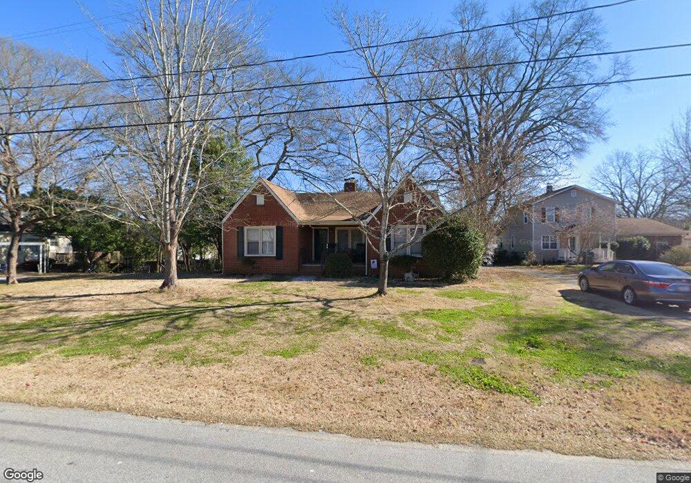
5104 N Dearing St NE Covington, GA 30014
Estimated Value: $256,000 - $316,000
--
Bed
2
Baths
1,388
Sq Ft
$208/Sq Ft
Est. Value
About This Home
This home is located at 5104 N Dearing St NE, Covington, GA 30014 and is currently estimated at $288,709, approximately $208 per square foot. 5104 N Dearing St NE is a home located in Newton County with nearby schools including East Newton Elementary School, Cousins Middle School, and Eastside High School.
Ownership History
Date
Name
Owned For
Owner Type
Purchase Details
Closed on
Nov 1, 2024
Sold by
Geoffroy Michael G
Bought by
Caroty Llc
Current Estimated Value
Purchase Details
Closed on
Aug 8, 2003
Sold by
Reid Billy F
Bought by
Geoffroy Michael G and Geoffroy Tara
Home Financials for this Owner
Home Financials are based on the most recent Mortgage that was taken out on this home.
Original Mortgage
$70,200
Interest Rate
5.24%
Mortgage Type
New Conventional
Create a Home Valuation Report for This Property
The Home Valuation Report is an in-depth analysis detailing your home's value as well as a comparison with similar homes in the area
Home Values in the Area
Average Home Value in this Area
Purchase History
| Date | Buyer | Sale Price | Title Company |
|---|---|---|---|
| Caroty Llc | $295,000 | -- | |
| Geoffroy Michael G | $78,000 | -- |
Source: Public Records
Mortgage History
| Date | Status | Borrower | Loan Amount |
|---|---|---|---|
| Previous Owner | Geoffroy Michael G | $70,200 |
Source: Public Records
Tax History Compared to Growth
Tax History
| Year | Tax Paid | Tax Assessment Tax Assessment Total Assessment is a certain percentage of the fair market value that is determined by local assessors to be the total taxable value of land and additions on the property. | Land | Improvement |
|---|---|---|---|---|
| 2024 | $2,397 | $79,400 | $17,200 | $62,200 |
| 2023 | $1,692 | $52,080 | $8,800 | $43,280 |
| 2022 | $1,556 | $47,880 | $8,800 | $39,080 |
| 2021 | $1,466 | $40,360 | $8,800 | $31,560 |
| 2020 | $1,442 | $36,160 | $8,800 | $27,360 |
| 2019 | $1,476 | $36,320 | $8,800 | $27,520 |
| 2018 | $1,456 | $35,440 | $6,000 | $29,440 |
| 2017 | $1,022 | $24,880 | $2,000 | $22,880 |
| 2016 | $1,055 | $25,680 | $2,800 | $22,880 |
| 2015 | $1,034 | $25,120 | $2,000 | $23,120 |
| 2014 | $1,033 | $25,120 | $0 | $0 |
Source: Public Records
Map
Nearby Homes
- 5130 N Dearing St NE
- 5139 West Dr NE
- 4105 Rose Ln NE
- 4181 A&B Floyd St NE
- 4128 Elizabeth St NE
- 4217 Elizabeth St NE
- 6127 Floyd St NE
- 5118 Floyd St NE
- 6104 Floyd St NE
- 0 Highway 278 NE Unit 10595588
- 3127 Mill St SE
- 3149 Thompson Ave SE
- 5150 Wheat St NE
- 3112 Floyd St NE
- 3183 Conyers St SE
- 4187 Cherry Laurel Dr SE
- 6192 Collins St NE
- 6193 Collins St NE
- 13224 Tolstoy
- 13238 Tolstoy
- 4176 N Dearing St NE
- 5114 N Dearing St NE
- 5141 Hartsook Dr NE
- 4185 Phedora St NE
- 5125 Hartsook Dr NE
- 5149 Hartsook Dr NE
- 5122 N Dearing St NE
- 4184 N Dearing St NE
- 4164 N Dearing St NE
- 4179 Phedora St NE
- 4184 Phedora St NE
- 5115 Hartsook Dr NE
- 4169 N Dearing St NE
- 0 Hartsook Dr NE Unit 7450753
- 0 Hartsook Dr NE Unit 7011999
- 0 Hartsook Dr NE Unit 7412927
- 0 Hartsook Dr NE Unit 7366834
- 4171 Phedora St NE
- 5159 Hartsook Dr NE
- 5159 Hartsook Dr NE Unit 12