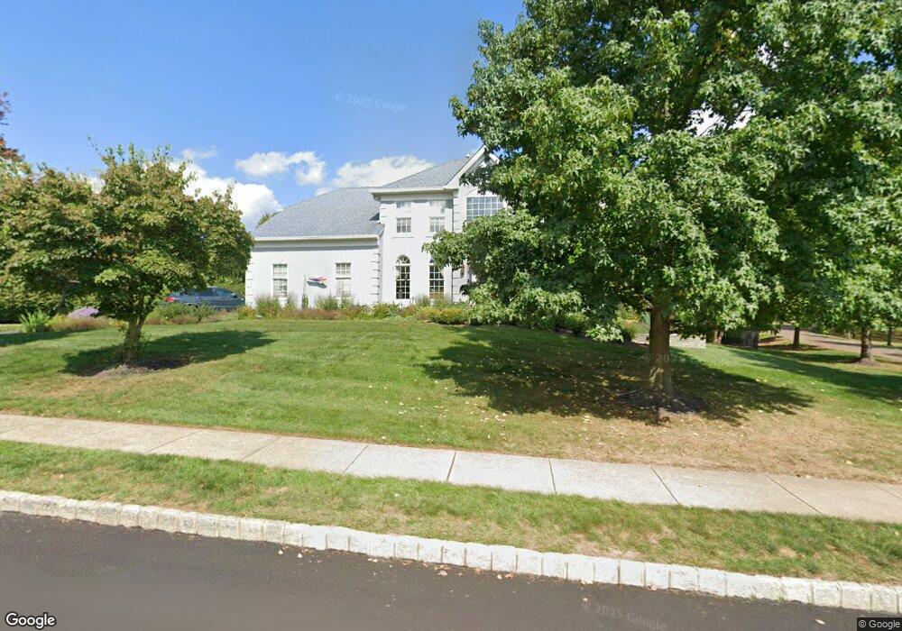
5105 Redfield Rd Doylestown, PA 18902
Estimated Value: $924,000 - $982,000
4
Beds
3
Baths
3,024
Sq Ft
$315/Sq Ft
Est. Value
About This Home
This home is located at 5105 Redfield Rd, Doylestown, PA 18902 and is currently estimated at $951,564, approximately $314 per square foot. 5105 Redfield Rd is a home located in Bucks County with nearby schools including Cold Spring Elementary School, Holicong Middle School, and Central Bucks High School - East.
Ownership History
Date
Name
Owned For
Owner Type
Purchase Details
Closed on
Dec 11, 2023
Sold by
Carey David M and Carey Laurie M
Bought by
David And Laurie Carey Living Trust and Carey
Current Estimated Value
Purchase Details
Closed on
May 15, 2003
Sold by
Tillger John J and Tillger Tracey D
Bought by
Carey David M and Carey Laurie M
Home Financials for this Owner
Home Financials are based on the most recent Mortgage that was taken out on this home.
Original Mortgage
$379,920
Interest Rate
5.86%
Mortgage Type
Purchase Money Mortgage
Purchase Details
Closed on
Oct 29, 1998
Sold by
Cold Spring Hunt Lp
Bought by
Tillger John J and Tillger Tracey D
Home Financials for this Owner
Home Financials are based on the most recent Mortgage that was taken out on this home.
Original Mortgage
$264,850
Interest Rate
6.49%
Create a Home Valuation Report for This Property
The Home Valuation Report is an in-depth analysis detailing your home's value as well as a comparison with similar homes in the area
Home Values in the Area
Average Home Value in this Area
Purchase History
| Date | Buyer | Sale Price | Title Company |
|---|---|---|---|
| David And Laurie Carey Living Trust | -- | None Listed On Document | |
| Carey David M | $474,900 | -- | |
| Tillger John J | $311,625 | -- |
Source: Public Records
Mortgage History
| Date | Status | Borrower | Loan Amount |
|---|---|---|---|
| Previous Owner | Carey David M | $379,920 | |
| Previous Owner | Tillger John J | $264,850 |
Source: Public Records
Tax History Compared to Growth
Tax History
| Year | Tax Paid | Tax Assessment Tax Assessment Total Assessment is a certain percentage of the fair market value that is determined by local assessors to be the total taxable value of land and additions on the property. | Land | Improvement |
|---|---|---|---|---|
| 2025 | $9,762 | $59,960 | $13,320 | $46,640 |
| 2024 | $9,762 | $59,960 | $13,320 | $46,640 |
| 2023 | $9,431 | $59,960 | $13,320 | $46,640 |
| 2022 | $9,318 | $59,960 | $13,320 | $46,640 |
| 2021 | $9,207 | $59,960 | $13,320 | $46,640 |
| 2020 | $9,207 | $59,960 | $13,320 | $46,640 |
| 2019 | $9,147 | $59,960 | $13,320 | $46,640 |
| 2018 | $9,147 | $59,960 | $13,320 | $46,640 |
| 2017 | $9,072 | $59,960 | $13,320 | $46,640 |
| 2016 | $9,162 | $59,960 | $13,320 | $46,640 |
| 2015 | -- | $59,960 | $13,320 | $46,640 |
| 2014 | -- | $59,960 | $13,320 | $46,640 |
Source: Public Records
Map
Nearby Homes
- 4250 Aly Dr
- 4925 Redfield Rd
- 4936 Davis Dr
- 3975 Amberton Ct
- 5063 Sagewood Ct
- 5115 Sugar Hill Ct
- 5184 Lovering Dr
- 5281 Harrington Ct
- 5491 Long Ln
- 4605 Twinbrook Cir
- 5182 Point Pleasant Pike
- 4542 Deep Creek Way
- 6680 Point Pleasant Pike
- 4964 Point Pleasant Pike
- 4221 Sir Andrew Cir
- 3689 Hancock Ln
- 4190 Milords Ln
- 3468 Holicong Rd
- 3479 Durham Rd
- 3455 Durham Rd
- 5100 Grundy Way
- 5095 Redfield Rd
- 5103 Grundy Way
- 5090 Redfield Rd
- 5092 Grundy Way
- 5099 Grundy Way
- 5085 Redfield Rd
- 5093 Grundy Way
- 4185 Leslie Dr
- 47 Via Quattro Novembre
- Owls Nest Ln
- Owls Nest Ln
- Owls Nest Ln
- 4195 Leslie Dr
- 4175 Leslie Dr
- 5075 Redfield Rd
- 5084 Grundy Way
- 4205 Leslie Dr
- 5085 Grundy Way
- 5065 Redfield Rd