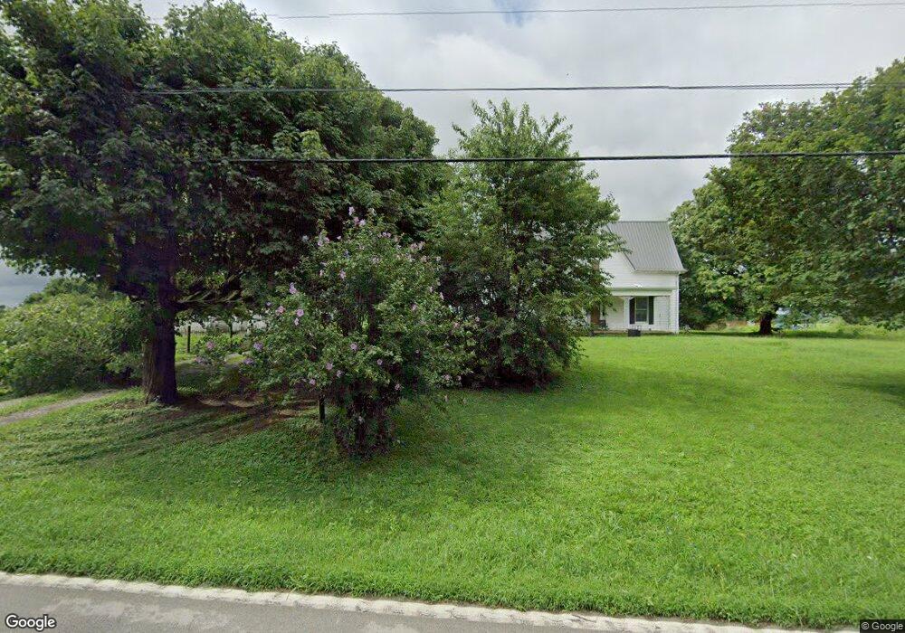
51068 Us Highway 62 Mays Lick, KY 41055
Estimated Value: $371,000 - $424,110
4
Beds
3
Baths
2,254
Sq Ft
$180/Sq Ft
Est. Value
About This Home
This home is located at 51068 Us Highway 62, Mays Lick, KY 41055 and is currently estimated at $405,370, approximately $179 per square foot. 51068 Us Highway 62 is a home located in Mason County with nearby schools including Charles Straub Elementary School, Mason County Intermediate School, and Mason County Middle School.
Ownership History
Date
Name
Owned For
Owner Type
Purchase Details
Closed on
Mar 27, 2020
Sold by
Williams Charles R and Williams Susan D
Bought by
Sweet Seth M and Sweet Samantha L
Current Estimated Value
Purchase Details
Closed on
Jun 16, 2017
Sold by
Anthony Wheary and Anthony Sheri
Bought by
Williams Charles R and Williams Susan D
Home Financials for this Owner
Home Financials are based on the most recent Mortgage that was taken out on this home.
Original Mortgage
$244,949
Interest Rate
3.87%
Mortgage Type
New Conventional
Purchase Details
Closed on
Dec 1, 2005
Bought by
Wheary Sheri and Wheary Anthony
Create a Home Valuation Report for This Property
The Home Valuation Report is an in-depth analysis detailing your home's value as well as a comparison with similar homes in the area
Home Values in the Area
Average Home Value in this Area
Purchase History
| Date | Buyer | Sale Price | Title Company |
|---|---|---|---|
| Sweet Seth M | $265,000 | Attorney Only | |
| Sweet Seth M | $265,000 | Attorney Only | |
| Williams Charles R | $242,500 | Northwest Title Agcy Inc | |
| Williams Charles R | $242,500 | Northwest Title Agcy Inc | |
| Wheary Sheri | -- | -- | |
| Wheary Sheri | -- | -- |
Source: Public Records
Mortgage History
| Date | Status | Borrower | Loan Amount |
|---|---|---|---|
| Previous Owner | Williams Charles R | $244,949 | |
| Closed | Williams Charles R | $244,949 |
Source: Public Records
Tax History Compared to Growth
Tax History
| Year | Tax Paid | Tax Assessment Tax Assessment Total Assessment is a certain percentage of the fair market value that is determined by local assessors to be the total taxable value of land and additions on the property. | Land | Improvement |
|---|---|---|---|---|
| 2025 | $1,146 | $108,457 | $10,949 | $97,508 |
| 2024 | $1,149 | $108,457 | $10,949 | $97,508 |
| 2023 | $1,166 | $108,457 | $10,949 | $97,508 |
| 2022 | $1,162 | $108,457 | $10,949 | $97,508 |
| 2021 | $1,166 | $108,457 | $10,949 | $97,508 |
| 2020 | $1,168 | $108,457 | $10,949 | $97,508 |
| 2019 | $1,170 | $108,457 | $10,949 | $97,508 |
| 2018 | $1,169 | $108,457 | $7,607 | $100,850 |
| 2017 | $535 | $78,943 | $7,607 | $71,336 |
| 2016 | -- | $52,246 | $7,607 | $44,639 |
| 2015 | -- | $43,246 | $7,607 | $35,639 |
| 2012 | -- | $52,246 | $16,607 | $35,639 |
Source: Public Records
Map
Nearby Homes
- 51148 Us-62
- 2728 Pea Ridge Rd
- 1580 Sardis Rd
- 2524 U S 68
- 2524 US Highway 68
- 2997 Us 68
- 5755 U S 68
- 5763 5763
- 5014 Raymond Rd
- 512 Brierly Ridge Rd
- 5032 Main St
- 159 E Walnut St
- 98 Rolling Acres Ln
- 271 W Walnut St
- 1363 Kentontown Rd
- 1121 Galbraith Rd
- 881 Galbraith Rd
- 607 Galbraith Rd
- 755 Galbraith Rd
- 817 Galbraith Rd
- 51016 Us Highway 62
- 51052 Us Highway 62
- 51068 Us Highway 62
- 51094 Us Highway 62
- 51020 Us Highway 62
- 51024 Us Highway 62
- 41043 Us Highway 62
- 4011 Blue Lick Rd N
- 41047 Us Highway 62
- 51020 Bucktown Rd
- 41049 U S 62
- 51020 U S 62
- 41083 Us Highway 62
- 41049 Us Highway 62
- 41053 Us Highway 62
- 41083 Us Highway 62
- 41017 Us Highway 62
- 62 Us
- 4975 Us Highway 62
- 4975 U S Highway 62