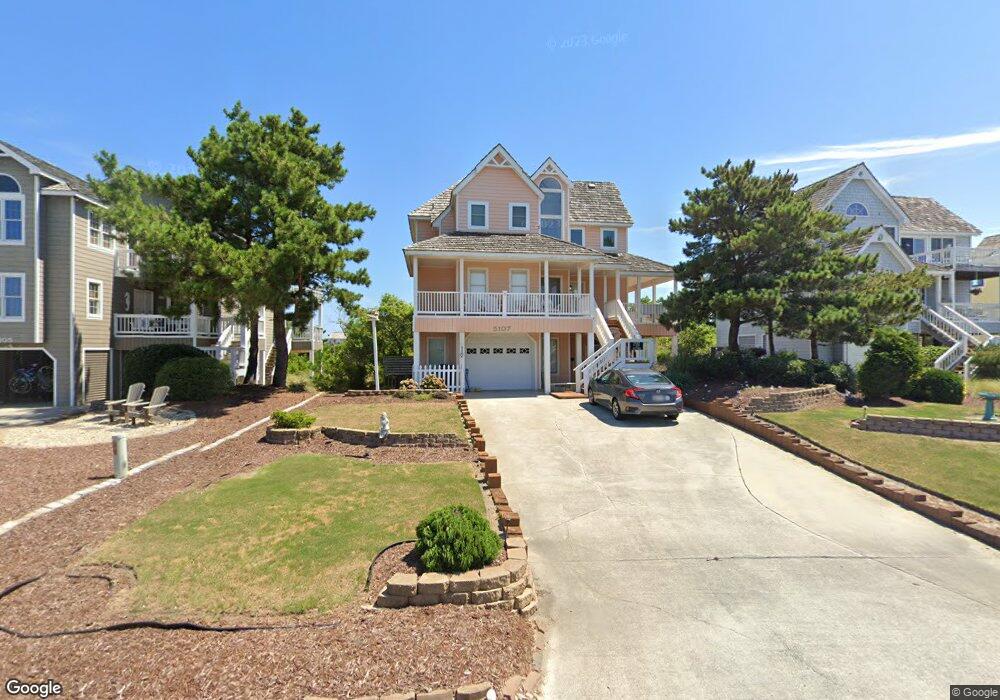
5107 S Links Dr Unit 12 Nags Head, NC 27959
Estimated Value: $762,738 - $840,000
4
Beds
3
Baths
1,932
Sq Ft
$411/Sq Ft
Est. Value
About This Home
This home is located at 5107 S Links Dr Unit 12, Nags Head, NC 27959 and is currently estimated at $794,935, approximately $411 per square foot. 5107 S Links Dr Unit 12 is a home located in Dare County with nearby schools including Nags Head Elementary School, Manteo Middle School, and Manteo High School.
Ownership History
Date
Name
Owned For
Owner Type
Purchase Details
Closed on
Jan 12, 2021
Sold by
Bruce Raymond R and Bruce Barbara M
Bought by
Overeem Peter T and Overeem Jennifer L
Current Estimated Value
Home Financials for this Owner
Home Financials are based on the most recent Mortgage that was taken out on this home.
Original Mortgage
$330,000
Outstanding Balance
$294,526
Interest Rate
2.71%
Mortgage Type
New Conventional
Estimated Equity
$500,409
Create a Home Valuation Report for This Property
The Home Valuation Report is an in-depth analysis detailing your home's value as well as a comparison with similar homes in the area
Home Values in the Area
Average Home Value in this Area
Purchase History
| Date | Buyer | Sale Price | Title Company |
|---|---|---|---|
| Overeem Peter T | $530,000 | None Available |
Source: Public Records
Mortgage History
| Date | Status | Borrower | Loan Amount |
|---|---|---|---|
| Open | Overeem Peter T | $330,000 |
Source: Public Records
Tax History Compared to Growth
Tax History
| Year | Tax Paid | Tax Assessment Tax Assessment Total Assessment is a certain percentage of the fair market value that is determined by local assessors to be the total taxable value of land and additions on the property. | Land | Improvement |
|---|---|---|---|---|
| 2024 | $3,220 | $430,700 | $178,900 | $251,800 |
| 2023 | $1,765 | $440,772 | $178,900 | $261,872 |
| 2022 | $1,765 | $440,772 | $178,900 | $261,872 |
| 2021 | $1,725 | $430,700 | $178,900 | $251,800 |
| 2020 | $1,545 | $430,700 | $178,900 | $251,800 |
| 2019 | $1,349 | $332,000 | $164,400 | $167,600 |
| 2018 | $1,349 | $332,000 | $164,400 | $167,600 |
| 2017 | $1,454 | $354,300 | $164,400 | $189,900 |
| 2016 | $1,330 | $354,300 | $164,400 | $189,900 |
| 2014 | $1,330 | $354,300 | $164,400 | $189,900 |
Source: Public Records
Map
Nearby Homes
- 5309 S Sand Wedge Ln Unit Lot 5
- 5306 S Virginia Dare Trail Unit lot3
- 5015 S Virginia Dare Trail Unit Lot 5
- 5001 S Virginia Dare Trail Unit Lot 25
- 114 E West Hawks Nest Ct Unit Lot 6
- 4639 S Blue Marlin Way Unit 121
- 5401 S Virginia Dare Trail Unit 5
- 5401 S Virginia Dare Trail Unit 5
- 4731 S Croatan Hwy Unit Lot 4C
- 101 W Greenside Ct Unit 10
- 4707 S Pompano Ct Unit Lot 21
- 5507 S Virginia Dare Trail Unit 103S
- 5507 S Virginia Dare Trail Unit 103-S
- 5507 S Virginia Dare Trail Unit 202B
- 4608 S Roanoke Way Unit Lot 18
- 5515 S Virginia Dare Trail Unit B1
- 5515 S Virginia Dare Trail Unit B-3
- 4704 S Virginia Dare Trail
- 118 W Marsh Cove Dr Unit Lot 20
- 4512 S Shiner Dr Unit Lot 7
- 5107 S Links Dr
- 5109 S Links Dr
- 5105 S Links Dr
- 5113 S Links Dr
- 5103 S Links Dr
- 5117 S Links Dr Unit 9
- 5117 S Links Dr
- 100 W Wee Burn Ct
- 101 W Craig End
- 5101 S Links Dr Unit 15
- 5101 S Links Dr
- 100 W Craig End
- 5201 S Links Dr Unit 8
- 5201 S Links Dr
- 102 W Wee Burn Ct
- 5017 S Links Dr Unit 16
- 5017 S Links Dr
- 102 W Craig End
- 107 W Craig End
- 103 W Craig End