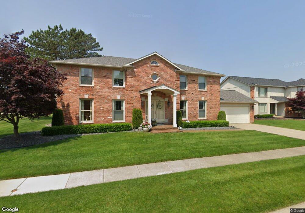
51077 Sandshores Dr Unit Bldg-Unit Shelby Township, MI 48316
Estimated Value: $600,084 - $722,000
4
Beds
3
Baths
3,037
Sq Ft
$217/Sq Ft
Est. Value
About This Home
This home is located at 51077 Sandshores Dr Unit Bldg-Unit, Shelby Township, MI 48316 and is currently estimated at $659,271, approximately $217 per square foot. 51077 Sandshores Dr Unit Bldg-Unit is a home located in Macomb County with nearby schools including Roberts Elementary School, Malow Junior High School, and Eisenhower High School.
Ownership History
Date
Name
Owned For
Owner Type
Purchase Details
Closed on
Jun 24, 2025
Sold by
Ersin Thomas E and Ersin Norma J
Bought by
Ersin Thomas E and Ersin Norma J
Current Estimated Value
Purchase Details
Closed on
May 31, 2018
Sold by
Weng Edward Eng Li and Weng Emily
Bought by
Ersin Norma J and Ersin Thomas E
Home Financials for this Owner
Home Financials are based on the most recent Mortgage that was taken out on this home.
Original Mortgage
$318,000
Interest Rate
4.5%
Mortgage Type
New Conventional
Create a Home Valuation Report for This Property
The Home Valuation Report is an in-depth analysis detailing your home's value as well as a comparison with similar homes in the area
Home Values in the Area
Average Home Value in this Area
Purchase History
| Date | Buyer | Sale Price | Title Company |
|---|---|---|---|
| Ersin Thomas E | -- | None Listed On Document | |
| Ersin Norma J | $415,500 | None Available |
Source: Public Records
Mortgage History
| Date | Status | Borrower | Loan Amount |
|---|---|---|---|
| Previous Owner | Ersin Norma J | $318,000 |
Source: Public Records
Tax History Compared to Growth
Tax History
| Year | Tax Paid | Tax Assessment Tax Assessment Total Assessment is a certain percentage of the fair market value that is determined by local assessors to be the total taxable value of land and additions on the property. | Land | Improvement |
|---|---|---|---|---|
| 2025 | $7,734 | $277,400 | $0 | $0 |
| 2024 | $4,578 | $285,500 | $0 | $0 |
| 2023 | $4,335 | $266,400 | $0 | $0 |
| 2022 | $6,993 | $245,700 | $0 | $0 |
| 2021 | $6,802 | $223,300 | $0 | $0 |
| 2020 | $3,982 | $217,200 | $0 | $0 |
| 2019 | $6,232 | $213,800 | $0 | $0 |
| 2018 | $4,679 | $193,900 | $0 | $0 |
| 2017 | $4,630 | $179,700 | $42,850 | $136,850 |
| 2016 | $4,597 | $179,700 | $0 | $0 |
| 2015 | $4,530 | $158,850 | $0 | $0 |
| 2012 | -- | $0 | $0 | $0 |
Source: Public Records
Map
Nearby Homes
- 51244 Forster Ln
- 51557 Forster Ln Unit Lot 1
- 51581 Forster Ln Unit Lot 2
- 51605 Forster Ln Unit Lot 3
- 3328 Forster Ln
- 3515 Forster Ln Unit Lot 20
- 51677 Forster Ln Unit Lot 6
- 4303 S Lake Ln
- 51341 Neumaier Dr
- 3191 Forster Ln Unit Lot 11
- 3252 Forster Ln
- 52527 Belle Vernon
- 51281 Shelby Rd
- 52461 Pappy Ln
- 2156 Austin Dr
- 53162 Briar Dr
- 5616 23 Mile Rd
- 53645 Lambeth Ct
- 5577 Harlowe Dr
- 53266 Garland Dr
- 51077 Sandshores Dr
- 51101 Sandshores Dr
- 51006 Forster Ln
- 51028 Forster Ln
- 51078 Sandshores Dr
- 51125 Sandshores Dr
- 51102 Sandshores Dr
- 51054 Sandshores Dr
- 51126 Sandshores Dr
- 51052 Forster Ln
- 51149 Sandshores Dr
- 51030 Sandshores Dr
- 51076 Forster Ln
- 51005 Forster Ln
- 51150 Sandshores Dr
- 51029 Forster Ln
- 51173 Sandshores Dr
- 51006 Sandshores Dr
- 51100 Forster Ln
- 51174 Sandshores Dr