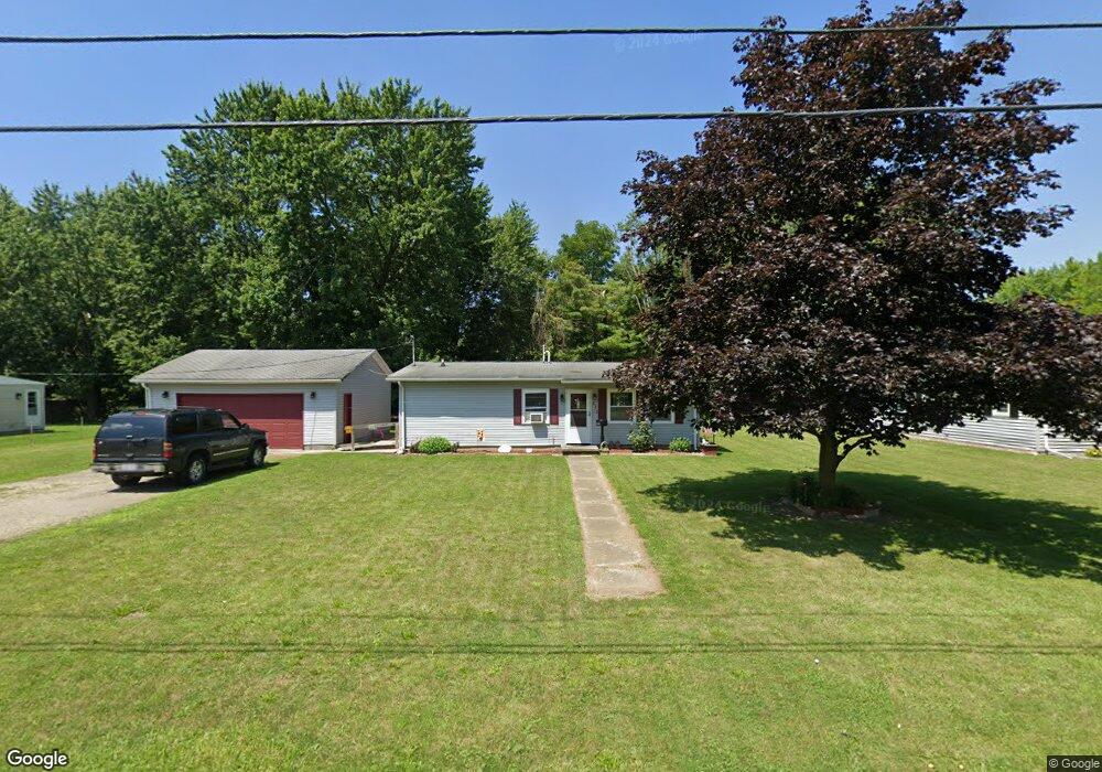
511 Burt St van Wert, OH 45891
Estimated Value: $88,787 - $107,000
2
Beds
1
Bath
864
Sq Ft
$110/Sq Ft
Est. Value
About This Home
This home is located at 511 Burt St, van Wert, OH 45891 and is currently estimated at $95,197, approximately $110 per square foot. 511 Burt St is a home located in Van Wert County with nearby schools including Van Wert Early Childhood Center, Van Wert High School, and Lifelinks Community School.
Ownership History
Date
Name
Owned For
Owner Type
Purchase Details
Closed on
May 2, 2017
Sold by
Patrick John A
Bought by
Mccarty Maggie
Current Estimated Value
Purchase Details
Closed on
Nov 25, 2013
Sold by
Ayers Lu Lu and Runser Allan
Bought by
Patrick John A
Purchase Details
Closed on
May 24, 2013
Sold by
Shook Robert L and Shook Nancy
Bought by
Lulu Ayers Estate and Runser C Allan
Purchase Details
Closed on
Dec 16, 2010
Sold by
Estate Of Walter S Ayers
Bought by
Ayers Lulu G
Purchase Details
Closed on
Nov 22, 2010
Sold by
Estate Of Richard E Ayers
Bought by
Ayers Lulu G and Ayers Walter S
Purchase Details
Closed on
Feb 17, 1994
Bought by
Ayers Walter S
Create a Home Valuation Report for This Property
The Home Valuation Report is an in-depth analysis detailing your home's value as well as a comparison with similar homes in the area
Home Values in the Area
Average Home Value in this Area
Purchase History
| Date | Buyer | Sale Price | Title Company |
|---|---|---|---|
| Mccarty Maggie | -- | Attorney | |
| Patrick John A | $27,000 | Attorney | |
| Lulu Ayers Estate | -- | Attorney | |
| Ayers Lulu G | -- | None Available | |
| Ayers Lulu G | -- | None Available | |
| Ayers Walter S | $43,000 | -- | |
| Ayers Walter S | $43,000 | -- |
Source: Public Records
Tax History
| Year | Tax Paid | Tax Assessment Tax Assessment Total Assessment is a certain percentage of the fair market value that is determined by local assessors to be the total taxable value of land and additions on the property. | Land | Improvement |
|---|---|---|---|---|
| 2024 | $428 | $21,380 | $5,330 | $16,050 |
| 2023 | $433 | $21,380 | $5,330 | $16,050 |
| 2022 | $722 | $18,120 | $5,120 | $13,000 |
| 2021 | $703 | $18,120 | $5,120 | $13,000 |
| 2020 | $702 | $18,120 | $5,120 | $13,000 |
| 2019 | $643 | $16,270 | $5,120 | $11,150 |
| 2018 | $624 | $16,270 | $5,120 | $11,150 |
| 2017 | $623 | $16,270 | $5,120 | $11,150 |
| 2016 | $539 | $15,120 | $5,120 | $10,000 |
| 2015 | $539 | $15,120 | $5,120 | $10,000 |
| 2014 | $534 | $15,120 | $5,120 | $10,000 |
| 2013 | $188 | $15,120 | $5,120 | $10,000 |
Source: Public Records
Map
Nearby Homes
- 302 Shaffer St
- 151 Blaine St
- 515 N Jefferson St
- 702 N Washington St
- 129 S Lynn St
- 142 Gleason Ave
- 692 N Market St
- 634 N Market St
- 138 E 2nd St
- 114 S Wall St
- 255 Parkview Dr
- 409 N Market St
- 000 Lincoln Hwy
- 14934 Lincoln Hwy
- 00 Lincoln Hwy
- 1328 Kathy St
- 522 South Ave
- 1421 Krendl Dr
- 610 State St
- 9188 John Brown Rd Unit 25
Your Personal Tour Guide
Ask me questions while you tour the home.