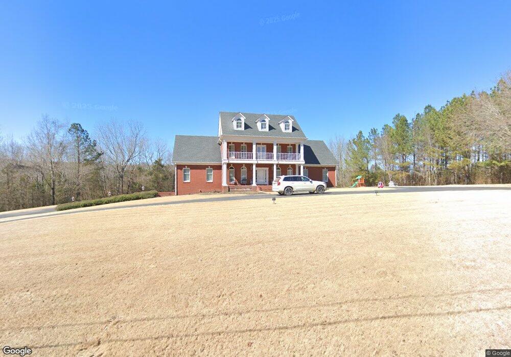
511 Michael Dr Waynesboro, TN 38485
Estimated Value: $845,092 - $877,000
Studio
5
Baths
6,236
Sq Ft
$138/Sq Ft
Est. Value
About This Home
This home is located at 511 Michael Dr, Waynesboro, TN 38485 and is currently estimated at $861,046, approximately $138 per square foot. 511 Michael Dr is a home located in Wayne County with nearby schools including Wayne Academy.
Ownership History
Date
Name
Owned For
Owner Type
Purchase Details
Closed on
Aug 22, 2024
Sold by
Haggard Kimberly A and Haggard Robert R
Bought by
Peebles William Denton and Peebles Katie
Current Estimated Value
Home Financials for this Owner
Home Financials are based on the most recent Mortgage that was taken out on this home.
Original Mortgage
$578,000
Outstanding Balance
$570,438
Interest Rate
6.89%
Mortgage Type
New Conventional
Estimated Equity
$290,608
Create a Home Valuation Report for This Property
The Home Valuation Report is an in-depth analysis detailing your home's value as well as a comparison with similar homes in the area
Purchase History
| Date | Buyer | Sale Price | Title Company |
|---|---|---|---|
| Peebles William Denton | $680,000 | None Listed On Document |
Source: Public Records
Mortgage History
| Date | Status | Borrower | Loan Amount |
|---|---|---|---|
| Open | Peebles William Denton | $578,000 |
Source: Public Records
Tax History
| Year | Tax Paid | Tax Assessment Tax Assessment Total Assessment is a certain percentage of the fair market value that is determined by local assessors to be the total taxable value of land and additions on the property. | Land | Improvement |
|---|---|---|---|---|
| 2025 | $4,975 | $303,050 | $12,275 | $290,775 |
| 2024 | $4,155 | $191,700 | $8,400 | $183,300 |
| 2023 | $5,967 | $191,700 | $8,400 | $183,300 |
| 2022 | $5,967 | $191,700 | $8,400 | $183,300 |
| 2021 | $5,151 | $191,700 | $8,400 | $183,300 |
| 2020 | $5,150 | $137,450 | $7,700 | $129,750 |
| 2019 | $3,979 | $137,450 | $7,700 | $129,750 |
| 2018 | $5,150 | $137,450 | $7,700 | $129,750 |
| 2017 | $5,150 | $137,450 | $7,700 | $129,750 |
| 2016 | $4,807 | $137,450 | $7,700 | $129,750 |
| 2014 | $4,878 | $138,567 | $0 | $0 |
Source: Public Records
Map
Nearby Homes
- 0B Waynesboro Hwy
- 0A Waynesboro Hwy
- 0D Waynesboro Hwy
- 0C Waynesboro Hwy
- 0 Waynesboro Hwy Unit RTC2991221
- 0 Waynesboro Hwy Unit RTC2821045
- 705 Hurricane Hill Dr
- 130 Sage Ln
- 413 Market St
- 123 Brewer Dr
- 209 Mathews St
- 310 W Hill St
- 414 Edward St
- 112 N High St
- 951 State Highway 99
- 202 Morris St
- 214 Mcwilliams St
- 308 S High St
- 1135 Mink Branch Rd
- 0 Walker Rd Unit RTC3143340
- 225 Emmett Skelton Rd
- 513 Michael Dr
- 516 Michael Dr
- 1412 Old 64 B Hwy
- 260 Betsy Dr
- 1904 Old Hog Creek Rd
- 526 Michael Dr
- 333 Michael Dr
- 256 Betsy Dr
- 0 Michael Dr
- 254 Betsy Dr
- 1465 Waynesboro Hwy
- 00 Waynesboro Hwy
- 529 Michael Dr
- 534 Michael Dr
- 109 Meyers Ln
- 434 Faye Dr
- 433 Waynesboro Hwy
- 310 Faye Dr
- 387 Faye Dr
Your Personal Tour Guide
Ask me questions while you tour the home.