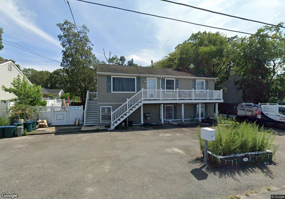
511 Middle Branch Dr Forked River, NJ 08731
Estimated Value: $557,000 - $824,000
3
Beds
3
Baths
3,780
Sq Ft
$183/Sq Ft
Est. Value
About This Home
This home is located at 511 Middle Branch Dr, Forked River, NJ 08731 and is currently estimated at $693,449, approximately $183 per square foot. 511 Middle Branch Dr is a home located in Ocean County with nearby schools including Lacey Township High School.
Ownership History
Date
Name
Owned For
Owner Type
Purchase Details
Closed on
Aug 20, 2004
Sold by
Dekker Charles M
Bought by
Furfero Michael and Furfero Jean
Current Estimated Value
Home Financials for this Owner
Home Financials are based on the most recent Mortgage that was taken out on this home.
Original Mortgage
$197,000
Outstanding Balance
$97,820
Interest Rate
6.02%
Mortgage Type
Purchase Money Mortgage
Estimated Equity
$595,629
Purchase Details
Closed on
Sep 5, 2002
Sold by
Clark Verna
Bought by
Dekker Charles M
Home Financials for this Owner
Home Financials are based on the most recent Mortgage that was taken out on this home.
Original Mortgage
$112,500
Interest Rate
6.27%
Purchase Details
Closed on
Mar 1, 1994
Sold by
Federal Home Loan Mortgage Corporation
Bought by
Clark Verna
Create a Home Valuation Report for This Property
The Home Valuation Report is an in-depth analysis detailing your home's value as well as a comparison with similar homes in the area
Home Values in the Area
Average Home Value in this Area
Purchase History
| Date | Buyer | Sale Price | Title Company |
|---|---|---|---|
| Furfero Michael | $297,000 | -- | |
| Dekker Charles M | $125,000 | -- | |
| Clark Verna | $53,000 | -- |
Source: Public Records
Mortgage History
| Date | Status | Borrower | Loan Amount |
|---|---|---|---|
| Open | Furfero Michael | $197,000 | |
| Previous Owner | Dekker Charles M | $112,500 |
Source: Public Records
Tax History
| Year | Tax Paid | Tax Assessment Tax Assessment Total Assessment is a certain percentage of the fair market value that is determined by local assessors to be the total taxable value of land and additions on the property. | Land | Improvement |
|---|---|---|---|---|
| 2025 | $8,385 | $330,900 | $79,000 | $251,900 |
| 2024 | $7,839 | $330,900 | $79,000 | $251,900 |
| 2023 | $7,488 | $330,900 | $79,000 | $251,900 |
| 2022 | $7,488 | $330,900 | $79,000 | $251,900 |
| 2021 | $7,363 | $330,900 | $79,000 | $251,900 |
| 2020 | $7,128 | $330,900 | $79,000 | $251,900 |
| 2019 | $7,002 | $330,900 | $79,000 | $251,900 |
| 2018 | $6,919 | $330,900 | $79,000 | $251,900 |
| 2017 | $6,760 | $330,900 | $79,000 | $251,900 |
| 2016 | $6,734 | $330,900 | $79,000 | $251,900 |
| 2015 | $6,433 | $330,900 | $79,000 | $251,900 |
| 2014 | $6,244 | $363,000 | $114,000 | $249,000 |
Source: Public Records
Map
Nearby Homes
- 10 Dolphin Ct
- 404 Beach Blvd
- 615 Beach Blvd
- 69 Saltspray Dr
- 75 Saltspray Dr
- 79 Saltspray Dr
- 34 Mariner Dr
- 635 Oakwood Dr
- 123 Oakwood Place
- 417 Riverview Rd
- 634 Fairview Ln
- 217 Nantucket Rd
- Lot1 Clearwater Dr
- 9 Hollywood Blvd S
- 0 Clearwater Dr Unit NJOC2035594
- 22 Saltspray Dr
- 703 Chesapeake Dr
- 102 Maria Loretta Ln
- Juniper Plan at Lacey Pines
- 126 Bay Ave
- 517 Middle Branch Dr
- 509 Middle Branch Dr
- 514 Beach Blvd
- 503 Middle Branch Dr
- 511 Beach Blvd
- 509 Beach Blvd
- 514 Middle Branch Dr
- 512 Middle Branch Dr
- 516 Middle Branch Dr
- 513 Beach Blvd
- 507 Beach Blvd
- 518 Beach Blvd
- 510 Middle Branch Dr
- 518 Middle Branch Dr
- 515 Beach Blvd
- 504 Beach Blvd
- 520 Middle Branch Dr
- 520 Beach Blvd
- 508 Middle Branch Dr
- 512 Nantucket Rd
Your Personal Tour Guide
Ask me questions while you tour the home.