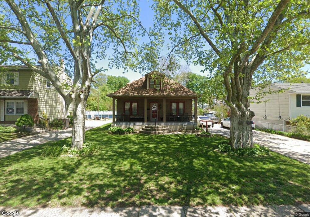
511 N Forklanding Rd Maple Shade, NJ 08052
Estimated Value: $305,000 - $340,000
2
Beds
1
Bath
1,300
Sq Ft
$246/Sq Ft
Est. Value
About This Home
This home is located at 511 N Forklanding Rd, Maple Shade, NJ 08052 and is currently estimated at $320,264, approximately $246 per square foot. 511 N Forklanding Rd is a home located in Burlington County with nearby schools including Ralph J Steinhauer Elementary School, Maude M. Wilkins Elementary School, and Howard R Yocum School.
Ownership History
Date
Name
Owned For
Owner Type
Purchase Details
Closed on
Jan 22, 2010
Sold by
Ashmen Sharon
Bought by
Durocher Robert T and Macclemmy Amanda J
Current Estimated Value
Home Financials for this Owner
Home Financials are based on the most recent Mortgage that was taken out on this home.
Original Mortgage
$7,049
Interest Rate
5.05%
Mortgage Type
Stand Alone Second
Purchase Details
Closed on
May 21, 2009
Sold by
Hilliard Linda
Bought by
Ashmen Sharon
Purchase Details
Closed on
Mar 31, 2000
Sold by
Bingham Kathryn
Bought by
Bingham Charles R
Create a Home Valuation Report for This Property
The Home Valuation Report is an in-depth analysis detailing your home's value as well as a comparison with similar homes in the area
Home Values in the Area
Average Home Value in this Area
Purchase History
| Date | Buyer | Sale Price | Title Company |
|---|---|---|---|
| Durocher Robert T | $179,500 | Group 21 Title Agency | |
| Ashmen Sharon | -- | None Available | |
| Bingham Charles R | -- | -- |
Source: Public Records
Mortgage History
| Date | Status | Borrower | Loan Amount |
|---|---|---|---|
| Closed | Durocher Robert T | $7,049 | |
| Open | Durocher Robert T | $176,248 |
Source: Public Records
Tax History
| Year | Tax Paid | Tax Assessment Tax Assessment Total Assessment is a certain percentage of the fair market value that is determined by local assessors to be the total taxable value of land and additions on the property. | Land | Improvement |
|---|---|---|---|---|
| 2025 | $7,038 | $185,400 | $56,700 | $128,700 |
| 2024 | $6,834 | $185,400 | $56,700 | $128,700 |
| 2023 | $6,834 | $185,400 | $56,700 | $128,700 |
| 2022 | $6,728 | $185,400 | $56,700 | $128,700 |
| 2021 | $6,663 | $185,400 | $56,700 | $128,700 |
| 2020 | $6,682 | $185,400 | $56,700 | $128,700 |
| 2019 | $6,437 | $185,400 | $56,700 | $128,700 |
| 2018 | $6,326 | $185,400 | $56,700 | $128,700 |
| 2017 | $6,252 | $185,400 | $56,700 | $128,700 |
| 2016 | $6,159 | $185,400 | $56,700 | $128,700 |
| 2015 | $6,026 | $185,400 | $56,700 | $128,700 |
| 2014 | $5,842 | $185,400 | $56,700 | $128,700 |
Source: Public Records
Map
Nearby Homes
- 400 N Forklanding Rd
- 27 Indian Queen Ln
- 331 Collins Ln
- 207 E Park Ave
- 728 Haverford Ave
- 22 Theodore Ave
- 411 A3 Stiles Ave Unit A-3
- 411 C12 Stiles Ave Unit C-12
- 411 A2 Stiles Ave Unit A-2
- 3444 New Jersey Ave
- 12 Overbrook Ave
- 8539 Bryn Mawr Ave
- 57 S Terrace Ave
- 47 S Lippincott Ave
- 42 Spruce Ave
- 61 S Maple Ave
- 2819 Haddonfield Rd
- 9 Woodbine Ave
- 2905 Powell Ave
- 8323 Maple Ave
- 515 N Forklanding Rd
- 507 N Forklanding Rd
- 525 N Forklanding Rd
- 503 N Forklanding Rd
- 21 E Germantown Ave
- 527 N Forklanding Rd
- 25 E Germantown Ave
- 504 N Forklanding Rd
- 531 N Forklanding Rd
- 7 W Germantown Ave
- 18 E Germantown Ave
- 4 E Germantown Ave
- 29 E Germantown Ave
- 8 Collins Ln
- 475 N Forklanding Rd
- 2 5th Ave
- 530 N Forklanding Rd
- 28 5th Ave
- 41 Collins Ln
Your Personal Tour Guide
Ask me questions while you tour the home.