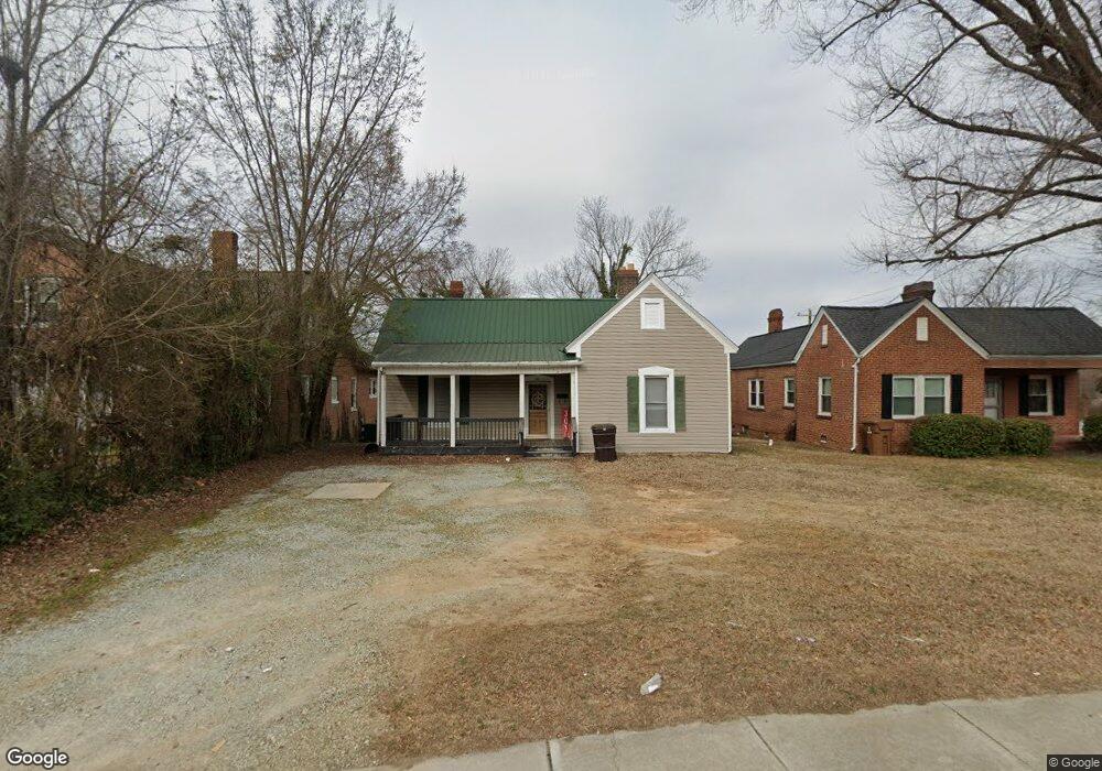
511 N Main St Roxboro, NC 27573
Estimated Value: $159,000 - $178,000
2
Beds
1
Bath
1,400
Sq Ft
$119/Sq Ft
Est. Value
About This Home
This home is located at 511 N Main St, Roxboro, NC 27573 and is currently estimated at $167,158, approximately $119 per square foot. 511 N Main St is a home located in Person County with nearby schools including Person High School, Roxboro Community School, and Roxboro Christian Academy.
Ownership History
Date
Name
Owned For
Owner Type
Purchase Details
Closed on
Aug 3, 2022
Sold by
Brent Clayton Calvin
Bought by
Alder Jill
Current Estimated Value
Purchase Details
Closed on
Jun 21, 2016
Sold by
Carver Frances S
Bought by
Sumner William T and Sumner Cynthia L
Purchase Details
Closed on
Oct 31, 2005
Sold by
Day Keith G and Day Beverly S
Bought by
Carver Frances S
Home Financials for this Owner
Home Financials are based on the most recent Mortgage that was taken out on this home.
Original Mortgage
$61,800
Interest Rate
5.71%
Mortgage Type
New Conventional
Create a Home Valuation Report for This Property
The Home Valuation Report is an in-depth analysis detailing your home's value as well as a comparison with similar homes in the area
Home Values in the Area
Average Home Value in this Area
Purchase History
| Date | Buyer | Sale Price | Title Company |
|---|---|---|---|
| Alder Jill | $145,000 | King Wells P | |
| Alder Jill | $145,000 | King Wells P | |
| Sumner William T | -- | None Available | |
| Carver Frances S | $62,000 | -- |
Source: Public Records
Mortgage History
| Date | Status | Borrower | Loan Amount |
|---|---|---|---|
| Previous Owner | Carver Frances S | $61,800 |
Source: Public Records
Tax History Compared to Growth
Tax History
| Year | Tax Paid | Tax Assessment Tax Assessment Total Assessment is a certain percentage of the fair market value that is determined by local assessors to be the total taxable value of land and additions on the property. | Land | Improvement |
|---|---|---|---|---|
| 2025 | $1,142 | $150,716 | $0 | $0 |
| 2024 | $1,142 | $75,012 | $0 | $0 |
| 2023 | $1,142 | $75,012 | $0 | $0 |
| 2022 | $1,065 | $75,012 | $0 | $0 |
| 2021 | $1,028 | $75,012 | $0 | $0 |
| 2020 | $980 | $70,501 | $0 | $0 |
| 2019 | $987 | $70,501 | $0 | $0 |
| 2018 | $860 | $62,771 | $0 | $0 |
| 2017 | $860 | $62,771 | $0 | $0 |
| 2016 | $860 | $62,771 | $0 | $0 |
| 2015 | $854 | $62,771 | $0 | $0 |
| 2014 | $854 | $62,771 | $0 | $0 |
Source: Public Records
Map
Nearby Homes
- 29 Oak St
- 318 Walker St
- 307 Broad St
- 307 W Gordon St
- 60 Sloan Rd
- 240 Crestwood Dr
- 209 Reade Dr
- 150 Summit St
- 421 S Morgan St
- 205 Gentry St
- 74 Alleghany Dr
- 305 W Barden St
- 531 Booth St
- 0 Broad Rd Unit 10083340
- 1249 Pointer St
- 0 N Main St Unit 10114094
- 167.10 Leasburg Rd
- 382 Wimbledon Dr
- 1257 Ridge Rd
- 2 Semora Rd