Estimated Value: $633,000 - $692,000
3
Beds
3
Baths
1,928
Sq Ft
$344/Sq Ft
Est. Value
About This Home
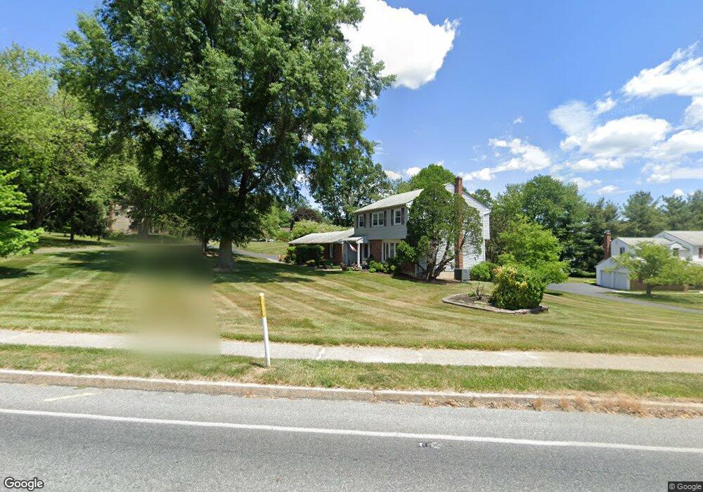
This home is located at 511 N Whitford Rd, Exton, PA 19341 and is currently estimated at $663,305, approximately $344 per square foot. 511 N Whitford Rd is a home located in Chester County with nearby schools including Lionville Elementary School, Lionville Middle School, and Downingtown High School East.
Ownership History
Date
Name
Owned For
Owner Type
Purchase Details
Closed on
Sep 4, 2019
Sold by
Puccella John T and Puccella Carol L
Bought by
Puccella John T and Puccella Carol L
Current Estimated Value
Purchase Details
Closed on
Jan 22, 1999
Sold by
Puccella John T and Puccella Carol L
Bought by
Puccella John T and Puccella Carol L
Home Financials for this Owner
Home Financials are based on the most recent Mortgage that was taken out on this home.
Original Mortgage
$149,000
Outstanding Balance
$34,292
Interest Rate
6.67%
Estimated Equity
$629,013
Create a Home Valuation Report for This Property
The Home Valuation Report is an in-depth analysis detailing your home's value as well as a comparison with similar homes in the area
Home Values in the Area
Average Home Value in this Area
Purchase History
| Date | Buyer | Sale Price | Title Company |
|---|---|---|---|
| Puccella John T | -- | None Available | |
| Puccella John T | -- | -- |
Source: Public Records
Mortgage History
| Date | Status | Borrower | Loan Amount |
|---|---|---|---|
| Open | Puccella John T | $149,000 |
Source: Public Records
Tax History Compared to Growth
Tax History
| Year | Tax Paid | Tax Assessment Tax Assessment Total Assessment is a certain percentage of the fair market value that is determined by local assessors to be the total taxable value of land and additions on the property. | Land | Improvement |
|---|---|---|---|---|
| 2025 | $6,636 | $193,860 | $50,400 | $143,460 |
| 2024 | $6,636 | $193,860 | $50,400 | $143,460 |
| 2023 | $6,442 | $193,860 | $50,400 | $143,460 |
| 2022 | $6,280 | $193,860 | $50,400 | $143,460 |
| 2021 | $6,175 | $193,860 | $50,400 | $143,460 |
| 2020 | $6,140 | $193,860 | $50,400 | $143,460 |
| 2019 | $6,140 | $193,860 | $50,400 | $143,460 |
| 2018 | $6,140 | $193,860 | $50,400 | $143,460 |
| 2017 | $6,140 | $193,860 | $50,400 | $143,460 |
| 2016 | $5,746 | $193,860 | $50,400 | $143,460 |
| 2015 | $5,746 | $193,860 | $50,400 | $143,460 |
| 2014 | $5,746 | $193,860 | $50,400 | $143,460 |
Source: Public Records
Map
Nearby Homes
- 214 Louis Dr
- 510 Woodview Dr
- 208 Morris Rd
- 324 Conner Dr
- 109 Glendale Rd
- 491 Orchard Cir
- 315 Oak Ln W
- 312 Green Cir
- 420 Oakland Dr
- 100 Brookhollow Dr
- 30 S Village Ave
- 534 Pewter Dr
- 577 Pewter Dr
- 464 E Radnor Ct
- 701 Worthington Dr Unit 701
- 17 Buttonwood Dr Unit 17
- 204 Mill Pond Dr
- Santorini Plan at Worthington Farm - Luxury Single-Family Homes
- Monaco Plan at Worthington Farm - Luxury Single-Family Homes
- Lisbon Plan at Worthington Farm - Luxury Single-Family Homes
- 509 N Whitford Rd
- 513 N Whitford Rd
- 216 Biddle Dr
- 218 Biddle Dr
- 103 Robin Rd
- 507 N Whitford Rd
- 3 Robin Rd
- 220 Biddle Dr
- 502 N Whitford Rd
- 2 Robin Rd
- 128 Biddle Dr
- 515 N Whitford Rd
- 222 Biddle Dr
- 505 N Whitford Rd
- 126 Biddle Dr
- 5 Robin Rd
- 500 N Whitford Rd
- 215 Biddle Dr
- 217 Biddle Dr
- 512 N Whitford Rd