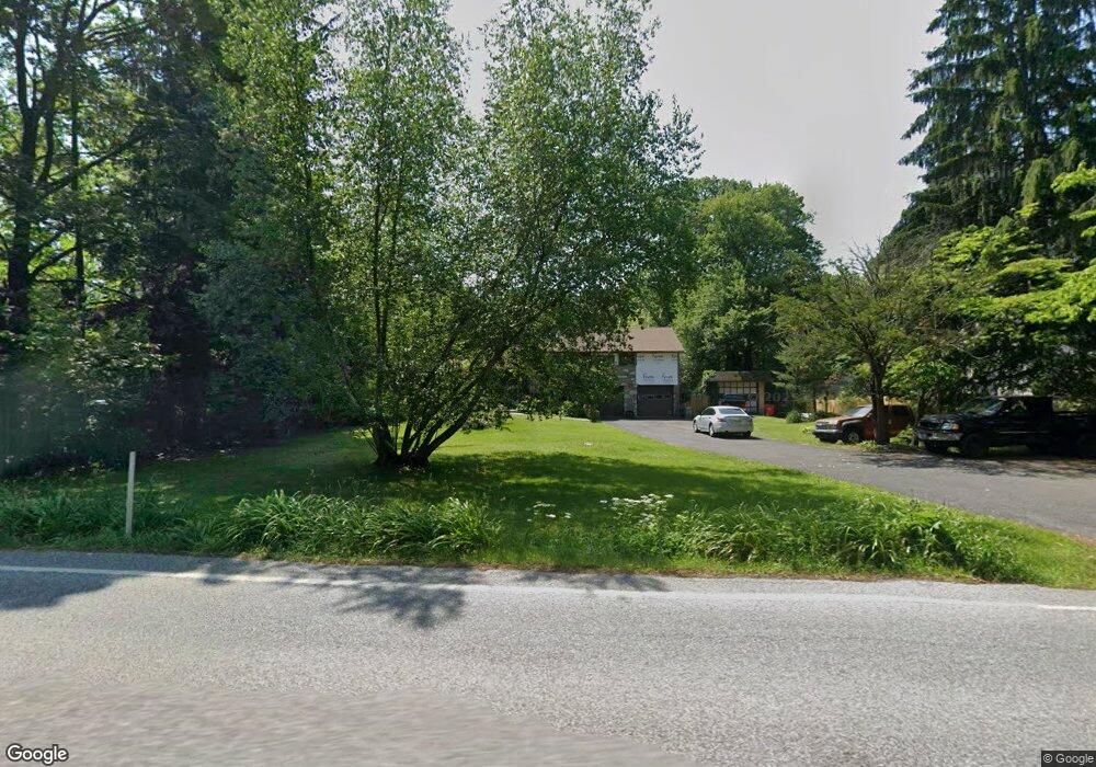
511 Norristown Rd Horsham, PA 19044
Estimated Value: $564,000 - $692,000
3
Beds
2
Baths
2,528
Sq Ft
$250/Sq Ft
Est. Value
About This Home
This home is located at 511 Norristown Rd, Horsham, PA 19044 and is currently estimated at $631,543, approximately $249 per square foot. 511 Norristown Rd is a home located in Montgomery County with nearby schools including Simmons Elementary School, Keith Valley Middle School, and Hatboro-Horsham Senior High School.
Ownership History
Date
Name
Owned For
Owner Type
Purchase Details
Closed on
May 10, 2024
Sold by
Kalnajs Valdis Ivars and Kalnajs Timothy V
Bought by
Kalnajs Timothy and Kalnajs Therese
Current Estimated Value
Purchase Details
Closed on
May 19, 2010
Sold by
Kalnajs Vija Mara and Kalnajs Viia Ramins
Bought by
Kalnajs Vija Mara and Kalnajs Valdis Ivars
Purchase Details
Closed on
Aug 21, 2006
Sold by
Kalnajs Vija Ramins and Dewolf Brigita Ramins
Bought by
Kalnajs Vija Ramins
Create a Home Valuation Report for This Property
The Home Valuation Report is an in-depth analysis detailing your home's value as well as a comparison with similar homes in the area
Home Values in the Area
Average Home Value in this Area
Purchase History
| Date | Buyer | Sale Price | Title Company |
|---|---|---|---|
| Kalnajs Timothy | -- | None Listed On Document | |
| Kalnajs Vija Mara | -- | None Available | |
| Kalnajs Vija Ramins | -- | None Available | |
| Kalnajs Vija Ramins | -- | None Available |
Source: Public Records
Tax History Compared to Growth
Tax History
| Year | Tax Paid | Tax Assessment Tax Assessment Total Assessment is a certain percentage of the fair market value that is determined by local assessors to be the total taxable value of land and additions on the property. | Land | Improvement |
|---|---|---|---|---|
| 2025 | $8,727 | $221,980 | $115,920 | $106,060 |
| 2024 | $8,727 | $221,980 | $115,920 | $106,060 |
| 2023 | $8,307 | $221,980 | $115,920 | $106,060 |
| 2022 | $8,037 | $221,980 | $115,920 | $106,060 |
| 2021 | $7,846 | $221,980 | $115,920 | $106,060 |
| 2020 | $7,661 | $221,980 | $115,920 | $106,060 |
| 2019 | $7,514 | $221,980 | $115,920 | $106,060 |
| 2018 | $6,393 | $221,980 | $115,920 | $106,060 |
| 2017 | $7,178 | $221,980 | $115,920 | $106,060 |
| 2016 | $7,092 | $221,980 | $115,920 | $106,060 |
| 2015 | $6,773 | $221,980 | $115,920 | $106,060 |
| 2014 | $6,773 | $221,980 | $115,920 | $106,060 |
Source: Public Records
Map
Nearby Homes
- 124 Sarahs Ln
- 221 Winchester Dr
- 45 Ember Ln
- 603 Norristown Rd
- 80 Whetstone Rd
- 585 Colonial Dr
- 2 Cedarbrook Dr
- 4 Beaver Hill Rd
- 45 Brookside Ct
- 44 Brookside Ct Unit 44
- 8 Barrel Stave Cir
- 15 Barrel Stave Cir
- 18 Hunt Dr
- 3 Emily Ct
- 6 Pheasant Run
- 454 1/2 Avenue A Unit A
- 43 Black Watch Ct
- 132 Hunt Dr
- 159 Hunt Dr
- 996 Whitney Ln
- 513 Norristown Rd
- 509 Norristown Rd
- 109 Victoria Ln
- 519 Norristown Rd
- 111 Victoria Ln
- 107 Victoria Ln
- 741 Jarrett Rd
- 2 Virginia Ln
- 113 Victoria Ln
- 739 Jarrett Rd
- 521 Norristown Rd
- 4 Virginia Ln
- 105 Victoria Ln
- 115 Victoria Ln
- 110 Victoria Ln
- 737 Jarrett Rd
- 744 Jarrett Rd
- 112 Victoria Ln
- 117 Victoria Ln
- 103 Victoria Ln