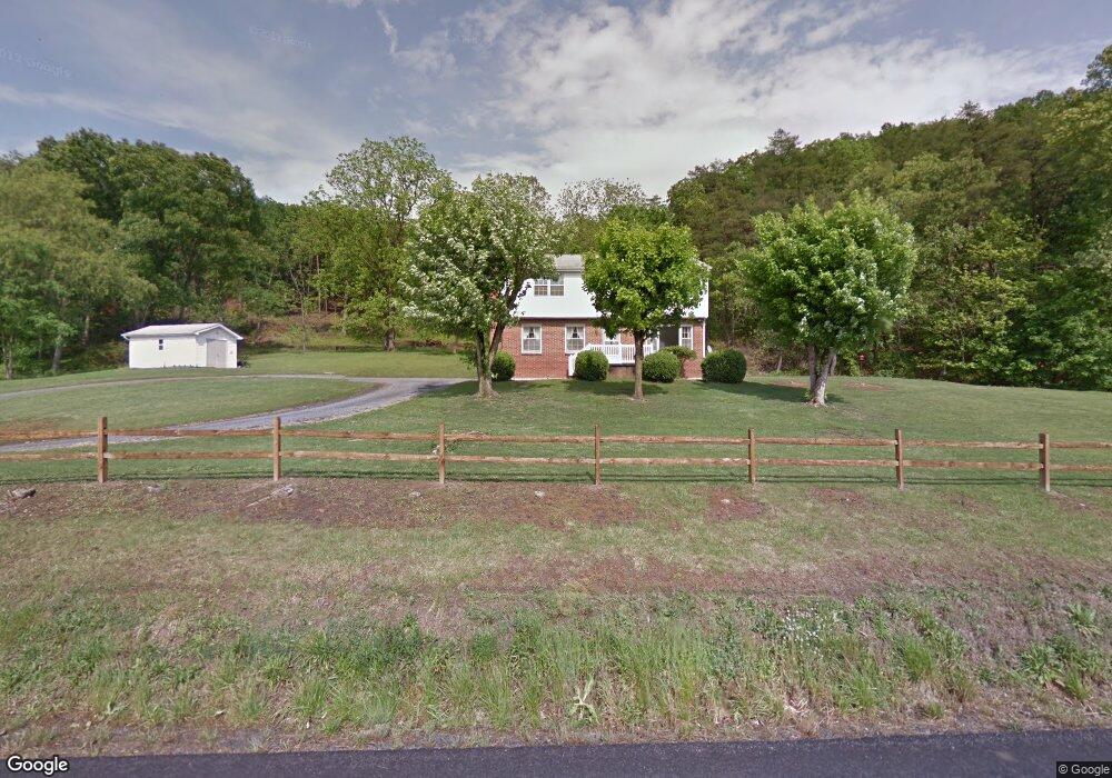
511 S Fork Rd Moorefield, WV 26836
Estimated Value: $215,000 - $313,000
4
Beds
2
Baths
1,908
Sq Ft
$138/Sq Ft
Est. Value
About This Home
This home is located at 511 S Fork Rd, Moorefield, WV 26836 and is currently estimated at $263,827, approximately $138 per square foot. 511 S Fork Rd is a home with nearby schools including Moorefield Elementary School, Moorefield Intermediate School, and Moorefield Middle School.
Ownership History
Date
Name
Owned For
Owner Type
Purchase Details
Closed on
Aug 20, 2010
Sold by
Allen Mark T and Allen Carl E
Bought by
Shockey John P
Current Estimated Value
Home Financials for this Owner
Home Financials are based on the most recent Mortgage that was taken out on this home.
Original Mortgage
$140,000
Outstanding Balance
$92,238
Interest Rate
4.55%
Mortgage Type
New Conventional
Estimated Equity
$171,589
Create a Home Valuation Report for This Property
The Home Valuation Report is an in-depth analysis detailing your home's value as well as a comparison with similar homes in the area
Home Values in the Area
Average Home Value in this Area
Purchase History
| Date | Buyer | Sale Price | Title Company |
|---|---|---|---|
| Shockey John P | $155,900 | -- |
Source: Public Records
Mortgage History
| Date | Status | Borrower | Loan Amount |
|---|---|---|---|
| Open | Shockey John P | $140,000 |
Source: Public Records
Tax History
| Year | Tax Paid | Tax Assessment Tax Assessment Total Assessment is a certain percentage of the fair market value that is determined by local assessors to be the total taxable value of land and additions on the property. | Land | Improvement |
|---|---|---|---|---|
| 2025 | $652 | $84,780 | $18,660 | $66,120 |
| 2024 | $634 | $82,380 | $18,660 | $63,720 |
| 2023 | $629 | $81,420 | $18,660 | $62,760 |
| 2022 | $622 | $79,920 | $18,660 | $61,260 |
| 2021 | $607 | $77,880 | $18,660 | $59,220 |
| 2020 | $592 | $76,380 | $18,660 | $57,720 |
| 2019 | $597 | $76,440 | $18,660 | $57,780 |
| 2018 | $597 | $76,500 | $18,660 | $57,840 |
| 2017 | $597 | $76,560 | $18,660 | $57,900 |
| 2016 | $603 | $76,800 | $18,660 | $58,140 |
| 2015 | $537 | $68,470 | $18,660 | $49,810 |
| 2014 | $537 | $68,470 | $18,660 | $49,810 |
Source: Public Records
Map
Nearby Homes
- 224 Chipley Ln
- 207 Clements St
- 1 S Fork Rd
- 123 N Elm St
- 201 Hope Mount Dr
- 506 Evening St
- 0 Route 220 Unit WVHD2002898
- 6836 W Virginia 55
- 000 Route 220 Hwy
- 9.38 Rt 55 E
- 158 Eastern Dr
- 205 Jacob Dr
- 140 Jacob Dr
- 431 Lost River State Park Rd
- 271 Ogden Farm Rd
- 38.43 Acres Howard Sions Rd
- 125 Ender Dr
- 6 ac Mountain Acres Loop
- 175 White Oak Crossing Rd
- 400 Locust Ridge
- 489 S Fork Rd
- 395 S Fork Rd
- 395 S Fork Rd
- 112 Natwick Cir
- 112 Natwick Cir
- 106 Natwick Cir Unit MDF
- 106 Natwick Cir
- 116 Natwick Cir
- 118 Natwick Cir
- 104 Natwick Cir
- 504 Clements St
- 504 Clements St
- 111 Natwick Cir
- 0 S Fork Rd Unit HD7254735
- 0 S Fork Rd Unit HD7436110
- 0 S Fork Rd Unit HD7548740
- 0 S Fork Rd Unit HD7585522
- 0 S Fork Rd Unit HD7821242
- 0 S Fork Rd Unit 1004991538
- 110 Natwick Cir
Your Personal Tour Guide
Ask me questions while you tour the home.