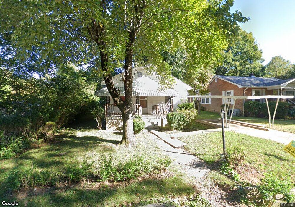
511 S Pennington Ave Lexington, NC 27292
Estimated Value: $63,000 - $133,000
2
Beds
1
Bath
1,008
Sq Ft
$97/Sq Ft
Est. Value
About This Home
This home is located at 511 S Pennington Ave, Lexington, NC 27292 and is currently estimated at $98,016, approximately $97 per square foot. 511 S Pennington Ave is a home located in Davidson County with nearby schools including South Lexington School, Lexington Middle School, and Lexington Senior High School.
Ownership History
Date
Name
Owned For
Owner Type
Purchase Details
Closed on
Sep 16, 2022
Sold by
Williams Otis V and Williams Vanessa
Bought by
Sutton Karen W and Leverette Eloise Patsy
Current Estimated Value
Purchase Details
Closed on
Mar 16, 2022
Sold by
Williams Otis V and Williams Vanessa
Bought by
Sutton Karen W and Leverette Eloise Patsy
Purchase Details
Closed on
Nov 15, 2002
Bought by
Williams Ossie Mae
Purchase Details
Closed on
Dec 1, 1982
Purchase Details
Closed on
Feb 1, 1974
Create a Home Valuation Report for This Property
The Home Valuation Report is an in-depth analysis detailing your home's value as well as a comparison with similar homes in the area
Home Values in the Area
Average Home Value in this Area
Purchase History
| Date | Buyer | Sale Price | Title Company |
|---|---|---|---|
| Sutton Karen W | -- | -- | |
| Sutton Karen W | -- | None Listed On Document | |
| Sutton Karen W | $10,000 | Curry Holly B | |
| Williams Ossie Mae | -- | -- | |
| -- | $15,000 | -- | |
| -- | $6,000 | -- |
Source: Public Records
Tax History Compared to Growth
Tax History
| Year | Tax Paid | Tax Assessment Tax Assessment Total Assessment is a certain percentage of the fair market value that is determined by local assessors to be the total taxable value of land and additions on the property. | Land | Improvement |
|---|---|---|---|---|
| 2025 | $502 | $38,590 | $0 | $0 |
| 2024 | $502 | $38,590 | $0 | $0 |
| 2023 | $502 | $38,590 | $0 | $0 |
| 2022 | $502 | $38,590 | $0 | $0 |
| 2021 | $502 | $38,590 | $0 | $0 |
| 2020 | $288 | $22,330 | $0 | $0 |
| 2019 | $293 | $22,330 | $0 | $0 |
| 2018 | $293 | $22,330 | $0 | $0 |
| 2017 | $293 | $22,330 | $0 | $0 |
| 2016 | $293 | $22,330 | $0 | $0 |
| 2015 | $281 | $22,330 | $0 | $0 |
| 2014 | $315 | $25,030 | $0 | $0 |
Source: Public Records
Map
Nearby Homes
- 10 Grant St
- 3 Linwood Rd
- 308 Carters Grove Rd
- 602 Old Linwood Rd
- 410 Irma Ave
- 517 Liberty Ave
- 603 Oak Ave
- 1301 Cotton Grove Rd
- 705 Laurel Ave
- 609 Peeler St
- 10 E 12th Ave
- 119 Cotton Grove Rd
- 412 Wall St
- 26 Harrington Ave
- 905 Kildee Dr
- 969 Old Linwood Rd
- 306 Pope St
- 422 Woodsway Dr
- 1235 Fairview Dr
- 644 Brown St
- 513 S Pennington Ave
- 515 S Pennington Ave
- 509 S Pennington Ave
- 601 S Pennington Ave
- 514 S Pennington Ave
- 603 S Pennington Ave
- 602 S Pennington Ave
- 309 Linwood Rd
- 313 Linwood Rd
- 301 Linwood Rd
- 401 Linwood Rd
- 606 S Pennington Ave
- 211 Linwood Rd
- 209 Linwood Rd
- 209 Old Linwood Rd
- 988 Ulysses St
- 608 S Pennington Ave
- 990 Ulysses St
- 205 Linwood Rd
- 205 Old Linwood Rd