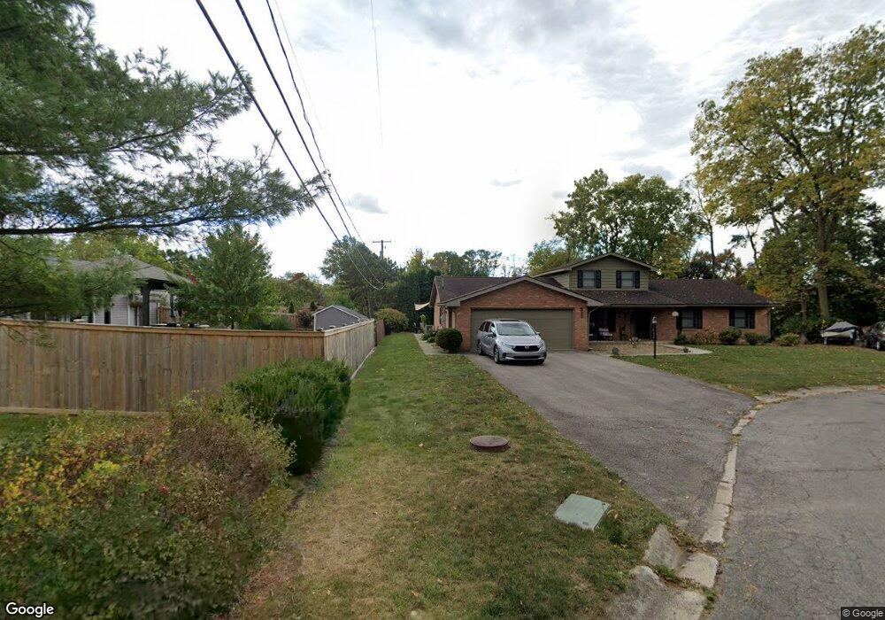
511 Shadyside Cir Marion, OH 43302
Estimated Value: $352,237 - $381,000
4
Beds
3
Baths
2,660
Sq Ft
$138/Sq Ft
Est. Value
About This Home
This home is located at 511 Shadyside Cir, Marion, OH 43302 and is currently estimated at $366,059, approximately $137 per square foot. 511 Shadyside Cir is a home located in Marion County with nearby schools including Benjamin Harrison Elementary School, Ulysses S. Grant Middle School, and Harding High School.
Ownership History
Date
Name
Owned For
Owner Type
Purchase Details
Closed on
Apr 29, 2019
Sold by
Gibson Benji A and Gibson Kathy L
Bought by
Watkins Ross A and Watkins Tiffany L
Current Estimated Value
Home Financials for this Owner
Home Financials are based on the most recent Mortgage that was taken out on this home.
Original Mortgage
$166,000
Outstanding Balance
$146,241
Interest Rate
4.3%
Mortgage Type
New Conventional
Estimated Equity
$219,818
Purchase Details
Closed on
Jan 31, 2003
Bought by
Gibson Benji A and Surv Kathy L
Purchase Details
Closed on
Jan 21, 2003
Bought by
Gibson Benji A and Surv Kathy L
Create a Home Valuation Report for This Property
The Home Valuation Report is an in-depth analysis detailing your home's value as well as a comparison with similar homes in the area
Home Values in the Area
Average Home Value in this Area
Purchase History
| Date | Buyer | Sale Price | Title Company |
|---|---|---|---|
| Watkins Ross A | $200,000 | None Available | |
| Gibson Benji A | $171,000 | -- | |
| Gibson Benji A | -- | -- |
Source: Public Records
Mortgage History
| Date | Status | Borrower | Loan Amount |
|---|---|---|---|
| Open | Watkins Ross A | $166,000 |
Source: Public Records
Tax History Compared to Growth
Tax History
| Year | Tax Paid | Tax Assessment Tax Assessment Total Assessment is a certain percentage of the fair market value that is determined by local assessors to be the total taxable value of land and additions on the property. | Land | Improvement |
|---|---|---|---|---|
| 2024 | $3,585 | $95,660 | $17,100 | $78,560 |
| 2023 | $3,585 | $95,660 | $17,100 | $78,560 |
| 2022 | $3,318 | $95,660 | $17,100 | $78,560 |
| 2021 | $2,907 | $75,440 | $14,870 | $60,570 |
| 2020 | $2,907 | $75,440 | $14,870 | $60,570 |
| 2019 | $2,911 | $75,440 | $14,870 | $60,570 |
| 2018 | $2,410 | $62,660 | $14,890 | $47,770 |
| 2017 | $2,442 | $62,660 | $14,890 | $47,770 |
| 2016 | $2,432 | $62,660 | $14,890 | $47,770 |
| 2015 | $2,423 | $61,070 | $14,180 | $46,890 |
| 2014 | $2,422 | $61,070 | $14,180 | $46,890 |
| 2012 | $2,292 | $57,290 | $12,570 | $44,720 |
Source: Public Records
Map
Nearby Homes
- 701 Brightwood Dr
- 763 Leetonia Rd
- 769 Summit St
- 667 King Ave
- 556 Hane Ave
- 556 S Vine St
- 338 Powhattan St
- 514 King Ave
- 482 King Ave
- 193 E Walnut St
- 686 Mount Vernon Ave Unit AV
- 991 Uhler Rd
- 239 Gurley Ave
- 858 Vernon Heights Cir
- 127 E Walnut St
- 301 S Vine St
- 604 S Prospect St
- 249 S Grand Ave
- 1043 Harding Memorial Pkwy
- 840 Forest Lawn Dr
- 505 Shadyside Cir
- 651 Brightwood Dr
- 510 Eveningside Cir
- 661 Brightwood Dr
- 506 Eveningside Cir
- 510 Shadyside Cir
- 681 Brightwood Dr
- 650 Brightwood Dr
- 505 Eveningside Cir
- 662 Brightwood Dr
- 670 Brightwood Dr
- 686 Brightwood Dr
- 645 Leetonia Rd
- 713 Brightwood Dr
- 700 Brightwood Dr
- 550 Shadyside Dr
- 675 Leetonia Rd
- 731 Brightwood Dr
- 520 Virginia Ave
- 601 Forest St