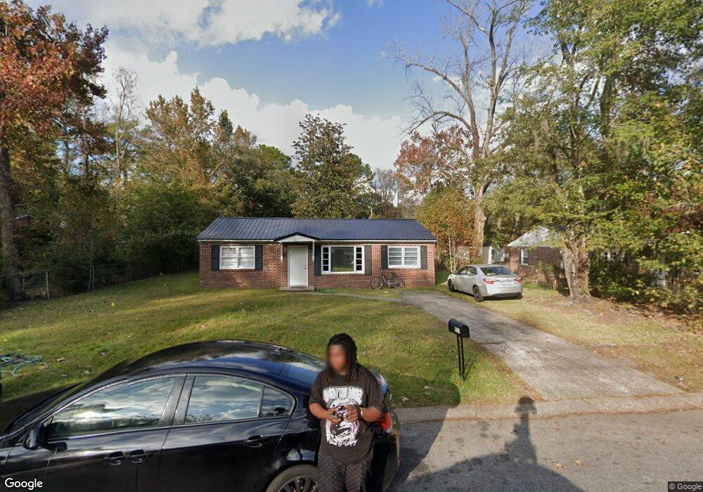
511 Stewart Dr Hinesville, GA 31313
Estimated Value: $152,031 - $162,000
2
Beds
1
Bath
960
Sq Ft
$165/Sq Ft
Est. Value
About This Home
This home is located at 511 Stewart Dr, Hinesville, GA 31313 and is currently estimated at $158,008, approximately $164 per square foot. 511 Stewart Dr is a home located in Liberty County with nearby schools including Joseph Martin Elementary School, Midway Middle School, and Liberty County High School.
Ownership History
Date
Name
Owned For
Owner Type
Purchase Details
Closed on
Sep 11, 2002
Sold by
Heritage Bank
Bought by
Smiley David N
Current Estimated Value
Purchase Details
Closed on
Aug 15, 2002
Sold by
Kitchings Robert W
Bought by
Heritage Bank
Purchase Details
Closed on
Jan 23, 1998
Sold by
Smiley David N
Bought by
Kitchings Robert W
Purchase Details
Closed on
Mar 11, 1997
Sold by
Fisher Thomas
Bought by
Smiley David N
Purchase Details
Closed on
Nov 19, 1991
Bought by
Fisher Thomas
Purchase Details
Closed on
Mar 5, 1991
Bought by
Admin Of Va Affairs
Create a Home Valuation Report for This Property
The Home Valuation Report is an in-depth analysis detailing your home's value as well as a comparison with similar homes in the area
Home Values in the Area
Average Home Value in this Area
Purchase History
| Date | Buyer | Sale Price | Title Company |
|---|---|---|---|
| Smiley David N | $30,000 | -- | |
| Heritage Bank | -- | -- | |
| Kitchings Robert W | $44,900 | -- | |
| Smiley David N | $35,500 | -- | |
| Fisher Thomas | $45,000 | -- | |
| Admin Of Va Affairs | -- | -- | |
| Collateral Mortgage | $34,800 | -- |
Source: Public Records
Tax History Compared to Growth
Tax History
| Year | Tax Paid | Tax Assessment Tax Assessment Total Assessment is a certain percentage of the fair market value that is determined by local assessors to be the total taxable value of land and additions on the property. | Land | Improvement |
|---|---|---|---|---|
| 2024 | $1,623 | $32,779 | $12,000 | $20,779 |
| 2023 | $1,623 | $30,461 | $12,000 | $18,461 |
| 2022 | $997 | $21,110 | $6,000 | $15,110 |
| 2021 | $927 | $19,234 | $6,000 | $13,234 |
| 2020 | $763 | $15,603 | $4,000 | $11,603 |
| 2019 | $769 | $15,857 | $4,000 | $11,857 |
| 2018 | $777 | $16,111 | $4,000 | $12,111 |
| 2017 | $539 | $16,369 | $4,000 | $12,369 |
| 2016 | $764 | $16,628 | $4,000 | $12,628 |
| 2015 | $927 | $16,628 | $4,000 | $12,628 |
| 2014 | $927 | $20,051 | $5,200 | $14,851 |
| 2013 | -- | $20,992 | $5,200 | $15,792 |
Source: Public Records
Map
Nearby Homes
- 407 Simpson St
- 411 Rogers Rd
- 514 Creekview Dr
- 606 Heritage Dr
- 402 W Oglethorpe Hwy
- 1 Oglethorpe Ave
- 412 Timberlane Cir
- 601 Tupelo Trail Unit 42
- 996 Stone Ct
- 148 Marron Way
- 173 Ironwood Dr
- 980 Grayson Ave
- 804 Grayson Ave
- 864 Grayson Ave
- 1078 Grayson Ave
- 24 Sherwood Dr
- 411 Woodland Dr
- 1.76 AC Tranquill Way
- 1.76 AC Shyam Dr
- 4 Lots Memorial Dr
- 513 Stewart Dr Unit A
- 509 Stewart Dr
- 510 Eisenhower Dr
- 512 Eisenhower Dr
- 508 Eisenhower Dr
- 515 Stewart Dr
- 507 Stewart Dr
- 514 Stewart Dr
- 514 Eisenhower Dr
- 512 Stewart Dr
- 510 Stewart Dr
- 505 Stewart Dr
- 504 Eisenhower Dr
- 509 Eisenhower Dr
- 508 Stewart Dr
- 511 Eisenhower Dr
- 507 Eisenhower Dr
- 518 Stewart Dr
- 506 Stewart Dr
- 513 Eisenhower Dr