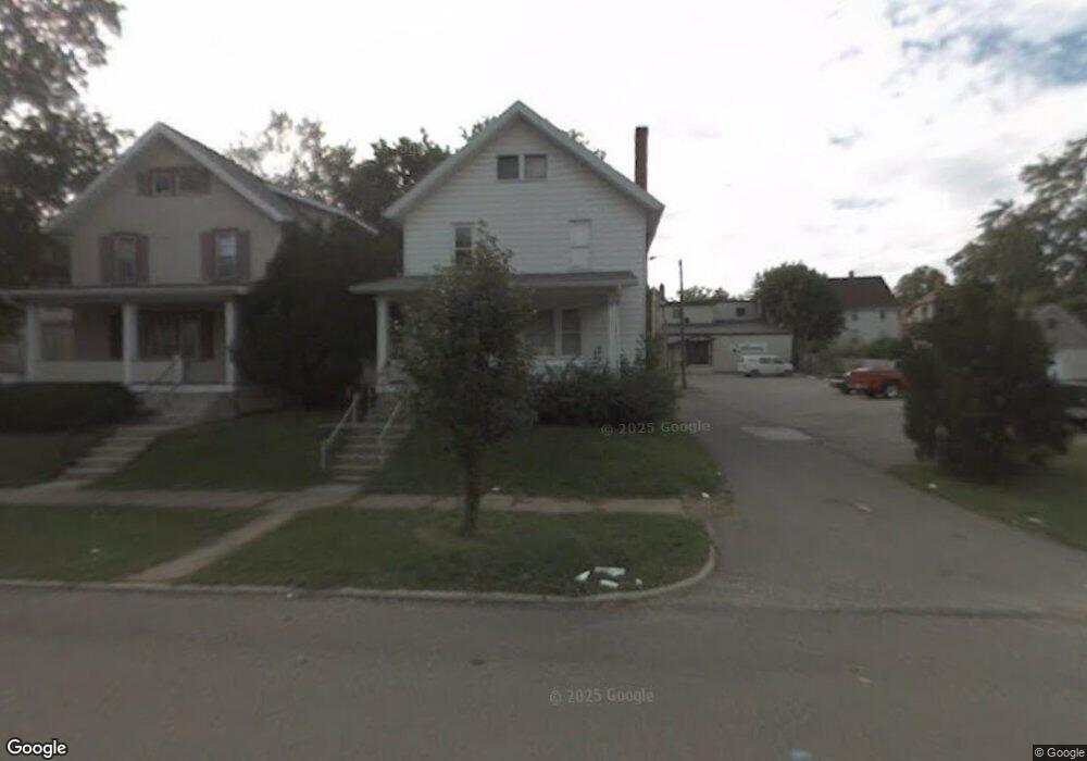
511 W 3rd St Mansfield, OH 44903
Estimated Value: $72,000 - $97,000
3
Beds
1
Bath
1,499
Sq Ft
$57/Sq Ft
Est. Value
About This Home
This home is located at 511 W 3rd St, Mansfield, OH 44903 and is currently estimated at $85,714, approximately $57 per square foot. 511 W 3rd St is a home located in Richland County with nearby schools including Goal Digital Academy, St. Peter's Elementary/Montessori School, and St. Peter's Junior High / High School.
Ownership History
Date
Name
Owned For
Owner Type
Purchase Details
Closed on
Sep 1, 2009
Sold by
Fannie Mae
Bought by
Ihejirika Frederick A
Current Estimated Value
Purchase Details
Closed on
Apr 16, 2009
Sold by
Mosier Alana J
Bought by
Fanniemae
Purchase Details
Closed on
Sep 8, 2003
Sold by
Mosier Jerry L and Mosier Marinetta J
Bought by
Mosier Alana J
Home Financials for this Owner
Home Financials are based on the most recent Mortgage that was taken out on this home.
Original Mortgage
$52,500
Interest Rate
5.97%
Mortgage Type
Purchase Money Mortgage
Purchase Details
Closed on
Oct 20, 1997
Sold by
Norris Walter M
Bought by
Mosier Jerry L and Mosier Marinetta J
Create a Home Valuation Report for This Property
The Home Valuation Report is an in-depth analysis detailing your home's value as well as a comparison with similar homes in the area
Home Values in the Area
Average Home Value in this Area
Purchase History
| Date | Buyer | Sale Price | Title Company |
|---|---|---|---|
| Ihejirika Frederick A | $8,000 | Ohio Title Corporation | |
| Fanniemae | $20,000 | Attorney | |
| Mosier Alana J | $70,000 | Southern Title | |
| Mosier Jerry L | $9,000 | -- |
Source: Public Records
Mortgage History
| Date | Status | Borrower | Loan Amount |
|---|---|---|---|
| Previous Owner | Mosier Alana J | $52,500 |
Source: Public Records
Tax History
| Year | Tax Paid | Tax Assessment Tax Assessment Total Assessment is a certain percentage of the fair market value that is determined by local assessors to be the total taxable value of land and additions on the property. | Land | Improvement |
|---|---|---|---|---|
| 2024 | $847 | $17,690 | $980 | $16,710 |
| 2023 | $1,104 | $17,690 | $980 | $16,710 |
| 2022 | $913 | $14,180 | $950 | $13,230 |
| 2021 | $816 | $14,180 | $950 | $13,230 |
| 2020 | $834 | $14,180 | $950 | $13,230 |
| 2019 | $925 | $14,180 | $950 | $13,230 |
| 2018 | $912 | $14,180 | $950 | $13,230 |
| 2017 | $851 | $14,180 | $950 | $13,230 |
| 2016 | $927 | $14,360 | $2,000 | $12,360 |
| 2015 | $886 | $14,360 | $2,000 | $12,360 |
| 2014 | $874 | $14,360 | $2,000 | $12,360 |
| 2012 | $670 | $14,360 | $2,110 | $12,250 |
Source: Public Records
Map
Nearby Homes
- 458 W West Dickson Ave
- 519 Heineman Blvd
- 10 Gray Ct
- 31 Bartley Ave
- 24 Stewart Ave S
- 30 Douglas Ave
- 71 Dawson Ave
- 31 Parkwood Blvd
- 51 Lind Ave
- 212 Penn Ave
- 126 Dawson Ave
- 108 Stewart Ave S
- 116 Stewart Ave S
- 230 Rae Ave
- 133 Stewart Ave S
- 344 W 5th St
- 158 Vennum Ave
- 368 W 6th St
- 189 Westwood Ave
- 183 Carpenter Rd
Your Personal Tour Guide
Ask me questions while you tour the home.