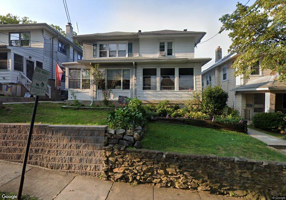
511 Wales Rd Havertown, PA 19083
Estimated Value: $382,000 - $421,000
3
Beds
1
Bath
1,280
Sq Ft
$312/Sq Ft
Est. Value
About This Home
This home is located at 511 Wales Rd, Havertown, PA 19083 and is currently estimated at $399,555, approximately $312 per square foot. 511 Wales Rd is a home located in Delaware County with nearby schools including Manoa Elementary School, Haverford Middle School, and Haverford Senior High School.
Ownership History
Date
Name
Owned For
Owner Type
Purchase Details
Closed on
May 7, 2010
Sold by
Lakose Jonathan
Bought by
Wheeler Gregory and Alessandroni Lisa
Current Estimated Value
Home Financials for this Owner
Home Financials are based on the most recent Mortgage that was taken out on this home.
Original Mortgage
$204,232
Interest Rate
4.76%
Mortgage Type
FHA
Purchase Details
Closed on
Nov 12, 2003
Sold by
Aughey Daniel John and Estate Of Mary E Aughey
Bought by
Lakose Jonathan
Home Financials for this Owner
Home Financials are based on the most recent Mortgage that was taken out on this home.
Original Mortgage
$107,120
Interest Rate
4.75%
Mortgage Type
Purchase Money Mortgage
Purchase Details
Closed on
Mar 30, 2001
Sold by
Mctamney Charles M and Mctamney Joseph P
Bought by
Aughey Mary E and Aughey Daniel John
Create a Home Valuation Report for This Property
The Home Valuation Report is an in-depth analysis detailing your home's value as well as a comparison with similar homes in the area
Home Values in the Area
Average Home Value in this Area
Purchase History
| Date | Buyer | Sale Price | Title Company |
|---|---|---|---|
| Wheeler Gregory | $208,000 | None Available | |
| Lakose Jonathan | $133,900 | Lawyers Title Ins | |
| Aughey Mary E | -- | -- |
Source: Public Records
Mortgage History
| Date | Status | Borrower | Loan Amount |
|---|---|---|---|
| Previous Owner | Wheeler Gregory | $204,232 | |
| Previous Owner | Lakose Jonathan | $107,120 |
Source: Public Records
Tax History Compared to Growth
Tax History
| Year | Tax Paid | Tax Assessment Tax Assessment Total Assessment is a certain percentage of the fair market value that is determined by local assessors to be the total taxable value of land and additions on the property. | Land | Improvement |
|---|---|---|---|---|
| 2025 | $5,996 | $233,210 | $92,640 | $140,570 |
| 2024 | $5,996 | $233,210 | $92,640 | $140,570 |
| 2023 | $5,826 | $233,210 | $92,640 | $140,570 |
| 2022 | $5,690 | $233,210 | $92,640 | $140,570 |
| 2021 | $9,270 | $233,210 | $92,640 | $140,570 |
| 2020 | $4,914 | $105,730 | $46,920 | $58,810 |
| 2019 | $4,824 | $105,730 | $46,920 | $58,810 |
| 2018 | $4,741 | $105,730 | $0 | $0 |
| 2017 | $4,640 | $105,730 | $0 | $0 |
| 2016 | $580 | $105,730 | $0 | $0 |
| 2015 | $580 | $105,730 | $0 | $0 |
| 2014 | $580 | $105,730 | $0 | $0 |
Source: Public Records
Map
Nearby Homes
- 447 W Chester Pike
- 542 Wales Rd
- 32 Westwood Park Dr
- 504 N Manoa Rd
- 48 Sycamore Rd
- 664 Washington Ave
- 145 Sycamore Rd
- 164 Woodbine Rd
- 100 E Manoa Rd
- 119 Wilson Ave
- 1216 Darby Rd
- 16 Chelten Rd
- 13 Princeton Rd
- 100 Brookline Blvd
- 213 N Ormond Ave
- 1228 Old Ln
- 110 E Township Line Rd
- 142 Foster Ave
- 223 E Park Rd
- 1133 Agnew Dr