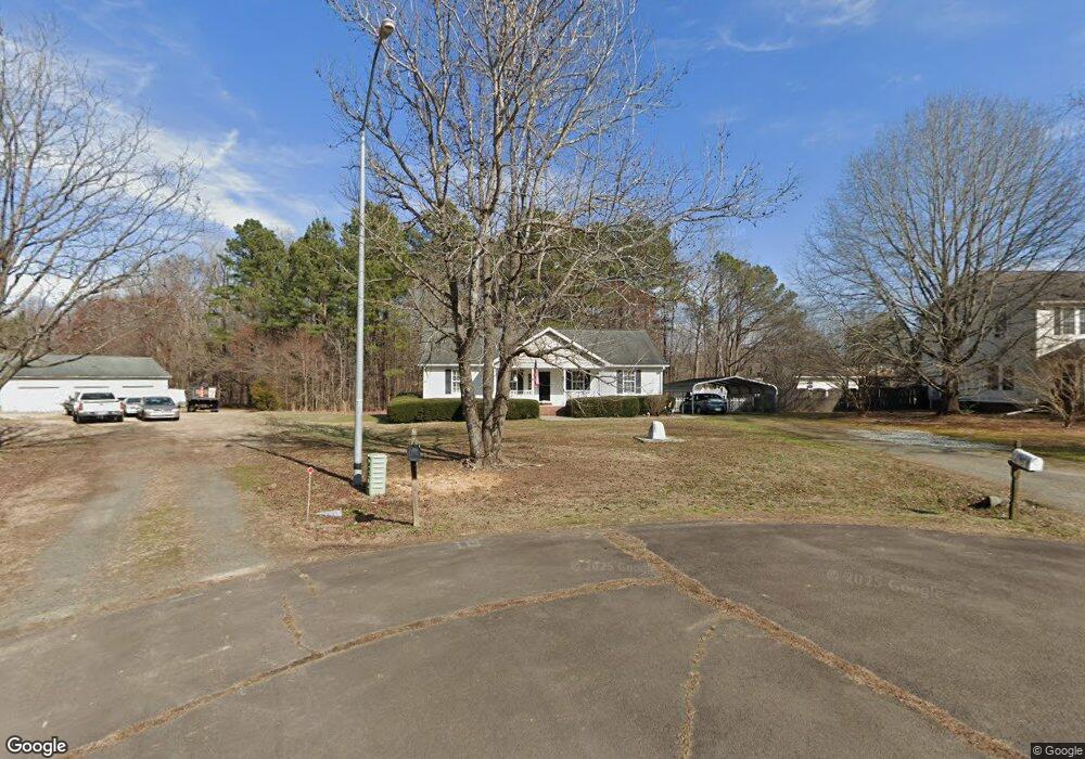
5110 Clint Ct Oxford, NC 27565
Estimated Value: $240,000 - $328,000
3
Beds
2
Baths
1,414
Sq Ft
$210/Sq Ft
Est. Value
About This Home
This home is located at 5110 Clint Ct, Oxford, NC 27565 and is currently estimated at $296,313, approximately $209 per square foot. 5110 Clint Ct is a home located in Granville County with nearby schools including West Oxford Elementary School, Northern Granville Middle School, and Granville Central High School.
Ownership History
Date
Name
Owned For
Owner Type
Purchase Details
Closed on
Sep 1, 2011
Sold by
Lamiy Amir and Lamiy Elham
Bought by
Tessin Timothy and Carpenter Cynthia A
Current Estimated Value
Home Financials for this Owner
Home Financials are based on the most recent Mortgage that was taken out on this home.
Original Mortgage
$70,000
Outstanding Balance
$46,161
Interest Rate
3.5%
Mortgage Type
Adjustable Rate Mortgage/ARM
Estimated Equity
$250,152
Create a Home Valuation Report for This Property
The Home Valuation Report is an in-depth analysis detailing your home's value as well as a comparison with similar homes in the area
Home Values in the Area
Average Home Value in this Area
Purchase History
| Date | Buyer | Sale Price | Title Company |
|---|---|---|---|
| Tessin Timothy | $110,000 | None Available |
Source: Public Records
Mortgage History
| Date | Status | Borrower | Loan Amount |
|---|---|---|---|
| Open | Tessin Timothy | $70,000 |
Source: Public Records
Tax History Compared to Growth
Tax History
| Year | Tax Paid | Tax Assessment Tax Assessment Total Assessment is a certain percentage of the fair market value that is determined by local assessors to be the total taxable value of land and additions on the property. | Land | Improvement |
|---|---|---|---|---|
| 2025 | $1,595 | $225,268 | $48,169 | $177,099 |
| 2024 | $1,595 | $225,268 | $48,169 | $177,099 |
| 2023 | $1,592 | $143,465 | $30,076 | $113,389 |
| 2022 | $1,324 | $143,465 | $30,076 | $113,389 |
| 2021 | $1,233 | $143,465 | $30,076 | $113,389 |
| 2020 | $1,233 | $143,465 | $30,076 | $113,389 |
| 2019 | $1,233 | $143,465 | $30,076 | $113,389 |
| 2018 | $1,233 | $143,465 | $30,076 | $113,389 |
| 2016 | $1,223 | $135,739 | $30,568 | $105,171 |
| 2015 | $1,150 | $135,739 | $30,568 | $105,171 |
| 2014 | $1,150 | $135,739 | $30,568 | $105,171 |
| 2013 | -- | $135,739 | $30,568 | $105,171 |
Source: Public Records
Map
Nearby Homes
- 5148 Lucy Averette Rd
- 2536 Enon Rd
- 5606 Oakley Hill
- 1545 Dogwood Dr
- Tract 2b Watkins Rd
- 5586 Shelton Creek Rd
- 6035 Mary Lee Dr
- 4148 Forest Ct
- 2605 Joe Pruitt Rd
- 2071 Thad Carey Rd
- 4158 Shock Overton Rd
- 4285 Belltown Rd
- 1106 Brookrun Dr
- 1105 Brookrun Dr
- 1103 Brookrun Dr
- 1104 Brookrun Dr
- 905 Brookrun Dr
- Lot 18 Spring Grove Dr
- 0 Spring Grove Dr
- Lot 25 Spring Grove Dr
- 5108 Misty Ln
- 5112 Clint Ct
- Lot 15 Clint Ct
- 5106 Misty Ln
- 5114 Misty Ln
- 5109 Misty Ln
- 5125 Lucy Averette Rd
- 5117 Misty Ln
- 5129 Lucy Averette Rd
- 5122 Misty Ln
- LOT 14 Misty Ln
- LOT 15 Misty Ln
- LOT 12 Misty Ln
- LOT 13 Misty Ln
- LOT 3 Misty Ln
- 5128 Lucy Averette Rd
- 5128 Lucy Averette Rd
- 5126 Misty Ln
- 5110 Lucy Averette Rd
- 5149 Lucy Averette Rd