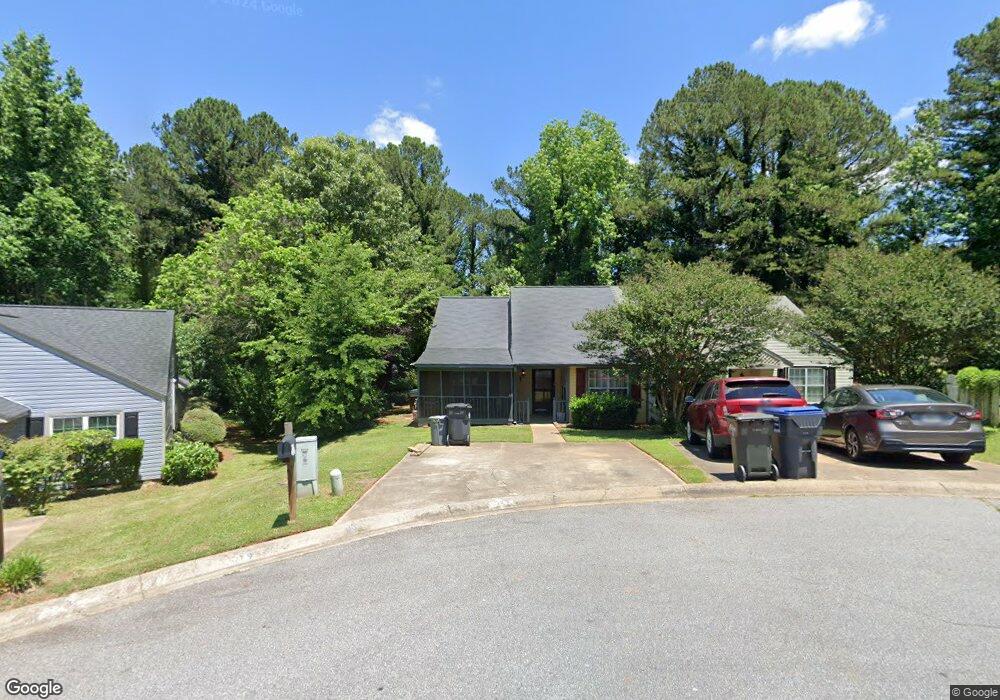
5110 Hill Farm Dr NE Unit 6 Woodstock, GA 30188
Sandy Plains NeighborhoodEstimated Value: $258,199 - $269,000
2
Beds
2
Baths
1,304
Sq Ft
$202/Sq Ft
Est. Value
About This Home
This home is located at 5110 Hill Farm Dr NE Unit 6, Woodstock, GA 30188 and is currently estimated at $264,050, approximately $202 per square foot. 5110 Hill Farm Dr NE Unit 6 is a home located in Cobb County with nearby schools including Nicholson Elementary School, McCleskey Middle School, and Kell High School.
Ownership History
Date
Name
Owned For
Owner Type
Purchase Details
Closed on
Jul 16, 2002
Sold by
Conradson Glen
Bought by
Gaines Sarah L
Current Estimated Value
Home Financials for this Owner
Home Financials are based on the most recent Mortgage that was taken out on this home.
Original Mortgage
$112,400
Outstanding Balance
$47,513
Interest Rate
6.67%
Mortgage Type
FHA
Estimated Equity
$216,537
Purchase Details
Closed on
Jul 7, 1998
Sold by
Parker Kathleen A and Parker John R
Bought by
Conradson Glen E
Home Financials for this Owner
Home Financials are based on the most recent Mortgage that was taken out on this home.
Original Mortgage
$74,900
Interest Rate
7.02%
Mortgage Type
FHA
Create a Home Valuation Report for This Property
The Home Valuation Report is an in-depth analysis detailing your home's value as well as a comparison with similar homes in the area
Home Values in the Area
Average Home Value in this Area
Purchase History
| Date | Buyer | Sale Price | Title Company |
|---|---|---|---|
| Gaines Sarah L | $113,300 | -- | |
| Conradson Glen E | $74,900 | -- |
Source: Public Records
Mortgage History
| Date | Status | Borrower | Loan Amount |
|---|---|---|---|
| Open | Gaines Sarah L | $112,400 | |
| Previous Owner | Conradson Glen E | $74,900 |
Source: Public Records
Tax History Compared to Growth
Tax History
| Year | Tax Paid | Tax Assessment Tax Assessment Total Assessment is a certain percentage of the fair market value that is determined by local assessors to be the total taxable value of land and additions on the property. | Land | Improvement |
|---|---|---|---|---|
| 2024 | $2,767 | $91,772 | $24,000 | $67,772 |
| 2023 | $2,435 | $80,752 | $18,000 | $62,752 |
| 2022 | $2,263 | $74,568 | $16,000 | $58,568 |
| 2021 | $1,593 | $52,472 | $12,000 | $40,472 |
| 2020 | $1,509 | $49,708 | $8,000 | $41,708 |
| 2019 | $1,509 | $49,708 | $8,000 | $41,708 |
| 2018 | $1,173 | $38,664 | $8,000 | $30,664 |
| 2017 | $1,058 | $36,796 | $8,000 | $28,796 |
| 2016 | $791 | $27,520 | $4,800 | $22,720 |
| 2015 | $738 | $25,060 | $4,800 | $20,260 |
| 2014 | $745 | $25,060 | $0 | $0 |
Source: Public Records
Map
Nearby Homes
- 5142 Farm Place Dr NE
- 639 Tigers Eye Terrace
- 540 Stockwood Dr
- 4793 Moonstone Trace
- The Gavin E Plan at The Village at Shallowford - Signature Series
- The Marion A Plan at The Village at Shallowford - Classic Series
- The Cary A Plan at The Village at Shallowford - Classic Series
- 4669 Blue Topaz Trail
- 4785 Moonstone Trace
- 4778 Moonstone Trace
- 707 Smokey Quartz Way
- 710 Smokey Quartz Way
- 694 Smokey Quartz Way
- 4785 Moonstone NE
- 703 Smokey Quartz Way
- 706 Smokey Quartz Way
- 702 Smokey Quartz Way
- 5116 Hill Farm Dr NE
- 5106 Hill Farm Dr NE Unit 5106
- 5120 Hill Farm Dr NE Unit IV
- 5105 Hill Farm Dr NE
- 5105 Hill Farm Dr NE
- 5124 Hill Farm Dr NE
- 5124 Hill Farm Dr NE Unit 4
- 4937 Farmstead Ct NE Unit 2
- 4935 Farmstead Ct NE Unit 2
- 4931 Farmstead Ct NE
- 5128 Hill Farm Dr NE
- 5128 Hill Farm Dr NE Unit 4
- 4933 Farmstead Ct NE
- 4939 Farmstead Ct NE Unit 4939-4941
- 4939 Farmstead Ct NE Unit 4941
- 4939 Farmstead Ct NE
- 5107 Hill Farm Dr NE
- 5109 Hill Farm Dr NE
- 4929 Farmstead Ct NE
- 4941 Farmstead Ct NE