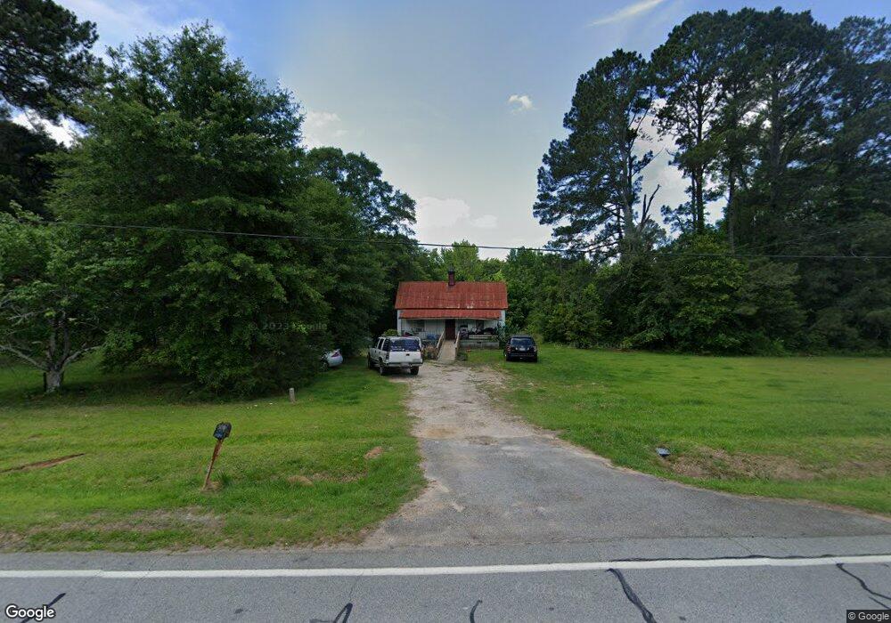
5111 Lamb Ave Union Point, GA 30669
Estimated Value: $67,778 - $140,000
1
Bed
1
Bath
788
Sq Ft
$123/Sq Ft
Est. Value
About This Home
This home is located at 5111 Lamb Ave, Union Point, GA 30669 and is currently estimated at $96,695, approximately $122 per square foot. 5111 Lamb Ave is a home located in Greene County with nearby schools including Greene County High School.
Ownership History
Date
Name
Owned For
Owner Type
Purchase Details
Closed on
May 11, 2007
Sold by
Cato Seaborn Charles
Bought by
Yearwood Gary Leroy
Current Estimated Value
Home Financials for this Owner
Home Financials are based on the most recent Mortgage that was taken out on this home.
Original Mortgage
$23,661
Interest Rate
6.17%
Mortgage Type
New Conventional
Purchase Details
Closed on
Jan 1, 1984
Sold by
Cato Thelma P
Bought by
Cato S Charles
Purchase Details
Closed on
Jan 1, 1978
Sold by
Cato S L
Bought by
Cato Thelma P
Purchase Details
Closed on
Jan 1, 1966
Bought by
Cato S L
Create a Home Valuation Report for This Property
The Home Valuation Report is an in-depth analysis detailing your home's value as well as a comparison with similar homes in the area
Purchase History
| Date | Buyer | Sale Price | Title Company |
|---|---|---|---|
| Yearwood Gary Leroy | $24,000 | -- | |
| Cato S Charles | -- | -- | |
| Cato Thelma P | -- | -- | |
| Cato S L | -- | -- |
Source: Public Records
Mortgage History
| Date | Status | Borrower | Loan Amount |
|---|---|---|---|
| Closed | Yearwood Gary Leroy | $23,661 |
Source: Public Records
Tax History
| Year | Tax Paid | Tax Assessment Tax Assessment Total Assessment is a certain percentage of the fair market value that is determined by local assessors to be the total taxable value of land and additions on the property. | Land | Improvement |
|---|---|---|---|---|
| 2025 | $656 | $18,320 | $13,240 | $5,080 |
| 2024 | $640 | $17,920 | $13,240 | $4,680 |
| 2023 | $510 | $17,880 | $13,240 | $4,640 |
| 2022 | $473 | $17,360 | $13,240 | $4,120 |
| 2021 | $478 | $16,960 | $13,240 | $3,720 |
| 2020 | $269 | $5,080 | $2,680 | $2,400 |
| 2019 | $272 | $5,080 | $2,680 | $2,400 |
| 2018 | $133 | $5,080 | $2,680 | $2,400 |
| 2017 | $241 | $5,129 | $2,700 | $2,429 |
| 2016 | $243 | $5,129 | $2,700 | $2,429 |
| 2015 | $215 | $5,129 | $2,700 | $2,429 |
| 2014 | $218 | $5,113 | $2,700 | $2,413 |
Source: Public Records
Map
Nearby Homes
- 509 Carlton Ave
- 405 Crawfordville Rd
- 1160 Moody St
- 202 Veazey St
- 5401 Union Point Hwy
- 0 Woodland Ct Unit 10543600
- 1241 Old Siloam Rd
- 1201 Buffalo Lick Rd
- 0 Buffalo Lick Rd Unit 10551234
- 0 Buffalo Lick Rd Unit 10551325
- 324 N Rhodes St
- 215 Hunter St
- 1581 Highway 77 S
- 1581 Highway 77 S Hwy
- 1071 Alexander St
- 000 Washington Hwy
- 0 Washington Hwy Unit 10686255
- 1251 Brick House Rd
- 1251 Brickhouse Rd
- 1251 Adams Rd
- 5091 Lamb Ave
- 5081 Lamb Ave
- 33 ac Union Point Hwy
- 101 Mckinley St
- 102 Mckinley St
- 204 Powers St
- 202 Powers St
- 5141 Lamb Ave
- 206 Powers St
- 101 Acree St
- 104 Mckinley St
- 208 Powers St
- 0 Mckinley St Unit 7521139
- 107 Mckinley St
- 104 Pine Dr
- 106 Mckinley St
- 102 Acree St
- 42.35 ACRES Penfield Rd Rd
- 105 Acree St
- 101 Pine Dr
Your Personal Tour Guide
Ask me questions while you tour the home.