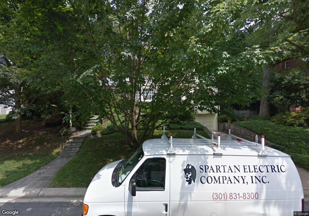
5111 Nahant St Bethesda, MD 20816
Sumner NeighborhoodEstimated Value: $1,322,000 - $1,577,000
--
Bed
4
Baths
1,948
Sq Ft
$738/Sq Ft
Est. Value
About This Home
This home is located at 5111 Nahant St, Bethesda, MD 20816 and is currently estimated at $1,437,439, approximately $737 per square foot. 5111 Nahant St is a home located in Montgomery County with nearby schools including Wood Acres Elementary School, Thomas W. Pyle Middle School, and Walt Whitman High School.
Ownership History
Date
Name
Owned For
Owner Type
Purchase Details
Closed on
Oct 22, 2010
Sold by
Legro Thomas E and Legro Susan M
Bought by
Legro Thomas
Current Estimated Value
Purchase Details
Closed on
Oct 2, 2001
Sold by
Rendleman Lorraine S
Bought by
Legro Thomas E and Legro Susan M
Purchase Details
Closed on
Jun 14, 2001
Sold by
Rendleman R Terrence R and Rendleman S L
Bought by
Rendleman Lorraine S
Purchase Details
Closed on
Sep 21, 1998
Sold by
Goldstein Avram
Bought by
Terrence Terrence R and Terrence Rendleman L
Create a Home Valuation Report for This Property
The Home Valuation Report is an in-depth analysis detailing your home's value as well as a comparison with similar homes in the area
Home Values in the Area
Average Home Value in this Area
Purchase History
| Date | Buyer | Sale Price | Title Company |
|---|---|---|---|
| Legro Thomas | -- | -- | |
| Legro Thomas E | $647,000 | -- | |
| Rendleman Lorraine S | -- | -- | |
| Terrence Terrence R | $465,000 | -- |
Source: Public Records
Tax History Compared to Growth
Tax History
| Year | Tax Paid | Tax Assessment Tax Assessment Total Assessment is a certain percentage of the fair market value that is determined by local assessors to be the total taxable value of land and additions on the property. | Land | Improvement |
|---|---|---|---|---|
| 2025 | $14,080 | $1,206,400 | $671,800 | $534,600 |
| 2024 | $14,080 | $1,159,567 | $0 | $0 |
| 2023 | $12,832 | $1,112,733 | $0 | $0 |
| 2022 | $8,591 | $1,065,900 | $610,800 | $455,100 |
| 2021 | $11,238 | $1,048,567 | $0 | $0 |
| 2020 | $11,238 | $1,031,233 | $0 | $0 |
| 2019 | $8,939 | $1,013,900 | $581,700 | $432,200 |
| 2018 | $10,852 | $1,000,667 | $0 | $0 |
| 2017 | $9,079 | $987,433 | $0 | $0 |
| 2016 | $10,133 | $974,200 | $0 | $0 |
| 2015 | $10,133 | $972,600 | $0 | $0 |
| 2014 | $10,133 | $971,000 | $0 | $0 |
Source: Public Records
Map
Nearby Homes
- 5116 Lawton Dr
- 5013 Nahant St
- 5903 Carlton Ln
- 5612 Namakagan Rd
- 5101 Baltan Rd
- 5144 Westpath Way
- 5715 Massachusetts Ave
- 5305 Carlton St
- 5605 Wood Way
- 5805 Massachusetts Ave
- 6004 Winnebago Rd
- 5103 Sentinel Dr
- 5105 Westbard Ave
- 5905 Osceola Rd
- 5340 Westpath Way
- 4960 Sentinel Dr
- 4974 Sentinel Dr
- 5109 River Hill Rd
- 5129 Wissioming Rd
- 5128 Wissioming Rd
- 5201 Nahant St
- 5109 Nahant St
- 5200 Belvoir Dr
- 5107 Nahant St
- 5202 Belvoir Dr
- 5112 Nahant St
- 5114 Nahant St
- 5201 Belvoir Dr
- 5110 Nahant St
- 5110 Lawton Dr
- 5205 Nahant St
- 5800 Madawaska Rd
- 5105 Nahant St
- 5108 Nahant St
- 5108 Lawton Dr
- 5815 Madawaska Rd
- 5204 Belvoir Dr
- 5112 Lawton Dr
- 5207 Nahant St
- 5203 Belvoir Dr
