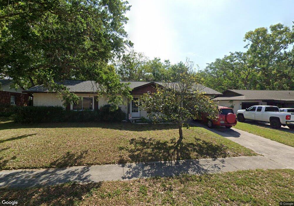
5111 Presidential St Seffner, FL 33584
Estimated Value: $302,000 - $317,000
2
Beds
2
Baths
1,425
Sq Ft
$218/Sq Ft
Est. Value
About This Home
This home is located at 5111 Presidential St, Seffner, FL 33584 and is currently estimated at $310,933, approximately $218 per square foot. 5111 Presidential St is a home located in Hillsborough County with nearby schools including Mango Elementary School, Jennings Middle School, and Armwood High School.
Ownership History
Date
Name
Owned For
Owner Type
Purchase Details
Closed on
May 7, 2015
Sold by
Lawrence Gail B
Bought by
Lindsay Heather E
Current Estimated Value
Home Financials for this Owner
Home Financials are based on the most recent Mortgage that was taken out on this home.
Original Mortgage
$114,880
Outstanding Balance
$88,724
Interest Rate
3.75%
Mortgage Type
FHA
Estimated Equity
$222,209
Purchase Details
Closed on
Feb 24, 2009
Sold by
Lawrence Gail B
Bought by
Lawrence Gail B
Create a Home Valuation Report for This Property
The Home Valuation Report is an in-depth analysis detailing your home's value as well as a comparison with similar homes in the area
Home Values in the Area
Average Home Value in this Area
Purchase History
| Date | Buyer | Sale Price | Title Company |
|---|---|---|---|
| Lindsay Heather E | $117,000 | Leading Edge Title Of Brando | |
| Lawrence Gail B | -- | None Available |
Source: Public Records
Mortgage History
| Date | Status | Borrower | Loan Amount |
|---|---|---|---|
| Open | Lindsay Heather E | $114,880 |
Source: Public Records
Tax History Compared to Growth
Tax History
| Year | Tax Paid | Tax Assessment Tax Assessment Total Assessment is a certain percentage of the fair market value that is determined by local assessors to be the total taxable value of land and additions on the property. | Land | Improvement |
|---|---|---|---|---|
| 2024 | $1,653 | $103,577 | -- | -- |
| 2023 | $1,579 | $100,560 | $0 | $0 |
| 2022 | $1,449 | $97,631 | $0 | $0 |
| 2021 | $1,407 | $94,787 | $0 | $0 |
| 2020 | $1,334 | $93,478 | $0 | $0 |
| 2019 | $1,252 | $91,376 | $0 | $0 |
| 2018 | $1,202 | $89,672 | $0 | $0 |
| 2017 | $1,175 | $102,836 | $0 | $0 |
| 2016 | $1,142 | $86,022 | $0 | $0 |
| 2015 | $649 | $80,774 | $0 | $0 |
| 2014 | $631 | $53,874 | $0 | $0 |
| 2013 | -- | $52,702 | $0 | $0 |
Source: Public Records
Map
Nearby Homes
- 5207 Burr Place Unit 2B
- 4819 Presidential St
- 4906 Presidential St
- 5225 Presidential St
- 4809 Reagan Ave
- 11531 Galway Rd
- 11533 Galway Rd Unit 107
- 11022 Connacht Way
- 11019 Connacht Way
- 11719 Blackbrook Ct
- 11721 Blackbrook Ct
- 11739 Blackbrook Ct
- 11741 Blackbrook Ct
- 11308 E Old Hillsborough Ave
- 11743 Blackbrook Ct
- 11747 Blackbrook Ct
- 11749 Blackbrook Ct
- 11763 Blackbrook Ct
- 11765 Blackbrook Ct
- 11767 Blackbrook Ct
- 5109 Presidential St
- 5113 Presidential St
- 5106 Presidential St
- 5116 Presidential St
- 5107 Presidential St
- 5115 Presidential St
- 5117 Presidential St
- 5105 Presidential St
- 5104 Presidential St
- 5118 Presidential St
- 11506 Grove Ln
- 5103 Presidential St Unit 2B
- 11503 Colony Hill Dr
- 5205 Garner Place
- 5207 Garner Place
- 11413 Colony Hill Dr
- 5102 Presidential St
- 5121 Presidential St
- 11502 Grove Ln
- 5101 Presidential St