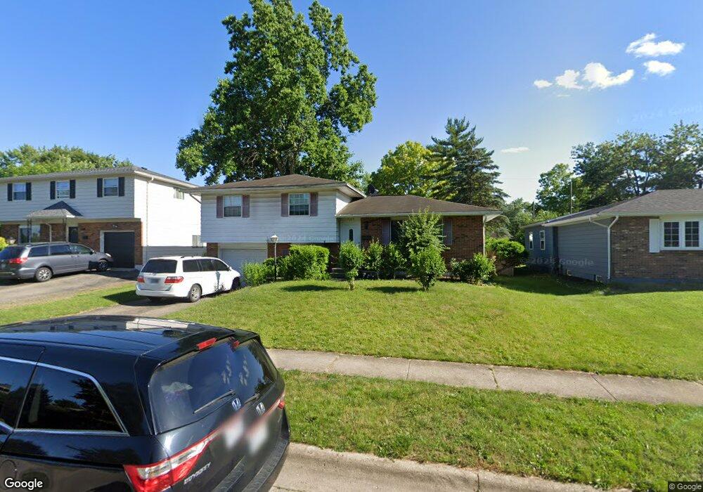
5115 Norcrest Dr Columbus, OH 43232
East Columbus-White Ash NeighborhoodEstimated Value: $216,000 - $253,000
3
Beds
2
Baths
1,550
Sq Ft
$149/Sq Ft
Est. Value
About This Home
This home is located at 5115 Norcrest Dr, Columbus, OH 43232 and is currently estimated at $230,837, approximately $148 per square foot. 5115 Norcrest Dr is a home located in Franklin County with nearby schools including Groveport Madison High School, A+ Arts Academy, and Eastland Preparatory Academy.
Ownership History
Date
Name
Owned For
Owner Type
Purchase Details
Closed on
Jun 6, 2011
Sold by
Dewhurst Jay Philip
Bought by
Melendez Joel
Current Estimated Value
Purchase Details
Closed on
Mar 23, 2011
Sold by
Dewhurst James M and Dewhurst Robert Joseph
Bought by
Melendez Joel
Home Financials for this Owner
Home Financials are based on the most recent Mortgage that was taken out on this home.
Original Mortgage
$80,797
Interest Rate
4.5%
Mortgage Type
FHA
Purchase Details
Closed on
Feb 14, 2008
Sold by
Dewhurst Jay Phillip
Bought by
Dewhurst James M and Dewhurst Robert Joseph
Purchase Details
Closed on
Sep 4, 1991
Create a Home Valuation Report for This Property
The Home Valuation Report is an in-depth analysis detailing your home's value as well as a comparison with similar homes in the area
Home Values in the Area
Average Home Value in this Area
Purchase History
| Date | Buyer | Sale Price | Title Company |
|---|---|---|---|
| Melendez Joel | -- | Talon Group | |
| Melendez Joel | $82,900 | Talon Group | |
| Dewhurst James M | -- | Attorney | |
| -- | $76,500 | -- |
Source: Public Records
Mortgage History
| Date | Status | Borrower | Loan Amount |
|---|---|---|---|
| Previous Owner | Melendez Joel | $80,797 |
Source: Public Records
Tax History Compared to Growth
Tax History
| Year | Tax Paid | Tax Assessment Tax Assessment Total Assessment is a certain percentage of the fair market value that is determined by local assessors to be the total taxable value of land and additions on the property. | Land | Improvement |
|---|---|---|---|---|
| 2024 | $3,025 | $59,790 | $17,820 | $41,970 |
| 2023 | $2,899 | $59,780 | $17,815 | $41,965 |
| 2022 | $2,070 | $33,460 | $6,300 | $27,160 |
| 2021 | $2,078 | $33,460 | $6,300 | $27,160 |
| 2020 | $2,106 | $33,460 | $6,300 | $27,160 |
| 2019 | $1,913 | $28,140 | $5,250 | $22,890 |
| 2018 | $1,932 | $28,140 | $5,250 | $22,890 |
| 2017 | $1,929 | $28,140 | $5,250 | $22,890 |
| 2016 | $1,988 | $26,290 | $4,340 | $21,950 |
| 2015 | $1,940 | $26,290 | $4,340 | $21,950 |
| 2014 | $1,959 | $26,290 | $4,340 | $21,950 |
| 2013 | $932 | $29,225 | $4,830 | $24,395 |
Source: Public Records
Map
Nearby Homes
- 5125 Upton Rd N
- 2901 Renfro Rd
- 2998 Osgood Rd E
- 5137 Holbrook Dr
- 2900 Ronda Rd
- 4906 Refugee Rd
- 5373 Spire Ln
- 5401 Spire Ln
- 2615 Carbondale Place
- 5278 Glenbriar Ct
- 2651 Brownfield Rd
- 5377 Bleaker Ave
- 4847 Amber Crossing Dr
- 3246 Latonia Rd
- 5114 Carbondale Dr
- 2342 Noe Bixby Rd
- 2336 Noe Bixby Rd
- 2360 Noe Bixby Rd
- 2354 Noe Bixby Rd
- 2348 Noe Bixby Rd
- 5111 Norcrest Dr
- 5123 Norcrest Dr
- 5142 Upton Rd N
- 5101 Norcrest Dr
- 5136 Upton Rd N
- 5131 Norcrest Dr
- 5128 Upton Rd N
- 5150 Upton Rd N
- 5120 Norcrest Dr
- 5112 Norcrest Dr
- 2933 Fleet Rd
- 5095 Norcrest Dr
- 2907 Fleet Rd
- 5104 Norcrest Dr
- 5120 Upton Rd N
- 5100 Norcrest Dr
- 2941 Fleet Rd
- 5089 Norcrest Dr
- 2954 Upton Rd E
- 5141 Upton Rd N