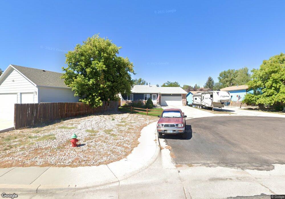
5116 Atlantic Dr Cheyenne, WY 82001
Sun Valley NeighborhoodEstimated Value: $354,000 - $394,132
4
Beds
2
Baths
1,040
Sq Ft
$357/Sq Ft
Est. Value
About This Home
This home is located at 5116 Atlantic Dr, Cheyenne, WY 82001 and is currently estimated at $371,283, approximately $357 per square foot. 5116 Atlantic Dr is a home located in Laramie County with nearby schools including Bain Elementary School, Johnson Junior High School, and South High School.
Ownership History
Date
Name
Owned For
Owner Type
Purchase Details
Closed on
Dec 5, 2008
Sold by
Kirby Terri A
Bought by
Kirby Adrienne L
Current Estimated Value
Home Financials for this Owner
Home Financials are based on the most recent Mortgage that was taken out on this home.
Original Mortgage
$157,611
Outstanding Balance
$97,365
Interest Rate
4.84%
Mortgage Type
FHA
Estimated Equity
$273,918
Purchase Details
Closed on
Oct 29, 2008
Sold by
Lasalle Bank National Association
Bought by
Kirby Adrienne L and Kirby Terri A
Home Financials for this Owner
Home Financials are based on the most recent Mortgage that was taken out on this home.
Original Mortgage
$157,611
Outstanding Balance
$97,365
Interest Rate
4.84%
Mortgage Type
FHA
Estimated Equity
$273,918
Purchase Details
Closed on
Aug 8, 2008
Sold by
Treat Wendy J and Treat Terry A
Bought by
Lasalle Bank Na
Purchase Details
Closed on
Jun 6, 2008
Sold by
Mortgage Electronic Registration Systems
Bought by
Lasalle Bank Na
Purchase Details
Closed on
Apr 7, 2008
Sold by
Treat Wendy J and Treat Terry A
Bought by
Mortgage Electronic Registration Systems
Purchase Details
Closed on
Aug 16, 2006
Sold by
Collister William A and Collister Cynthia L
Bought by
Treat Terry A and Treat Wendy J
Home Financials for this Owner
Home Financials are based on the most recent Mortgage that was taken out on this home.
Original Mortgage
$136,000
Interest Rate
8.5%
Mortgage Type
Purchase Money Mortgage
Purchase Details
Closed on
Jun 9, 2000
Sold by
Martinez Carlos and Martinez Chanda
Bought by
Collister William A and Collister Cynthia L
Home Financials for this Owner
Home Financials are based on the most recent Mortgage that was taken out on this home.
Original Mortgage
$100,000
Interest Rate
8.13%
Mortgage Type
Credit Line Revolving
Purchase Details
Closed on
Dec 24, 1998
Sold by
Hester Cliff C and Hester Stacia D
Bought by
Martinez Carlos and Martinez Chanda
Home Financials for this Owner
Home Financials are based on the most recent Mortgage that was taken out on this home.
Original Mortgage
$109,610
Interest Rate
6.85%
Create a Home Valuation Report for This Property
The Home Valuation Report is an in-depth analysis detailing your home's value as well as a comparison with similar homes in the area
Home Values in the Area
Average Home Value in this Area
Purchase History
| Date | Buyer | Sale Price | Title Company |
|---|---|---|---|
| Kirby Adrienne L | -- | None Available | |
| Kirby Adrienne L | -- | None Available | |
| Lasalle Bank Na | $137,700 | None Available | |
| Lasalle Bank Na | -- | None Available | |
| Mortgage Electronic Registration Systems | $137,700 | None Available | |
| Treat Terry A | -- | None Available | |
| Collister William A | -- | -- | |
| Martinez Carlos | -- | Laramie Cnty Abstract & Titl |
Source: Public Records
Mortgage History
| Date | Status | Borrower | Loan Amount |
|---|---|---|---|
| Open | Kirby Adrienne L | $157,611 | |
| Closed | Kirby Adrienne L | $157,611 | |
| Previous Owner | Treat Terry A | $136,000 | |
| Previous Owner | Collister William A | $100,000 | |
| Previous Owner | Martinez Carlos | $109,610 |
Source: Public Records
Tax History Compared to Growth
Tax History
| Year | Tax Paid | Tax Assessment Tax Assessment Total Assessment is a certain percentage of the fair market value that is determined by local assessors to be the total taxable value of land and additions on the property. | Land | Improvement |
|---|---|---|---|---|
| 2025 | $2,057 | $22,519 | $4,246 | $18,273 |
| 2024 | $2,057 | $29,087 | $5,661 | $23,426 |
| 2023 | $2,048 | $28,969 | $5,661 | $23,308 |
| 2022 | $1,890 | $26,178 | $5,571 | $20,607 |
| 2021 | $1,682 | $23,253 | $5,571 | $17,682 |
| 2020 | $1,545 | $21,416 | $5,571 | $15,845 |
| 2019 | $1,440 | $19,941 | $5,571 | $14,370 |
| 2018 | $1,372 | $19,184 | $5,223 | $13,961 |
| 2017 | $1,270 | $17,604 | $3,397 | $14,207 |
| 2016 | $1,351 | $18,716 | $3,265 | $15,451 |
| 2015 | $1,329 | $18,396 | $3,265 | $15,131 |
| 2014 | $1,342 | $18,458 | $3,265 | $15,193 |
Source: Public Records
Map
Nearby Homes
- 5001 Phoenix Dr
- 4949 Atlantic Dr
- 5016 Phoenix Dr
- 800 Everglade Dr
- Lot 10 Raleigh Dr
- Lot 11 Raleigh Dr
- Lot 12 Raleigh Dr
- 4705 Raleigh Dr
- 4703 Raleigh Dr
- 618 Mcgovern Ave
- 828 Sun Valley Dr
- 6031 Atlantic Dr
- TBD Campstool Rd
- 6111 Atlantic Dr
- 6119 Atlantic Dr
- TBD Taft Ave
- 6201 Atlantic Dr
- 1511 Gettysburg Dr
- 4802 E 13th St
- 4811 E 14th St
- 5120 Atlantic Dr
- 5131 Kennedy Dr
- 5105 Kennedy Dr
- 5119 Kennedy Dr
- 5124 Atlantic Dr
- 531 Cottonwood Dr
- 541 Cottonwood Dr
- 5119 Atlantic Dr
- 5117 Atlantic Dr
- 521 Cottonwood Dr
- 5221 Kennedy Dr
- 5123 Atlantic Dr
- 5111 Atlantic Dr
- 5125 Atlantic Dr
- 5109 Atlantic Dr
- 5250 Atlantic Dr
- 5105 Atlantic Dr
- 5129 Atlantic Dr
- 5132 Kennedy Dr
- 5110 Kennedy Dr