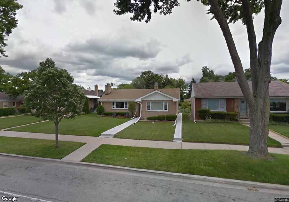
5117 Howard St Skokie, IL 60077
Southwest Skokie NeighborhoodEstimated Value: $423,978 - $472,000
3
Beds
2
Baths
1,382
Sq Ft
$320/Sq Ft
Est. Value
About This Home
This home is located at 5117 Howard St, Skokie, IL 60077 and is currently estimated at $442,245, approximately $320 per square foot. 5117 Howard St is a home located in Cook County with nearby schools including Fairview South Elementary School, Niles West High School, and Cheder Lubavitch Hebrew Day School.
Ownership History
Date
Name
Owned For
Owner Type
Purchase Details
Closed on
Nov 2, 2006
Sold by
Khizickia Elia R
Bought by
Khizickia Elia R and Oraha Vivian
Current Estimated Value
Home Financials for this Owner
Home Financials are based on the most recent Mortgage that was taken out on this home.
Original Mortgage
$309,000
Interest Rate
6.75%
Mortgage Type
New Conventional
Purchase Details
Closed on
Jun 17, 1997
Sold by
Ireland Mary A
Bought by
Ireland Mary A and Mary A Ireland Revocable Trust
Create a Home Valuation Report for This Property
The Home Valuation Report is an in-depth analysis detailing your home's value as well as a comparison with similar homes in the area
Home Values in the Area
Average Home Value in this Area
Purchase History
| Date | Buyer | Sale Price | Title Company |
|---|---|---|---|
| Khizickia Elia R | -- | Ticor Title Insurance Compan | |
| Ireland Mary A | -- | -- |
Source: Public Records
Mortgage History
| Date | Status | Borrower | Loan Amount |
|---|---|---|---|
| Closed | Khizickia Elia R | $309,000 |
Source: Public Records
Tax History Compared to Growth
Tax History
| Year | Tax Paid | Tax Assessment Tax Assessment Total Assessment is a certain percentage of the fair market value that is determined by local assessors to be the total taxable value of land and additions on the property. | Land | Improvement |
|---|---|---|---|---|
| 2024 | $3,351 | $15,828 | $3,949 | $11,879 |
| 2023 | $3,240 | $15,828 | $3,949 | $11,879 |
| 2022 | $3,240 | $15,828 | $3,949 | $11,879 |
| 2021 | $2,897 | $12,834 | $2,778 | $10,056 |
| 2020 | $2,796 | $12,834 | $2,778 | $10,056 |
| 2019 | $2,849 | $14,260 | $2,778 | $11,482 |
| 2018 | $2,854 | $13,014 | $2,413 | $10,601 |
| 2017 | $2,889 | $13,014 | $2,413 | $10,601 |
| 2016 | $2,850 | $13,014 | $2,413 | $10,601 |
| 2015 | $2,687 | $11,603 | $2,047 | $9,556 |
| 2014 | $2,604 | $11,603 | $2,047 | $9,556 |
| 2013 | $2,637 | $11,603 | $2,047 | $9,556 |
Source: Public Records
Map
Nearby Homes
- 5153 Dobson St
- 7500 Laramie Ave
- 7507 Frontage Rd
- 5037 Fargo Ave
- 4931 Brummel St
- 7748 Lincoln Ave
- 7848 Lincoln Ave
- 5261 Mulford St
- 4944 Jarvis Ave
- 4838 Howard St Unit 301
- 5207 Galitz St
- 4907 Hull St
- 5251 Galitz St Unit 410
- 5251 Galitz St Unit 311
- 4906 Hull St
- 4856 Hull St
- 4757 Howard St Unit 205B
- 4817 Hull St Unit 2B
- 4858 W Chase Ave
- 4953 Oakton St Unit 510
- 5117 Howard St
- 5121 Howard St
- 5121 Howard St
- 5111 Howard St
- 5114 Jerome Ave
- 5125 Howard St
- 5125 Howard St
- 5114 Jerome Ave
- 5120 Jerome Ave
- 5131 W Howard St
- 7552 Le Claire Ave
- 5131 Howard St
- 5126 Jerome Ave
- 5126 Jerome Ave
- 5108 Jerome Ave
- 5118 W Howard St
- 5104 Jerome Ave
- 5133 Howard St
- 5133 Howard St
- 5118 Howard St