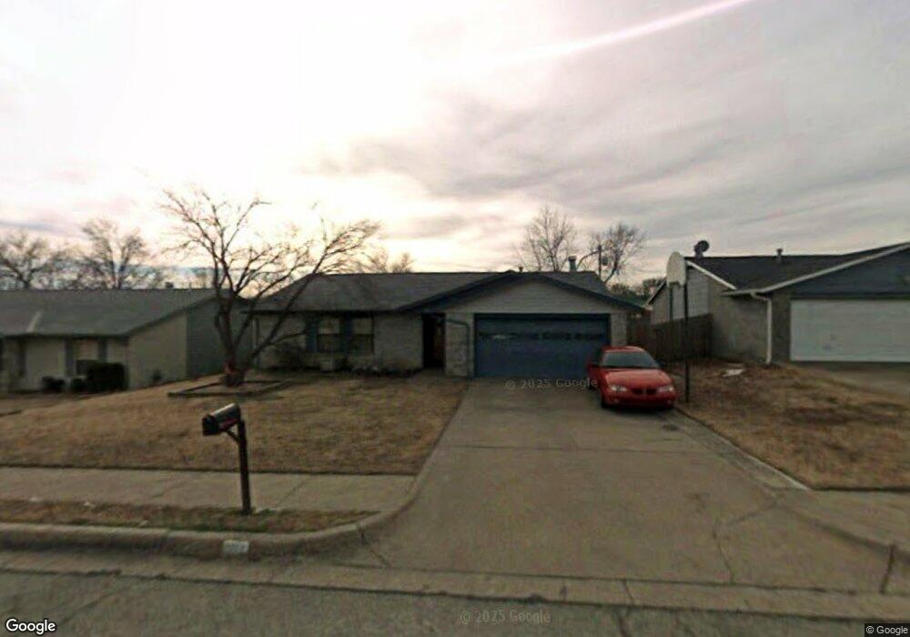
5117 Manning Rd Bartlesville, OK 74006
Estimated Value: $114,492 - $166,000
--
Bed
2
Baths
1,428
Sq Ft
$102/Sq Ft
Est. Value
About This Home
This home is located at 5117 Manning Rd, Bartlesville, OK 74006 and is currently estimated at $145,123, approximately $101 per square foot. 5117 Manning Rd is a home located in Washington County with nearby schools including Ranch Heights Elementary School, Madison Middle School, and Bartlesville High School.
Ownership History
Date
Name
Owned For
Owner Type
Purchase Details
Closed on
Apr 19, 2006
Sold by
Woodard Steven L and Woodard Kathryn E
Bought by
Tafoya Sean and Tafoya Kimberly
Current Estimated Value
Home Financials for this Owner
Home Financials are based on the most recent Mortgage that was taken out on this home.
Original Mortgage
$80,364
Outstanding Balance
$43,142
Interest Rate
6.32%
Mortgage Type
FHA
Estimated Equity
$101,981
Create a Home Valuation Report for This Property
The Home Valuation Report is an in-depth analysis detailing your home's value as well as a comparison with similar homes in the area
Home Values in the Area
Average Home Value in this Area
Purchase History
| Date | Buyer | Sale Price | Title Company |
|---|---|---|---|
| Tafoya Sean | $81,000 | None Available |
Source: Public Records
Mortgage History
| Date | Status | Borrower | Loan Amount |
|---|---|---|---|
| Open | Tafoya Sean | $80,364 |
Source: Public Records
Tax History Compared to Growth
Tax History
| Year | Tax Paid | Tax Assessment Tax Assessment Total Assessment is a certain percentage of the fair market value that is determined by local assessors to be the total taxable value of land and additions on the property. | Land | Improvement |
|---|---|---|---|---|
| 2025 | $740 | $7,375 | $1,200 | $6,175 |
| 2024 | $740 | $7,160 | $1,200 | $5,960 |
| 2023 | $740 | $6,952 | $1,200 | $5,752 |
| 2022 | $713 | $6,952 | $1,200 | $5,752 |
| 2021 | $699 | $6,952 | $1,200 | $5,752 |
| 2020 | $715 | $6,952 | $1,200 | $5,752 |
| 2019 | $697 | $6,805 | $1,200 | $5,605 |
| 2018 | $694 | $6,805 | $1,200 | $5,605 |
| 2017 | $832 | $6,805 | $1,200 | $5,605 |
| 2016 | $781 | $6,805 | $1,200 | $5,605 |
| 2015 | $1,373 | $11,815 | $588 | $11,227 |
| 2014 | $1,324 | $11,252 | $588 | $10,664 |
Source: Public Records
Map
Nearby Homes
- 1206 Saddle Ln
- 5012 Allen Ct
- 4910 Rolling Meadows Rd
- 1242 May Ln
- 1258 Guinn Ln
- 1250 Macklyn Ln
- 1267 Guinn Ln
- 1264 Guinn Ln
- 1058 Renick Ln
- 1063 Rolling Meadows Ct
- 4626 Rolling Meadows Rd
- 1000 Meadow Dr
- 1222 Lariat Dr
- 953 Yale Dr
- 1030 East Dr
- 1354 Harris Dr
- 1054 Meadow Dr
- 644 SE Elmhurst Ave
- 4701 Dartmouth Dr
- 1050 Grandview Rd
- 5123 Manning Rd
- 5109 Manning Rd
- 5110 Hazel Rd
- 5129 Manning Rd
- 5116 Hazel Rd
- 5101 Manning Rd
- 5106 Hazel Rd
- 5122 Hazel Rd
- 5108 Manning Rd
- 5114 Manning Rd
- 5100 Hazel Rd
- 5201 Manning Rd
- 5100 Manning Rd
- 5120 Manning Rd
- 5215 Manning Rd
- 5200 Hazel Rd
- 5200 Manning Rd
- 5211 Manning Rd
- 5212 Hazel Rd
- 1101 May Ln