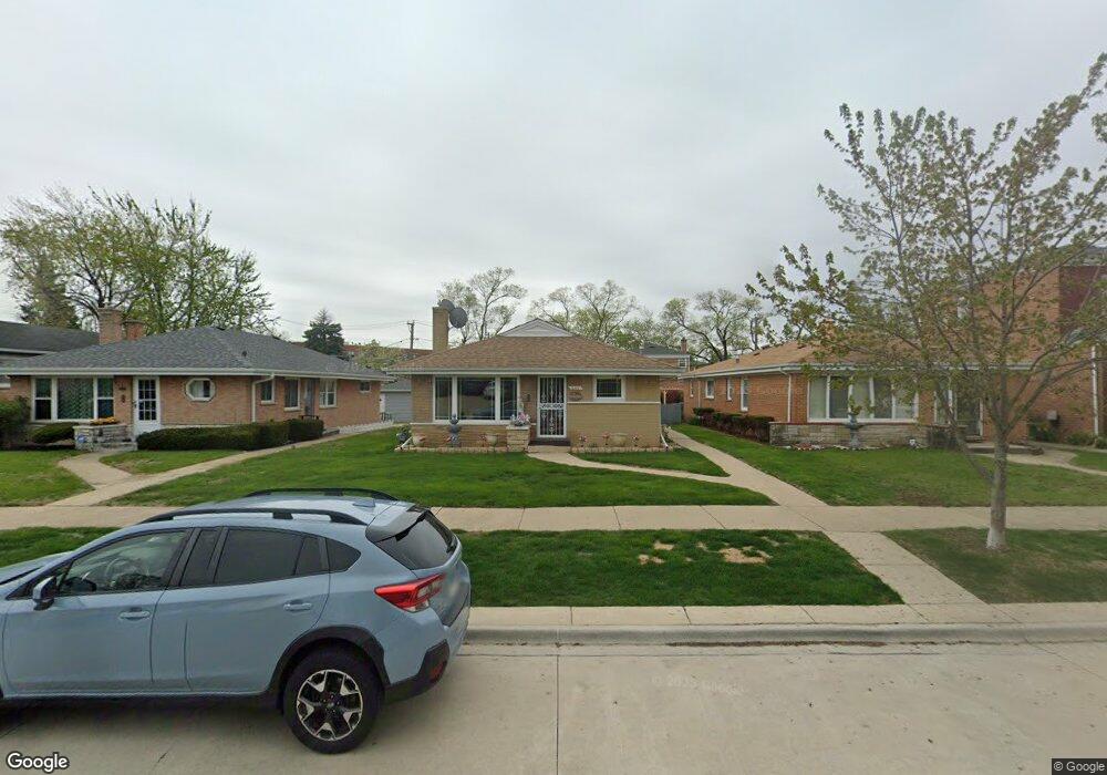
5117 Suffield Ct Skokie, IL 60077
Southwest Skokie NeighborhoodEstimated Value: $414,794 - $456,000
3
Beds
2
Baths
1,165
Sq Ft
$375/Sq Ft
Est. Value
About This Home
This home is located at 5117 Suffield Ct, Skokie, IL 60077 and is currently estimated at $436,699, approximately $374 per square foot. 5117 Suffield Ct is a home located in Cook County with nearby schools including Old Orchard Jr High School, Jane Stenson School, and Niles North High School.
Ownership History
Date
Name
Owned For
Owner Type
Purchase Details
Closed on
Sep 13, 2004
Sold by
White Roger C
Bought by
Aziz Odisho and Aziz Victoria
Current Estimated Value
Home Financials for this Owner
Home Financials are based on the most recent Mortgage that was taken out on this home.
Original Mortgage
$243,750
Outstanding Balance
$121,323
Interest Rate
5.95%
Mortgage Type
Purchase Money Mortgage
Estimated Equity
$315,376
Create a Home Valuation Report for This Property
The Home Valuation Report is an in-depth analysis detailing your home's value as well as a comparison with similar homes in the area
Home Values in the Area
Average Home Value in this Area
Purchase History
| Date | Buyer | Sale Price | Title Company |
|---|---|---|---|
| Aziz Odisho | $325,000 | Executive Land Title |
Source: Public Records
Mortgage History
| Date | Status | Borrower | Loan Amount |
|---|---|---|---|
| Open | Aziz Odisho | $243,750 |
Source: Public Records
Tax History Compared to Growth
Tax History
| Year | Tax Paid | Tax Assessment Tax Assessment Total Assessment is a certain percentage of the fair market value that is determined by local assessors to be the total taxable value of land and additions on the property. | Land | Improvement |
|---|---|---|---|---|
| 2024 | $6,916 | $31,000 | $6,770 | $24,230 |
| 2023 | $6,706 | $31,000 | $6,770 | $24,230 |
| 2022 | $6,706 | $31,000 | $6,770 | $24,230 |
| 2021 | $6,266 | $26,224 | $4,166 | $22,058 |
| 2020 | $6,266 | $26,224 | $4,166 | $22,058 |
| 2019 | $6,415 | $29,466 | $4,166 | $25,300 |
| 2018 | $5,791 | $24,931 | $3,775 | $21,156 |
| 2017 | $5,849 | $24,931 | $3,775 | $21,156 |
| 2016 | $5,820 | $24,931 | $3,775 | $21,156 |
| 2015 | $5,063 | $20,763 | $3,255 | $17,508 |
| 2014 | $4,960 | $20,763 | $3,255 | $17,508 |
| 2013 | $4,933 | $20,763 | $3,255 | $17,508 |
Source: Public Records
Map
Nearby Homes
- 5247 Suffield Ct
- 8950 Lavergne Ave
- 5317 Suffield Ct
- 8836 Bronx Ave
- 8717 Gross Point Rd
- 9011 Bronx Ave
- 8940 Lamon Ave
- 5352 Greenwood St
- 5032 Crain St
- 9012 Lamon Ave
- 5346 Suffield Terrace
- 8914 La Crosse Ave Unit 2S
- 5309 Crain St
- 4901 Carol Unit F St
- 4801 Grove St
- 5109 Greenleaf St
- 8710 Skokie Blvd Unit 3BS
- 8655 Harms Rd
- 8534 Terminal Ave
- 8644 Skokie Blvd
- 5121 Suffield Ct
- 5111 Suffield Ct
- 5125 Suffield Ct
- 5107 Suffield Ct
- 5131 Suffield Ct
- 5135 Suffield Ct
- 5101 Suffield Ct
- 8922 Gross Point Rd
- 5124 Greenwood St
- 5124 Greenwood St
- 8920 Gross Point Rd
- 8916 Gross Point Rd
- 5116 Suffield Ct Unit 2
- 5116 Suffield Ct
- 8914 Gross Point Rd
- 8910 Gross Point Rd
- 5128 Greenwood St
- 8908 Gross Point Rd
- 8906 Gross Point Rd
- 5112 Greenwood St