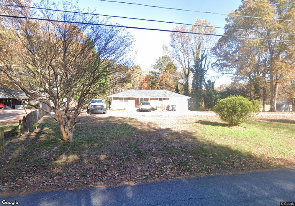
512 Allen Dr Lawrenceville, GA 30043
Estimated Value: $241,000 - $292,000
2
Beds
1
Bath
1,009
Sq Ft
$266/Sq Ft
Est. Value
About This Home
This home is located at 512 Allen Dr, Lawrenceville, GA 30043 and is currently estimated at $268,451, approximately $266 per square foot. 512 Allen Dr is a home located in Gwinnett County with nearby schools including Dyer Elementary School, Twin Rivers Middle School, and Mountain View High School.
Ownership History
Date
Name
Owned For
Owner Type
Purchase Details
Closed on
Aug 24, 2010
Sold by
Kapur Chander M
Bought by
Kapur Chander M and Kapur Aleyamma
Current Estimated Value
Purchase Details
Closed on
May 4, 2010
Sold by
Wells Fargo Bk Na
Bought by
Federal Natl Mtg Assn Fnma
Purchase Details
Closed on
Feb 21, 1995
Sold by
Berry Jim James B
Bought by
Elliot Rhonda S
Create a Home Valuation Report for This Property
The Home Valuation Report is an in-depth analysis detailing your home's value as well as a comparison with similar homes in the area
Home Values in the Area
Average Home Value in this Area
Purchase History
| Date | Buyer | Sale Price | Title Company |
|---|---|---|---|
| Kapur Chander M | -- | -- | |
| Kapur Chander M | -- | -- | |
| Federal Natl Mtg Assn Fnma | -- | -- | |
| Wells Fargo Bk Na | $107,935 | -- | |
| Elliot Rhonda S | $53,500 | -- |
Source: Public Records
Tax History Compared to Growth
Tax History
| Year | Tax Paid | Tax Assessment Tax Assessment Total Assessment is a certain percentage of the fair market value that is determined by local assessors to be the total taxable value of land and additions on the property. | Land | Improvement |
|---|---|---|---|---|
| 2024 | $3,172 | $78,760 | $24,080 | $54,680 |
| 2023 | $3,172 | $75,840 | $24,080 | $51,760 |
| 2022 | $0 | $67,080 | $19,680 | $47,400 |
| 2021 | $2,168 | $51,000 | $12,080 | $38,920 |
| 2020 | $2,105 | $51,000 | $12,080 | $38,920 |
| 2019 | $2,105 | $51,000 | $12,080 | $38,920 |
| 2018 | $2,101 | $51,000 | $12,080 | $38,920 |
| 2016 | $1,741 | $40,200 | $10,080 | $30,120 |
| 2015 | $1,487 | $32,480 | $10,080 | $22,400 |
| 2014 | $1,191 | $24,000 | $6,000 | $18,000 |
Source: Public Records
Map
Nearby Homes
- 509 Woodland Ln
- 1148 Woodland Cir
- 699 Sunstone Ln
- 695 Sunstone Ln
- 693 Sunstone Ln
- 689 Sunstone Ln
- 687 Sunstone Ln
- Brooks Plan at River Walk Place
- Bryson Plan at River Walk Place
- 664 Sunstone Ln
- 662 Sunstone Ln
- 660 Sunstone Ln
- 658 Sunstone Ln
- Lot 16 Coronada Dr
- Lot 17 Coronada Dr
- 531 Shyrewood Dr
- 951 Northside Dr
- 1244 Riverloch Way
- 1230 Rivershyre Pkwy
- 1287 Sunny Lake Dr
- 506 Allen Dr
- 502 Allen Dr Unit 31
- 522 Allen Dr
- 511 Allen Dr
- 494 Allen Dr
- 525 Woodland Ln Unit 7
- 525 Woodland Ln
- 525 Woodland Ln Unit 2
- 515 Woodland Ln
- 523 Allen Dr
- 0 Allen Dr Unit 3286085
- 0 Allen Dr Unit 8954365
- 0 Allen Dr Unit 9001897
- 0 Allen Dr Unit 8524765
- 0 Allen Dr Unit 8124690
- 0 Allen Dr Unit 7099859
- 0 Allen Dr Unit 7246101
- 0 Allen Dr
- 542 Allen Dr
- 533 Woodland Ln