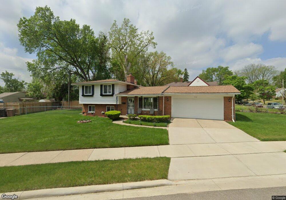
512 Avon Rd Pontiac, MI 48341
Estimated Value: $152,000 - $193,000
3
Beds
2
Baths
1,324
Sq Ft
$136/Sq Ft
Est. Value
About This Home
This home is located at 512 Avon Rd, Pontiac, MI 48341 and is currently estimated at $179,556, approximately $135 per square foot. 512 Avon Rd is a home located in Oakland County with nearby schools including Walt Whitman Elementary School, Pontiac Middle School, and Pontiac High School.
Ownership History
Date
Name
Owned For
Owner Type
Purchase Details
Closed on
Mar 12, 2020
Sold by
Groves Abuesta
Bought by
Groves Arvesta and Groves Kyle E
Current Estimated Value
Purchase Details
Closed on
Apr 25, 2006
Sold by
Seay Jerry L and Seay Toyika R
Bought by
Groves Arvesta
Purchase Details
Closed on
Nov 5, 2004
Sold by
Groves Arvesta and Groves Clarence W
Bought by
Seay Jerry L and Seay Toyika R
Home Financials for this Owner
Home Financials are based on the most recent Mortgage that was taken out on this home.
Original Mortgage
$125,000
Interest Rate
5.84%
Mortgage Type
Seller Take Back
Create a Home Valuation Report for This Property
The Home Valuation Report is an in-depth analysis detailing your home's value as well as a comparison with similar homes in the area
Home Values in the Area
Average Home Value in this Area
Purchase History
| Date | Buyer | Sale Price | Title Company |
|---|---|---|---|
| Groves Arvesta | -- | None Available | |
| Groves Arvesta | -- | None Available | |
| Seay Jerry L | $130,000 | -- |
Source: Public Records
Mortgage History
| Date | Status | Borrower | Loan Amount |
|---|---|---|---|
| Previous Owner | Seay Jerry L | $125,000 |
Source: Public Records
Tax History Compared to Growth
Tax History
| Year | Tax Paid | Tax Assessment Tax Assessment Total Assessment is a certain percentage of the fair market value that is determined by local assessors to be the total taxable value of land and additions on the property. | Land | Improvement |
|---|---|---|---|---|
| 2024 | $1,008 | $69,190 | $0 | $0 |
| 2023 | $961 | $60,860 | $0 | $0 |
| 2022 | $996 | $53,290 | $0 | $0 |
| 2021 | $967 | $45,310 | $0 | $0 |
| 2020 | $873 | $40,640 | $0 | $0 |
| 2019 | $1,363 | $36,330 | $0 | $0 |
| 2018 | $1,318 | $30,640 | $0 | $0 |
| 2017 | $1,264 | $27,790 | $0 | $0 |
| 2016 | $1,285 | $24,330 | $0 | $0 |
| 2015 | -- | $22,270 | $0 | $0 |
| 2014 | -- | $21,730 | $0 | $0 |
| 2011 | -- | $30,210 | $0 | $0 |
Source: Public Records
Map
Nearby Homes
- 901 Argyle Ave
- 1061 Dorchester Ave
- 1205 Leinbach Ave
- 1160 Dorchester Ave
- 1254 Desiax Ave
- 1253 Atkinson Ave
- 8 Myra Ave
- 000 Lake St
- 0000 Ward Road Ward Rd
- 49 Canal Dr Unit 300-049
- 14 Riverbank Dr Unit 300-114
- 243 Cherokee Rd
- 21 Canal Dr Unit 300-021
- 1785 Ward Rd
- 25 Riverbank Dr Unit 300-125
- 27 Riverbank Dr Unit 300-127
- 26 Edna Ave
- 1386 Avondale St
- 207 Navajo Ave
- 10 Wenonah Dr
- 975 Canterbury Dr
- 979 Canterbury Dr
- 504 Avon Rd
- 983 Canterbury Dr
- 956 Berwick Blvd
- 970 Berwick Blvd
- 974 Berwick Blvd
- 964 Berwick Blvd
- 957 Canterbury Dr
- 987 Canterbury Dr
- 978 Berwick Blvd
- 976 Canterbury Dr
- 989 Canterbury Dr
- 509 Avon Rd
- 970 Canterbury Dr
- 982 Berwick Blvd
- 962 Canterbury Dr
- 980 Canterbury Dr
- 986 Berwick Blvd
- 515 Avon Rd