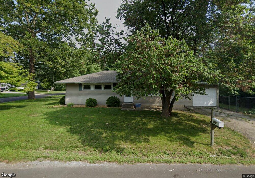
512 Breen Dr Unit 1 Champaign, IL 61820
Bolten Field NeighborhoodEstimated Value: $163,000 - $216,000
4
Beds
1
Bath
1,056
Sq Ft
$181/Sq Ft
Est. Value
About This Home
This home is located at 512 Breen Dr Unit 1, Champaign, IL 61820 and is currently estimated at $191,333, approximately $181 per square foot. 512 Breen Dr Unit 1 is a home located in Champaign County with nearby schools including Central High School, Montessori Habitat School, and Devonshire KinderCare.
Ownership History
Date
Name
Owned For
Owner Type
Purchase Details
Closed on
Apr 29, 2022
Sold by
Savannah Homes Llc
Bought by
Crs Single Family
Current Estimated Value
Home Financials for this Owner
Home Financials are based on the most recent Mortgage that was taken out on this home.
Original Mortgage
$1,246,800
Outstanding Balance
$358,747
Interest Rate
4.25%
Mortgage Type
New Conventional
Estimated Equity
-$167,414
Purchase Details
Closed on
Feb 14, 2007
Sold by
Garth Scott A
Bought by
Savannah Homes Llc
Home Financials for this Owner
Home Financials are based on the most recent Mortgage that was taken out on this home.
Original Mortgage
$104,000
Interest Rate
6.27%
Mortgage Type
Purchase Money Mortgage
Create a Home Valuation Report for This Property
The Home Valuation Report is an in-depth analysis detailing your home's value as well as a comparison with similar homes in the area
Home Values in the Area
Average Home Value in this Area
Purchase History
| Date | Buyer | Sale Price | Title Company |
|---|---|---|---|
| Crs Single Family | $1,247,000 | None Listed On Document | |
| Savannah Homes Llc | $104,000 | None Available |
Source: Public Records
Mortgage History
| Date | Status | Borrower | Loan Amount |
|---|---|---|---|
| Open | Crs Single Family | $1,246,800 | |
| Previous Owner | Savannah Homes Llc | $104,000 |
Source: Public Records
Tax History
| Year | Tax Paid | Tax Assessment Tax Assessment Total Assessment is a certain percentage of the fair market value that is determined by local assessors to be the total taxable value of land and additions on the property. | Land | Improvement |
|---|---|---|---|---|
| 2024 | $2,870 | $41,530 | $18,070 | $23,460 |
| 2023 | $2,870 | $37,830 | $16,460 | $21,370 |
| 2022 | $2,657 | $34,890 | $15,180 | $19,710 |
| 2021 | $2,582 | $34,200 | $14,880 | $19,320 |
| 2020 | $2,586 | $34,200 | $14,880 | $19,320 |
| 2019 | $2,491 | $33,490 | $14,570 | $18,920 |
| 2018 | $2,426 | $32,960 | $14,340 | $18,620 |
| 2017 | $2,321 | $31,690 | $13,790 | $17,900 |
| 2016 | $2,071 | $31,040 | $13,510 | $17,530 |
| 2015 | $2,078 | $30,490 | $13,270 | $17,220 |
| 2014 | $2,060 | $30,490 | $13,270 | $17,220 |
| 2013 | $2,042 | $30,490 | $13,270 | $17,220 |
Source: Public Records
Map
Nearby Homes
- 1708 Park Haven Dr
- 716 Devonshire Dr
- 809 Ayrshire Dr
- 812 Dodds Dr
- 701 Hamilton Dr
- 2115 Melrose Dr Unit C
- 22 Greencroft Dr
- 21 Greencroft Dr
- 1206 S Prospect Ave
- 7 Greencroft Dr
- 1205 Broadmoor Dr
- 1108 S Prospect Ave
- 2404 Melrose Dr
- 910 Foley Ave
- 911 Foley Ave
- 2501 Bedford Dr
- 807 Haines Blvd
- 1224 Foothill Dr
- 1310 Broadmoor Dr
- 2402 N Nottingham Ct
- 512 Breen Dr
- 1728 Park Haven Dr
- 511 Breen Dr
- 1726 Park Haven Dr
- 1727 Park Haven Dr
- 1801 Park Haven Dr
- 1725 Park Haven Dr
- 1724 Park Haven Dr
- 1804 Park Haven Dr
- 1739 Westhaven Dr
- 606 Breen Dr
- 1806 Park Haven Dr
- 603 Breen Dr
- 1722 Park Haven Dr
- 1737 Westhaven Dr
- 1803 Park Haven Dr
- 605 Breen Dr
- 1808 Park Haven Dr
- 1720 Park Haven Dr
- 608 Breen Dr
Your Personal Tour Guide
Ask me questions while you tour the home.